Alert

Alerts

To see around
See more
Open
Close
Show
Show
Show
Show
Show
Show
Show
Show
Show
Show
Show

Oups... It would appear that Cirkwi does not have permission to use your location.

Presentation
Description
Map
Points of interest
Ratings and reviews
See around

Hike along the Petit Balcon Sud: Merlet-Plan de la Cry

Hike along the Petit Balcon Sud: Merlet-Plan de la Cry

IGN cards

3531ETR - SAINT-GERVAIS-LES-BAINS RESISTANTE MASSIF DU MONT BLANC
Editor : IGN
Collection : TOP 25 RÉSISTANTE
Scale : 1:25 000
17.20€
3530ETR - SAMOENS RESISTANTE HAUT-GIFFRE
Editor : IGN
Collection : TOP 25 RÉSISTANTE
Scale : 1:25 000
17.20€
3530ET - SAMOENS HAUT-GIFFRE
Editor : IGN
Collection : TOP 25 ET SÉRIE BLEUE
Scale : 1:25 000
13.90€
3531ET - SAINT-GERVAIS-LES-BAINS MASSIF DU MONT BLANC
Editor : IGN
Collection : TOP 25 ET SÉRIE BLEUE
Scale : 1:25 000
13.90€
TOP75004 - BEAUFORTAIN MASSIF DU MONT BLANC
Editor : IGN
Collection : TOP 75
Scale : 1:75 000
9.80€
TOP75007 - ENTRE LÉMAN ET MONT BLANC CHABLAIS FAUCIGNY
Editor : IGN
Collection : TOP 75
Scale : 1:75 000
9.80€
TOP100D74 - HAUTE-SAVOIE ANNECY THONON-LES-BAINS MASSIF DU MONT BLANC CHAÎNE DES ARAVIS
Editor : IGN
Collection : TOP 100
Scale : 1:100 000
8.40€
TOP100D73 - SAVOIE CHAMBÉRY ALBERTVILLE PARC NATIONAL DE LA VANOISE PNR DU MASSIF DES BAUGES
Editor : IGN
Collection : TOP 100
Scale : 1:100 000
8.40€
202 JURA ALPES DU NORD
Editor : IGN
Collection : TOP 200
Scale : 1:200 000
6.80€
89025 - TOUR DU MONT-BLANC GR TMB®
Editor : IGN
Collection : DECOUVERTE DES CHEMINS
Scale : 1:50 000
9.10€
NR14 AUVERGNE-RHÔNE-ALPES RECTO/VERSO MASSIF CENTRAL
Editor : IGN
Collection : CARTES RÉGIONALES IGN
Scale : 1:250 000
6.80€
NR15 AUVERGNE-RHÔNE-ALPES RECTO/VERSO MASSIF ALPIN
Editor : IGN
Collection : CARTES RÉGIONALES IGN
Scale : 1:250 000
6.80€
SUISSE
Editor : IGN
Collection : DÉCOUVERTE DES PAYS DU MONDE IGN
Scale : 1:303 000
7.00€
EUROPE
Editor : IGN
Collection : DÉCOUVERTE DES PAYS DU MONDE IGN
Scale : 1:2 500 000
7.00€

Description

A hike that mainly goes through the woods. A trail that offers sweeping views of the Mont Blanc Massif.
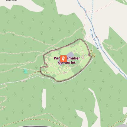
From the entrance of the park, go up to the right along the fences and take on the right during 10 mn the path of Bel-Lachat and Brévent. Leave it and go horizontally on the left for 400 m. Go down leaving the Chailloux path on the right. A few twists and turns in the slope lead to a fork: leave the Houches trail on the left and take the one that goes horizontally to the right in the forest. It passes a little below the Lac Noir and reaches the Plan de la Cry.

Possibility to start from Les Houches, Les Bossons or Chamonix.
More information available at the Tourist Office or the High Mountain Office and in our trail guide.
Attention : The conditions of the trails are likely to change, think of informing you before leaving.

Technical Information

Walking
Difficulty
Easy
Duration
3h
Dist.
3.1 km
Show more

Altimetric profile

Starting point

Parking de Merlet Chemin de Merlet , 74310   Les Houches
Lat : 45.907875Lng : 6.822478

Points of interest

Additional information

Updated by

Office de Tourisme de la Vallée de Chamonix-Mont-Blanc - 24/06/2024
www.chamonix.com
Report a problem

Open period

From 10/04 to 31/10.

Subject to snow conditions.

Contact

Phone :
04 50 55 50 62
04 50 53 00 24

Email : info@leshouches.com

Website : www.leshouches.com

Ratings and reviews

To see around
See more
Open
Close
Show
Show
Show
Show
Show
Show
Show
Show
Show
Show
Show
Caution!
We have no information on the difficulty of this circuit. You may encounter some surprises along the way. Before you go, please feel free to inquire more and take all necessary precautions. Have a good trip! 🌳🥾