Alert

Alerts

To see around
See more
Open
Close
Show
Show
Show
Show
Show
Show
Show
Show
Show
Show
Show

Oups... It would appear that Cirkwi does not have permission to use your location.

Presentation
Description
Map
Ratings and reviews
See around

Tour of Lac d’Annecy. (Variante A/R) Refuge de Pré vérel - La Tournette (2351m) –. Stage 4

Tour of Lac d’Annecy. (Variante A/R) Refuge de Pré vérel - La Tournette (2351m) –. Stage 4

IGN cards

3431OTR - LAC D'ANNECY RESISTANTE
Editor : IGN
Collection : TOP 25 RÉSISTANTE
Scale : 1:25 000
17.20€
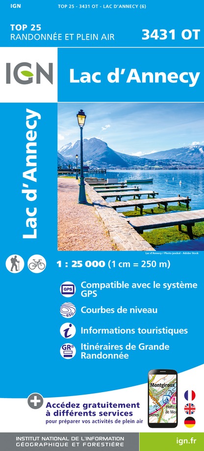
3431OT - LAC D'ANNECY
Editor : IGN
Collection : TOP 25 ET SÉRIE BLEUE
Scale : 1:25 000
13.90€
TOP75032 - CHAINE DES ARAVIS - MASSIF DES BAUGES
Editor : IGN
Collection : TOP 75
Scale : 1:75 000
9.80€
TOP100D73 - SAVOIE CHAMBÉRY ALBERTVILLE PARC NATIONAL DE LA VANOISE PNR DU MASSIF DES BAUGES
Editor : IGN
Collection : TOP 100
Scale : 1:100 000
8.40€
TOP100D74 - HAUTE-SAVOIE ANNECY THONON-LES-BAINS MASSIF DU MONT BLANC CHAÎNE DES ARAVIS
Editor : IGN
Collection : TOP 100
Scale : 1:100 000
8.40€
TOP100D01 - AIN BOURG-EN-BRESSE AMBÉRIEU-EN-BUGEY PAYS DE GEX
Editor : IGN
Collection : TOP 100
Scale : 1:100 000
8.40€
202 JURA ALPES DU NORD
Editor : IGN
Collection : TOP 200
Scale : 1:200 000
6.80€
89026 - GRANDES TRAVERSÉES DU JURA - GTJ
Editor : IGN
Collection : DECOUVERTE DES CHEMINS
Scale : 1:105 000
9.10€
D38 ISÈRE
Editor : IGN
Collection : CARTES DÉPARTEMENTALES IGN
Scale : 1:150 000
5.90€
D01-69 AIN RHÔNE
Editor : IGN
Collection : CARTES DÉPARTEMENTALES IGN
Scale : 1:150 000
5.90€
NR14 AUVERGNE-RHÔNE-ALPES RECTO/VERSO MASSIF CENTRAL
Editor : IGN
Collection : CARTES RÉGIONALES IGN
Scale : 1:250 000
6.80€
NR15 AUVERGNE-RHÔNE-ALPES RECTO/VERSO MASSIF ALPIN
Editor : IGN
Collection : CARTES RÉGIONALES IGN
Scale : 1:250 000
6.80€
EUROPE
Editor : IGN
Collection : DÉCOUVERTE DES PAYS DU MONDE IGN
Scale : 1:2 500 000
7.00€
SUISSE
Editor : IGN
Collection : DÉCOUVERTE DES PAYS DU MONDE IGN
Scale : 1:303 000
7.00€

Description

This route is only suitable for experienced hikers as the rock is often wet and slippery in places and the peak is equipped with chains and a ladder. Only to be attempted in good weather.
The path starts to the right of the Chalet de l'Aulp and climbs steeply up to the Refuge de la Tournette (1774m), then rises under the Tournette foothills in a huge S-shape. Leave the lake-side slope for a moment before reaching a fixed ladder, equipped with a chain, which takes you to the summit, also known as the "fauteuil". A 360° panorama gives you a view not only of the lake, but of all the surrounding mountains. You can also have fun finding your itinerary from previous days! The return journey to the Pré Vérel refuge takes the same route, so be careful.

Technical Information

Walking
Difficulty
Not specified
Duration
6h
Dist.
6.3 km
Show more

Altimetric profile

Starting point

74230   Les Clefs
Lat : 45.826388Lng : 6.286361

Date and time

  • From 15/06/2025 to 30/09/2025

Additional information

Updated by

Conseil Départemental de la Haute-Savoie - 10/12/2024
www.hautesavoiexperience.fr
Report a problem

Open period

From 15/06 to 30/09.

Data author

Ratings and reviews

To see around
See more
Open
Close
Show
Show
Show
Show
Show
Show
Show
Show
Show
Show
Show
Caution!
We have no information on the difficulty of this circuit. You may encounter some surprises along the way. Before you go, please feel free to inquire more and take all necessary precautions. Have a good trip! 🌳🥾