Alert

Alerts

To see around
See more
Open
Close
Show
Show
Show
Show
Show
Show
Show
Show
Show
Show
Show

Oups... It would appear that Cirkwi does not have permission to use your location.

Presentation
Description
Map
Points of interest
Ratings and reviews
See around

UNESCO Global Geopark Famenne-Ardenne: Wellin Geotrail "On the borders of the Calestienne and the Ardennes"

UNESCO Global Geopark Famenne-Ardenne: Wellin Geotrail "On the borders of the Calestienne and the Ardennes"
Credit : Geopark Famenne-Ardenne

Description

"On the borders of the Calestienne and the Ardennes":
Welcome to this countryside walk around the town of Wellin, the starting point for your geotrail exploring the Famenne-Ardenne Geopark. Before getting started, let’s take a quick look at the history of Wellin, which stretches back a very long way. A series of archaeological excavations has shed some light on its early origins. The town takes its name from Wadalinus, a Frankish landowner. These different digs, which unearthed some richly furnished 6th century tombs, were instrumental in dating the origins of the town at least back to this period. They also provided proof of habitation, uncovering 80 post holes for wooden houses, indicating that Wellin was the centre of a vast Merovingian estate.

Technical Information

Walking
Difficulty
Easy
Duration
2h30mn (1d)
Dist.
9.7 km
Show more

Altimetric profile

Starting point

152 Les-Hayettes , 6920   Wellin
Lat : 50.08286Lng : 5.11083

Points of interest

image du object

Anastasia Farm Gîte

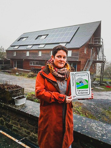
Gîte farm "Anastasia" is a partner of the Geopark Famenne-Ardenne. Our partners receive the label "Geopark Famenne-Ardenne", an area recognized by UNESCO. What is it you do? "We are a permaculture farm, constantly experimenting and engaged in sustainable farming for over 25 years. We currently offer a large-capacity gîtein a separate eco-building built from solid wood." What prompted you to seek "Famenne-Ardenne UNESCO Global Geopark Partner" status? "I am so proud of our region winning this UNESCO status. I have worked in the Geopark for the past 20 years, in the Caves of Han to be precise, and been involved in promoting it, and I have an abiding love for the land, so I would be immensely proud to represent the Geopark through our gîte." What is your approach to sustainable development and environment friendly practices? "We have always been committed to eco-friendly practices and sustainable development. All the materials used for the gîte are green, low-energy (even lower than low-energy, since we used solid wood!), and untreated. Rainwater is captured and treated by lagooning, then filtered by reverse osmosis. We use solar panels and our heating is provided by a large wood-burning boiler. We farm sustainably, without mechanization, focusing on humanising the way we treat the land." Isabelle Köchli - Manager Contact details: Les Hayettes, 126 6920 Wellin 084 38 96 67 koechli.isabelle@gmail.com Facebook fermearcenciel.be

128 Les-Hayettes 6920 Wellin
- UNESCO Global Geopark Famenne-Ardenne -
Consulter
image du object

Maison Lefebvre et Fils butcher shop

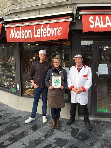
Maison Lefebvre et Fils is a partner of the Geopark Famenne-Ardenne. Our partners are awarded the label "Geopark Famenne-Ardenne", a territory recognised by UNESCO. What is it you do? "Maison Lefevbre & Fils is a butcher's and delicatessen that also provides catering services. We are proud of our heritage as craft butchers through three generations. The vast majority of our products are locally sourced, and we continue to follow traditional production methods and recipes. Our smoked products are prepared in a traditional smoker dating back over 80 years." What prompted you to seek "Famenne-Ardenne UNESCO Global Geopark Partner" status? "The spirit behind the Geopark chimes with our philosophy of adhering exclusively to traditional methods for three generations. Since 1952, we have been providers of Walloon and primarily local products, prepared according to age-old tradition. We aim to introduce our customers to quality craft-made products that reflect our knowhow and the best our lovely region has to offer." What is your approach to sustainable development and environment friendly practices? "We are very keen on using green energy in this establishment, and we employ a specialist firm to sort all our waste. We work with local producers and act as ambassadors for short food supply chains and for traditional craft-based expertise. We are also very much part of the local community in Wellin, and we take part in and sponsor the Wellin Carnival." Benjamin Lefebvre, General Manager Contact details: rue de Beauraing, 182B 6920 Wellin 084 38 83 59 info@boucherielefebvre.com boucherielefebvre.com

182 Rue de Beauraing 6920 Wellin
- UNESCO Global Geopark Famenne-Ardenne -
Consulter
image du object

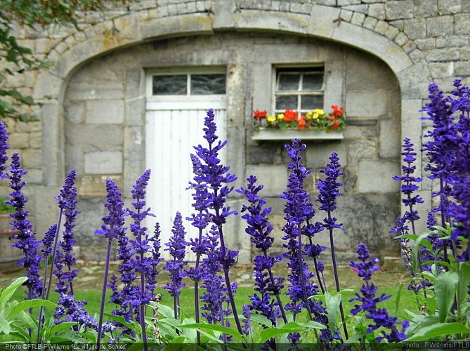
Sohier, One of the Most Beautiful Villages in Wallonia

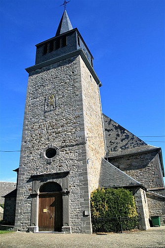
Sohier stands on the borders of the Calestienne and the Ardennes, and is famous for its architectural heritage: this includes in particular its many traditional houses and its 13 farms, all now beautifully restored and maintained, but not forgetting its scenic views, its ancient oak, the Gros Chêne, its former school, the church of Saint-Lambert (1870) and the presbytery. It is the quality and uniformity of its buildings, most built from natural stone in the 19th century, that has earned Sohier recognition as one of the “Most Beautiful Villages in Wallonia”. The photo shows a section of the outer wall of one of the village farmhouses. Alongside the greyish limestone fieldstones (easily identified by their smooth surface), you can also see various colours of sandstone (generally greenish, but sometimes brownish or red and with a rough surface). But the villagers of Sohier can also take some of the credit for the accolade bestowed on their village: every year, at the start of summer, the entire village is filled with flowers. Sohier also has a long history. The burial ground discovered at the spot known as “Le Gibet” (the gibbet) has yieldedevidence of Gallo-Roman occupation in the 1st century. Excavations have revealed pottery, coins and other artefacts. In later times, the village grew up around its fortress, which was originally encircled by a moat. Over a period of four centuries, just three families, all inter-related, held the Seigneury and castle of Sohier.

1 Rue Basse 6920 Wellin
- UNESCO Global Geopark Famenne-Ardenne -
Consulter
image du object

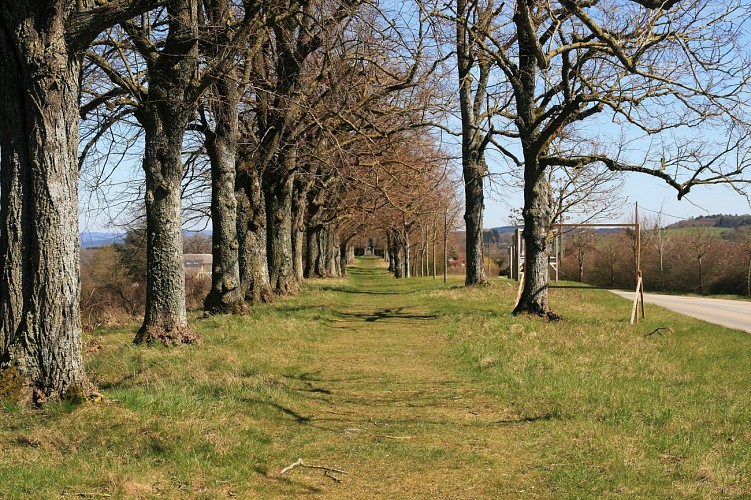
The Drêve des Tilleuls and the Neo-Gothic Chapel

The Drève des Tilleuls and the Neo-Gothic Chapel This is the final stopping-place on your walk through the region of Wellin. The Drève, an avenue of linden trees, stands slightly outside the village on a hillside of clastic rock, and offers an impressive panorama. To the south, the land rises fairly smoothly, pastures fading in the distance into deep forests: this is the Ardennes. In the opposite direction, looking northward, the terrain is more varied. In the foreground, you can make out a depression, La Grande Fagne, carved out of soft rock easily eroded by a combination of frost and run-off, and by root action. This rock has the composition of clay but has been consolidated by a lengthy geological process into a hard rock known to geologists as schist. Beyond this depression, the land rises towards a wooded hill running east to west, the Tienne de Reumont. Walking this hill, you will note a number of limestone outcrops indicating that we have now entered the Calestienne. After a stretch of schists, the limestone strip continues for over a kilometre (Bois de Haur). For an idea of the scale of the strip, we need to look west, towards the bell-tower of Lomprey church; just above the level of the motorway, you can make out the working face of the Limites quarry where the limestone is extracted. To the north of theCalestienne, the broad Famenne depression lies in the shales of the Upper Devonian, before the terrain rises sharply to the Condroz. The Drève des Tilleuls leads to the Chapel of Our Lady of the Seven Sorrows, built in 1860 on the orders of the Baroness Baré de Comogne. To reach the oratory, you must first negotiate the magnificent alley of trees symbolising the seven sorrows of the Virgin. The chapel is neo-Gothic in style and built on asiltstone promontory. And since history is often interwoven with religion, in times of drought the faithful would come together in procession along the avenue to the chapel to pray for rain.

36 Rue de Lomprez 6920 Wellin
- UNESCO Global Geopark Famenne-Ardenne -
Consulter

Ratings and reviews

To see around
See more
Open
Close
Show
Show
Show
Show
Show
Show
Show
Show
Show
Show
Show
Caution!
We have no information on the difficulty of this circuit. You may encounter some surprises along the way. Before you go, please feel free to inquire more and take all necessary precautions. Have a good trip! 🌳🥾