Alert
Alerts
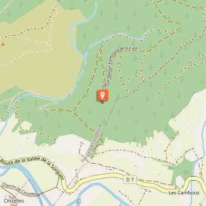
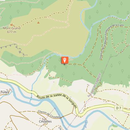
Notre-Dame du Cayla path


IGN cards


Description
Take your walking stick and go for a stroll along the national forest of La Calm to reach a small Romanesque chapel which overlooks the Sorgues valley from the top of its rocky promontory.After the bridge, turn to the right, then after 50m take a left turn to follow the rue de la ville. Once you’ve passed through the arch walk uphill to the right, then to the left. After 100 m you reach the junction of Notre Dame du Cayla from where we will later walk back to our cars.Carry on your way on a gently rising path and reach another fork.Take a track to the right that turns into a rather steep and stony path. 200 m further on, on the right, leave this path that winds is way up to the Montgrand cross. Keep going until you reach the edge of the national forest. Walk along the edge of the forest to the right, then follow an alley to the left that runs up to the forester's house of La Calm.After the forester's house, take a winding trail to the right until you reach an intersection.Turn to the right towards Notre-Dame-du- Cayla chapel. Walk downhill to the right towards the ravine of La Calm. After three hairpin bends, cross the ravine and go to the right bank of the river where you reach an intersection. Keep going to the right on a gently rising path. Walk through the woodland area, then walk along the edge of the fields up to Versols.
Technical Information
Altimetric profile
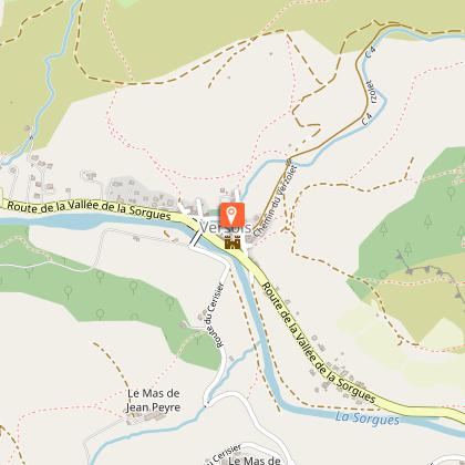
Starting point
Steps
Points of interest


Additional information
Public transport
Travel by bus or train: lio.laregion.fr/carpooling : BlaBlaCar, Rézo Pouce, Mobicoop, Idvroom, LaRoueVerte, Roulez malin
Advice
Box tree months are active from May to October. During the caterpillar phase, they feed on the leaves of box trees. They crawl down trees and move on long silken threads, although these threads are annoying when hiking they do not pose any health risk
Advised parking
Parking rive gauche de la Sorgues, de l’autre côté du pont à Versols-et-Lapeyre
Access
Saint-Affrique is situated 31 km South-West from Millau via the D992 and D999, then head toward Versols-et-Lapeyre
Arrival
Carpark is set on the left bank of the Sorgues River, on the other side of bridge in Versols-et-Lapeyre
Ambiance
The fortified village of Versols is the starting point of this hike and offers a convenient access to a traditional pilgrimage site. From stony paths to tracks through the forest, this route leads you up to Notre-Dame du Cayla, a discreet building perched on a limestone spur. A hiking loop full of charm throughout the Sorgues valley.
Departure
Carpark is set on the left bank of the Sorgues River, on the other side of bridge in Versols-et-Lapeyre
Data author
