Alert
Alerts
Versols hiking circuit "A path, a school"


IGN cards


Description
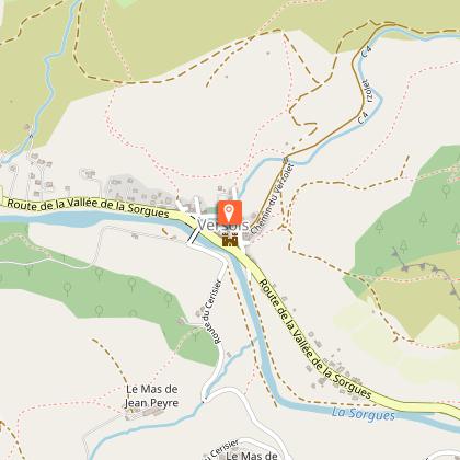
This family stroll is perfect for exploring the right bank of the river Sorgues. As you walk along the schoolchildren's path and off the beaten tracks, you will discover the hidden treasures in Versols: the medieval bridge and the ingenious irrigation system in the village.This circuit is part of the "4 chemins, 1 école" series which was carried out by the schools in the Sorgues valley in partnership with the CDRP and the municipal councils in the valley (Versols-et-Lapeyre, Saint-Felix-de Sorgues, Marnhagues-et-Latour).Park your car on the parking lot by the riverside, opposite the former school. Take the D7 road to the left, towards the Northwest. Before the bridge, turn to the right in the Rue de la Ville. On the right-hand side, notice the castle which is open to the public during the summer season. Pass under the arch, which used to be the porch of the ancient battlements. Turn to the right and take an ascending street. At the Plo du Four, take a left turn and walk into the buissière (a passage lined up with box-trees). Head your way towards Notre Dame du Cayla (right path is a direct route). At the intersection, take to the right and carry straight on. Enjoy the scenic view over the valley all along the path. A 50m long stretch of this path is poorly marked, and you should be careful not to enter into plots of land (to the right and then to the left). Also, notice on the left, the remains of old low stone walls. After your walking through a small oak wood, take the path to the left.At the hairpin bend, turn to the right and walk along the temporary brook. Reach a trail and take it to the right. Follow the old path to the left, notice the wall running along the right side. At the intersection, carry straight on along a broader trail to get back to the path. Observe to the left an old terraced vineyard. Get back to the road.Walk across the D7 road opposite the Cinzelles electric power station, and keep going to the right (towards the East). Catch sight of an old shelter on the right side of the road. Take the path sloping down to the Sorgues river to the left. Walk along the Sorgues up to the car park.
Technical Information
Altimetric profile
Starting point
Additional information
Advised parking
Park your car on the parking lot by the riverside, opposite the former school's Versols
Public transport
Getting around by bus or by train: lio.laregion.fr/ Carsharing: BlaBlaCar, Rézo Pouce, Mobicoop, Idvroom, LaRoueVerte, Roulez malin
Access
Versols is situated 10 km South of Saint- Affrique via the D7 road
Ambiance
From the fountain to the Cinzelles electric power station, from the castle to the formerly cultivated terraces, from the 14th-century bridge to the Montgrand cliffs where birds of prey nestle. Go and explore the village of Versols and its surroundings, from the old battlements to the Larzac foothills.
Arrival
Park your car on the parking lot by the riverside, opposite the former school's Versols.
Departure
Park your car on the parking lot by the riverside, opposite the former school's Versols.
Data author


