Alert
Alerts
Hike The Siniq Valley


IGN cards


Description
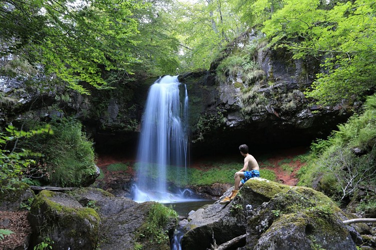
Hike in a beautiful glacial valley where you can find in June some rare orchids. Care for good hiking shoes, some paths are wet and slippery. In Malbo restaurant and bar to take a breather or eat something.
D - DEPART: From the church at LACAPELLE-BARRES. Return to just before the D990. To the right a path leads to the bridge. Cross the bridge and take the path to the left.
1 - Higher up take the 2nd path on the right. Follow this to the D401.
2 - .Follow the D 401 on the left and 50m before the crossroad of CHATOUR cross the field to the right and cross the Siniq. A good cobblestone track climbs to NOUVIALLE (this track can be very wet underfoot.)
3 - Cross the village and follow the road
4 - Take the path to the left. The path leads to the D57.View to the Puy de Bâne
5 - Climbing again take the path on the left to just behind ROUPON and to the left
to a ford (a little footbridge to the right).
6 - Arrive on the road and take the path at right climbing to MALBO (can be very muddy). Cross the village and in a bend to the right follow the road for 300m. Take the path to the left, further on the path descends very steeply to LA FRANCIO.
7 - Cross the road. follow at right. Ahead the path climbs to LABRO and right behind CHATOURS. Viex to the Aubrac plateau.
8 - After the "vacherie of Malmeza" follow the same direction in private land and 300m further below cross the stile. A path leads to the bridge and to the point of departure by a path on the left after the bridge.
Mountainbike: not possible, too dangerous and wet paths.
Technical Information
Altimetric profile
Starting point
Points of interest
Date and time
- From 01/05/2024 to 31/10/2034
- From 01/05/2025 to 31/10/2035
Additional information
Environments
In the country
Mountain view
Overview on river
Updated by
Office de Tourisme des Pays de Saint-Flour - 24/06/2024
www.pays-saint-flour.fr
Report a problem
Open period
From 01/05 to 31/10.
Subject to favorable snow and weather conditions.
Contact
Phone : 04 71 23 38 04
Website : www.pays-saint-flour.fr
Type of land
Ground
Not suitable for strollers


