Alert
Alerts


Walking itinerary: the pointe d'Angolon


IGN cards


Description
From the Col de Joux Plane this route follows the ridge leading from the Pointe de Chamossiere to the summit of the Pointe d'Angolon. This is a little frequented but very interesting hike that opens onto a beautiful panorama.
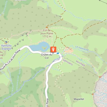
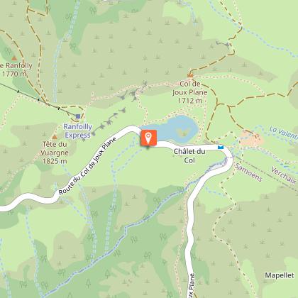
From the Joux-Plane pass, take the path on the right after the Nordic welcome chalet.
Follow this path to its end and continue along a path leading between two nipples towards the ridge to the left of the Pointe de Chamossière.
On the edge of the ridge you can observe, with caution, the vertiginous corridors of very loose rock that descend towards the torrent of Clévieux.
The route continues along the ridge leading to the top of the Chamossière chairlift (Morzine ski area). The path passes behind a gazex* and climbs with the help of a cable a short rocky passage leading to the summit of Collu. Continue along the ridge to reach the summit of the Pointe d'Angolon in a few minutes.
The view opens up to a 360° panorama stretching from Lake Geneva to the peaks of the Chablais: the Cornettes de Bise, the Dents d'Oche, the peaks of the Haut Giffre and the Mont Blanc range.
For the return journey, go to the chairlift station and take the slope that goes down towards the lake.
Itinerary for guidance only.
Technical Information
Altimetric profile
Starting point
Points of interest


Date and time
- From 20/06/2025 to 20/09/2025
- From 20/06/2026 to 20/09/2026
Additional information
Environments
Lakeside or by stretch of water
Lake view
Mountain location
Waterside
Updated by
Office de Tourisme de Samoëns - 26/02/2025
www.samoens.com
Report a problem
Open period
From 20/06 to 20/09.
Contact
Phone : 04 50 96 64 19
Email : nordic.hg@orange.fr
Website : www.valleeduhautgiffre.fr
Animals accepted
Animals are accepted.
Data author
