Alert
Alerts
Métairies Balade

IGN cards


Description
Departure from the parking of the town hall of Pugnac
From the parking, pass between the school and the hall, street "St Mamet - La Salvetat". Continue straight until the stop sign. Take the pave road in front until the next stop.
At the intersection, turn right. We arrive at the hamlet "Les Métairies", cross it.
At the following hamlet, go to the second intersection, at the signs, turn left. This pave road became a path that we take straight to toward the marshes of Moron.
After the last house, you can go straight to take a break on the edge of the Moron. Otherwise, continuer the ballade, turn left on a grassy path. Then, at the intersection of two paths, continue straight ahead. Few meters away, turn left. Continue straight along a pond. At the signs, go on the right.
Before the stop, turn right to take the white path. Arrived at the pave road, cross it and take the path in front to "Cassillac". At the end of the hamlet, turn left and continue on this same path to enter in "Augereau". Then, turn left and at the end of it, turn right.
Take the right side again to "Lassalle".
This is particularly here that there was a roman housing was excavated and then covered to prevent damages. At the entrance of the hamlet , leave the pave road to take on the right a path, going to "Le Vieux Moulin". Close to the creek, at the watermill's ruin well hidden by the vegetation, turn left and continue straight in undergrowth until "St-Urbain".
At the road D23, cross it to arrive at the St Urbain Chapel, from the VXIIth century. The West entrance has a a steeple, which was restored in 1894 you can visit the Chapel or take a break on the public bench. Get back on the road and turn right : Caution with the traffic. A the signs, turn right. At the next intersection, walk straight ahead to "St Christoly".
At the signs, go on the left on the path. At the end of the vines parcel, turn left. Go around it between the vineyard and the wood. Take the right at the end of the parcel and straight then right until the next signs. Get back on the pave road. Turn left to join the D135. At the intersection, turn right.
At a hundred meters, turn left to go down in undergrowth. Just after the creek, go on the right to take a grassy path that winds between plots : turn left to go up, then on the right and finally on the left to a little pave road.
At the intersection, at the signs, go up straight ahead. Stay on this little road, to the center of Pugnac.
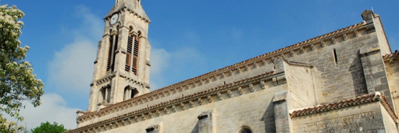
After the cemetery, at the signs of the intersection, turn left to arrive at the street "Des Anciens Combattants" that take you back at the starting point. Before going back at the town hall, you can go at the church Notre-Dame of Pugnac, this romanesque church was destroyed and rebuilt at the XIXth century.
Technical Information
Altimetric profile
Starting point
Points of interest
Data author


