Alert
Alerts
Ballade of the wash houses

IGN cards


Description
Start from the parking of the function room of Bayon.
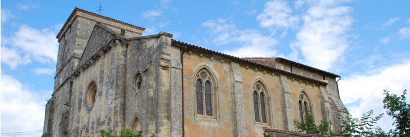
From the parking of the function hall, pass between buildings and the romanesque church of Bayon from the XIIth century. Go toward the town hall and the school. Take the main way to go to a crossroad. At the sign, go ahead in "Chemin Moulin Déchamps". At the end of this road, at the signs, turn left.
In the village, turn left into "Chemin des Rocques" street. The tarred way continues straight ahead by a grassy path at then end of the vines.
Continue straight to the undergrowth, forbidden for cars. Go down the path until you see the angle of a house. at the signs, turn left to arrive on a Corniche road. On this road, turn right and continue on "Route de la Reuille".
Turn right into "Escalier du PIcquet" street and climb up in the cliff by the stairs. You can see some cave dwellings and on the opposite bank the first isles of the estuary.
At the toad, turn completely to the right and continue to go up the path. At the vines, admire the wonderful view from the confluence between the Dordogne and the Garonne. Follow the signs and stay on the path that goes up. At "Chemin de Plisseau" street, turn left. At the next crossroad, go straight. From "Route de l'île du Nord" street, you can see the Medoc Châteaux and especially the Châteaux margaux.
Enter in the village of Francicot. At the stop sign, turn left in front of the shop and at the sign take to the left the "escalier des falaises" street.
At the next signs, follow "Escalier de la Vierge. Stay on this way until the house. At the sign, get down the stairs until the Corniche road. At the village "Le Rigalet", turn right and continue on the road until the locality "La Mayanne". At the signs, turn right to "Escaliers de la falaise" street". Climb the "Stairs of the cliff" and go to the right on a with path.
At the tarred part, follow on the right and the back of the village of Gauriac. Caution with the traffic on the D669. Cross the road, and go down into "Rue de l'église" street to the ancient part of Gauriac. Pass close to the church and go down to the cemetery. Turn right into "Chemin du lavoir" and go onto the little paved path along a wash house and a fountain. Go up the path that will become white, until the intersection and the signs.
Turn left. At the woody part, turn right to go down by a white path: between the vines and wood. At the bottom of the road, at the signs, turn right.
At the next signs, turn left to join a little stream that we cross by a wood bridge.
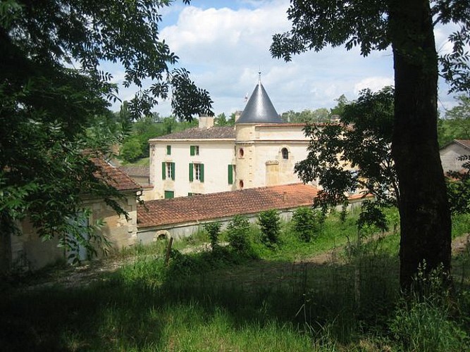
Go up in the parcels of vines. Follow until the stop sign this white path which becomes tarred. Cross straight ahead and enter in the center of St Ciers de Canesse. Pass close to the church St Jean Baptiste from the XIIIth century. At the signs, turn right to “La Grolet”. Go down to others signs and go on the right until the Château La Grolet. Go up the road. Continue on this little tarred path. At the right turn, take the earth path in front which the entrance has two rocks in front. At the end of this path, at the intersection, turn lef and go down the tarred way. At the next intersection, turn left and then immediately on the right to follow “Le Petit Homme”.
At the intersection, turn right and continue on the path until the village “Perogendre”. At the village, continue straight to join the main road.
Cross and go on the right, but stay the closest you can to the vines to be safe.
At the intersectin, turn left to “La Jauge”. Make a stop to admire the old windmill that has been restaured. Go straight until the stop. At the signs, take "Route des crêtes" street and continue straight. 100 meters away, go down on the right into "Chemin du lavoir" street on a tarred path that becomes white. In the descent, at the angle of the 1st house, turn left and continues to go down. A fountain, a wash house and a bench are there, make a stop to relax.
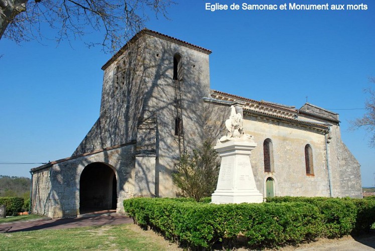
Turn left into "Route du Pont du Domaine" and continue on this path until the center of Samonac : wonderful view on the church. Turn to the right into "Avenue des Côtes de Bourg" street to get to the crossroad of the church St Martin.
Turn left into "Allée des vignes" street. Close to the wood, turn right and immediately to the left to go up the path. At the end of the vine, this path leads to a tarred road. Turn left into "Route de Lansac" until the intersection. Turn right into "Chemin de Peyrefaure" to go to “Peyrefaure”. At the hamlet, turn right at the signs and go on a path. Go up and straight to the other side and follow the path at the end of the range of vines. To the sign, almost at the top, turn left and go down in undergrowth by a nice little way. Go to at a nice wash house and a bench. At the angle of an industrial fence, turn left. At the intersection with a path, take the right and go up the village. After you get back on a road, stay straight until the stop. Turn left into "Avenue des Tourteaux" street and continue on this road until "Route des châteaux" street. Cross, go to the left but stay close to the vines. At the first path, turn right in the way "Liaison Bayon" and go down to St Seurin of Bourg.
After about thirty meters, tunr to the right and go down to the wood by a white path. Stay on this way. Pass a fountain and a wash house. The way goes up to some houses and it becomes tarred. At the corner of a house, turn left into "Chemin de Honziou" street to join a little road.
To the sign, turn left and follow this way until its end. Turn right into "Chemin du lavoir". We arrive at a covered wash house and a fountain, before passing under the ancient bridge of the railway that used to join Bourg, Blaye and St André De Cubzac. At the intersection, turn left into "Chemin de Gourou" street. Then, turn left at "Château de Nodot" and go up until the last house. At the corner, turn right into "Chemin des vignes" street. Follow this road until a bifurcation completely on the right. Go down until the intersection with the D669 : caution with the traffic.
Cross and go toward the Château Tayac, very nice Château. Face to the entering gate, turn right into "Chemin de Tanesse". At the end of this road, at the stop, turn right into "Route de la mairie" street to join the starting point.
Technical Information
Altimetric profile
Starting point
Points of interest
Data author


