Alert
Alerts
Hike along the Petit Balcon Nord: Argentière-Les Bois


IGN cards


Description
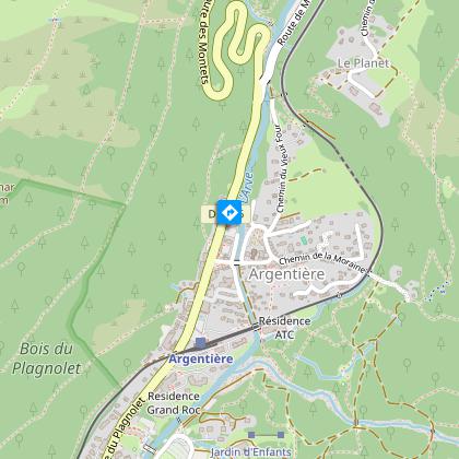
This trail links Argentière to Chamonix on the north side at a height of around 200 m above the valley.
From the center of Argentière, take the Chemin de la Moraine, passing under the SNCF tracks, to reach the beginning of the Chemin des Rambles.
Take the path that goes to the right in the forest (cross-country trail in winter), cross the Arveyron, a torrent coming down from the glacier. Continue down the chemin de la Glacière, then left through the tunnel under the ski slope. Then pass under the Lognan cable car, leave the forest for a few moments at the top of the place called La Rosière and walk along the Maison Forte, one of the oldest ruins in the valley. Cross under the ski lift and leave on the left the path going up to the Croix de Lognan: the Petit Balcon remains at a low altitude while passing the villages of Les Chosalets and Les Grassonnets.
You will soon reach the edge of the forest and the plateau of La Laurel by a succession of short ascents and descents.
of the forest and the plateau of Lavancher. Reach the top of the village by the road
or better by the path of the Coutire which joins the road not far from the last hotel.
Go up 100 m to the point where two paths start: the first one on the right goes down to Les Tines.
the second one on the left, Iarge cross-country track slightly downhill at the beginning
downhill at the beginning which cuts the forest: it joins the village of Les Bois by the Côte du Piget.
des Bois.
More information available at the Tourist Office or the High Mountain Office and in our trail guide.
Attention : The conditions of the trails are likely to change, think of informing you before leaving.
Technical Information
Altimetric profile
Starting point
Points of interest
Additional information
Updated by
Office de Tourisme de la Vallée de Chamonix-Mont-Blanc - 31/10/2024
www.chamonix.com
Report a problem
Open period
From 06/04 to 17/11.
Subject to favorable snow and weather conditions.
Contact
Phone : 04 50 53 00 24
Email : info@chamonix.com
Facebook : www.facebook.com/chamonixmontblanc/
Twitter : twitter.com/chamonix_france
Data author


