Alert
Alerts
RANDONNÉE - CIRCUIT DÉCOUVERTE DES CROIX
IGN cards









Description
Access: From Remiremont, go to Val-d'ajol.
Parking: opposite the Peugeot garage, route de Plombières.
Distance: 7.5 km / Duration: 2 h 30 / Difference in height: 100m / Signs: green ring.
1) Leave the car park in the direction of the church. Turn right before the bridge and walk along the river to the next bridge. Cross the De Buyer bridge and head towards the Post Office (1719 cross on the right of the Post Office). Go back in the direction of the church. Go back to the small square in rue de Plombières (border marker). Continue to the small square at the foot of the church, opposite the bakery (a 17th century cross). Go up the main street for 200m, passing the war memorial.
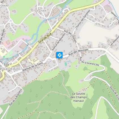
2) In the middle of a small square, go towards the Gravel cross (named after a former tabellion general). Continue along the main road to the next crossroads. Follow the Rue du Prieuré d'Hérival which leads to the old station. Walk along the square on the right. At the next crossroads, turn left onto the D20 in the direction of Hamanxard or rue des Mousses. Along the wall of the hotel, a path leads to a place of meditation (imitation of the grotto at Lourdes).
3) Continue along rue des Mousses (D20). On the pavement on the right are three old calvaries (two from the 17th century, one from 1803). Then branch off onto the route de Rapaumont (the Jean Sauvé cross at the crossroads).
4) At the bottom of the hill after a small bridge, a 500m loop leads to the hamlet of La Rochotte (1636 cross and panoramic view of the Val-d'Ajol). Back at the bottom of the hill, walk along the meadow to the hamlet of Bouchâtel. Take the D23 on the right.
5) Stop at Les Chênes (three crosses to visit). After this small hamlet, follow the small road of La Banvoie to the left.
6) At the hamlet called le Pied du Mont (one cross) turn left.
7) At La Banvoie, go back 100m to the right (2 crosses).
8) At the Mésaubé (a cross on the left), go back 30m then head towards the Granges (a cross) and the Cross (a small calvary from 1601).
9) Turn right towards Le Moncel.
10) In the hamlet of Moncel (an old cross at the crossroads), go back 100m to the right (second cross) and return to the starting point by the left-hand street.
Technical Information
Altimetric profile
Starting point
Points of interest
Additional information
Contact
Tel : 03 29 30 61 55
Email : remiremont@otrp.fr
Producteur de la donnée
Ces informations sont issues de la plateforme SITLOR - Système d’Information Touristique - Lorraine
Elles sont synchronisées dans le cadre du partenariat entre Cirkwi, l’Agence régionale du Tourisme Grand Est et les membres du comité technique de Sitlor.
Data author


