Alert
Alerts
Randonnée - la vallée d'hamanxard et rapaumont

IGN cards






Description
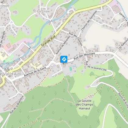
Access: From Remiremont go to Val-d'Ajol, go to the church.
Parking: Park at Place du Sô.
Distance: 11 km / Duration: 3 h 30 / Difference in height: 390m / Marking: Green disc.
1) From the church, follow the road to Saint-Bresson (former Gerbe d'Or brewery). Take the forest path and then a tarmac track leading off to the left to an inhabited clearing. Go around the dwellings by a forest track to the top of the mountain (old quarries on the left on the summit used to build the church). Follow the ridge path through the large Scots pines without leaving the forest.
2) At the junction with a tarmac path, head towards the farm on the left (fountain). At the first bend, a path on the left descends through a beech forest. Through a succession of small paths, reach the bottom of the Hamanxard valley (old workers' housing estate, school, farms).
3) The D20 at the bottom of the valley offers a shortcut in case of fatigue or unforeseen circumstances. If you choose to continue, cross the hamlet of Leyval straight ahead (several calvaries). A new ascent begins on a dirt track after a succession of fountains.
4) When you reach the hamlet of Les Granges de Leyval, turn sharply left after the last building. Continue along a grassy path in the direction of the television relay station on the other side (panoramic view of Faymont, Les Feuillées and the Val-d'Ajol).
5) Go down on a small road towards the village of Val-d'Ajol, which you can soon see.
6) Go down through the pastures on a grassy path. After crossing a wetland area often covered with periwinkle, take the path on the right.
7) At the hamlet of La Rochotte (17th century cross and viewpoint), follow the right-hand track which runs down the rest of the hill and leads back to the village by the road.
Technical Information
Altimetric profile
Starting point
Points of interest
Additional information
Producteur de la donnée
Ces informations sont issues de la plateforme SITLOR - Système d’Information Touristique - Lorraine
Elles sont synchronisées dans le cadre du partenariat entre Cirkwi, l’Agence régionale du Tourisme Grand Est et les membres du comité technique de Sitlor.
Contact
Tel : 03 29 30 61 55
Email : remiremont@otrp.fr
Data author

