Alert
Alerts
Randonnée - outremont et la croix de jaranceau


IGN cards







Description
Access: East of Val-d'Ajol.
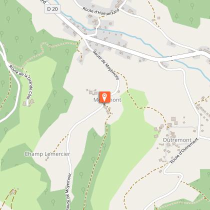
Parking: Park in the car park in Outremont.
Distance: 7,7 km / Duration: 2 h 30 / Difference in height: 220m / Signs: red ring.
1 Leave from the hamlet of Outremont (a visitor's car park has been provided at a crossroads). Head towards the densest and oldest part of the hamlet. Walk through the hamlet from bottom to top (numerous fountains and calvaries).
2 A dirt track on the right leads to the so-called "Angleys" (the largest calvary in the commune, but it is missing its cross).
3 Continue up the road, turning left at the first opportunity and then right before reaching a farm.
4 Walk 200m round trip to see one of the oldest carved crosses from the 17th century. Continue towards the forest. Cross the tarmac road.
5 Take a path that marks the boundary between Lorraine and Franche-Comté with some very special boundary markers (St André cross and Lorraine cross).
6 Leave the border path on the left to join the small road to Combelles. At the next crossroads, take a gravel road that passes the ONF refuge chalet.
7 Cross a large crossroads where several forest tracks converge. Go down a short steep slope to the left. The path joins a tarmac road downstream. Follow it to finish the route.
Technical Information
Altimetric profile
Starting point
Points of interest
Additional information
Producteur de la donnée
Ces informations sont issues de la plateforme SITLOR - Système d’Information Touristique - Lorraine
Elles sont synchronisées dans le cadre du partenariat entre Cirkwi, l’Agence régionale du Tourisme Grand Est et les membres du comité technique de Sitlor.
Contact
Tel : 03 29 62 23 70
Email : remiremont@otrp.fr
Data author


