Alert
Alerts
Parcours trail - les Cuveaux

IGN cards



Description
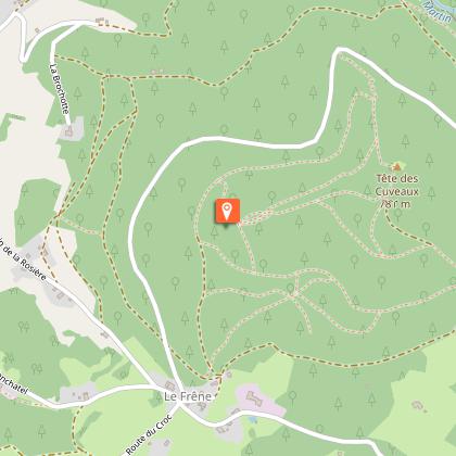
Leaving Le Frêne, you take a very short tarmac section before arriving on a narrow, steep path that climbs up to the head of the basins. You arrive at this very popular site via a little-known path that allows you to admire the lower part of the rock of the cuveaux before enjoying the sublime view over the Moselle valley and the plain. You then continue along a very pleasant path for a few hundred metres before reaching the belvedere. Once at the top of the belvedere, you can enjoy a breathtaking 360° view of the Vosges massif. The descent is via a different route, bringing you to the end of the route at Le Frêne.
Technical Information
Altimetric profile
Starting point
Points of interest
Additional information
Producteur de la donnée
Ces informations sont issues de la plateforme SITLOR - Système d’Information Touristique - Lorraine
Elles sont synchronisées dans le cadre du partenariat entre Cirkwi, l’Agence régionale du Tourisme Grand Est et les membres du comité technique de Sitlor.
Contact
Tel : 03 29 62 23 70
Email : remiremont@otrp.fr
Data author

