Alert
Alerts
Type of practice
Walking
Easy
3h30mn
Presentation
Description
Map
Steps
Ratings and reviews
See around
Les Fours à Pain
IGN cards

1913SB - ÉVREUX CONCHES-EN-OUCHE
Editor : IGN
Collection : TOP 25 ET SÉRIE BLEUE
Scale : 1:25 000
13.90€
1912SB - ELBEUF BOURGTHEROULDE-INFREVILLE
Editor : IGN
Collection : TOP 25 ET SÉRIE BLEUE
Scale : 1:25 000
13.90€

117 CAEN EVREUX PAYS D'AUGE ET D'OUCHE
Editor : IGN
Collection : TOP 100
Scale : 1:100 000
8.40€

D28 EURE-ET-LOIR
Editor : IGN
Collection : CARTES DÉPARTEMENTALES IGN
Scale : 1:150 000
5.90€

D27-76 EURE SEINE-MARITIME
Editor : IGN
Collection : CARTES DÉPARTEMENTALES IGN
Scale : 1:150 000
5.90€

D14-61 CALVADOS ORNE
Editor : IGN
Collection : CARTES DÉPARTEMENTALES IGN
Scale : 1:150 000
5.90€

NR02 NORMANDIE
Editor : IGN
Collection : CARTES RÉGIONALES IGN
Scale : 1:250 000
6.80€

801 FRANCE NORD OUEST
Editor : IGN
Collection : CARTES NATIONALES IGN
Scale : 1:320 000
6.10€

EUROPE
Editor : IGN
Collection : DÉCOUVERTE DES PAYS DU MONDE IGN
Scale : 1:2 500 000
7.00€
Technical Information
Walking
Difficulty
Easy
Duration
3h30mn
Dist.
13 km
Type of practice
Walking
Easy
3h30mn
Show more
Altimetric profile
Starting point
GOUPIL-OTHON
Lat : 49.126907068492Lng : 0.76078337789492
Steps
Additional information
Facilities
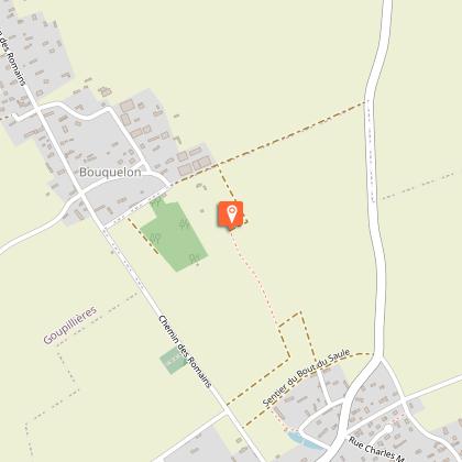
Picnic area - Place Saint-Jean, au lieu-dit Bouquelon à Goupillère
Data author

proposed by
EUREKA, Agence d'Attractivité de l'Eure
26 rue Victor Hugo 27000 EVREUX
Ratings and reviews
To see around
