Alert

Alerts

To see around
See more
Open
Close
Show
Show
Show
Show
Show
Show
Show
Show
Show
Show
Show

Oups... It would appear that Cirkwi does not have permission to use your location.

Description
Map
Steps
Points of interest
Ratings and reviews
See around

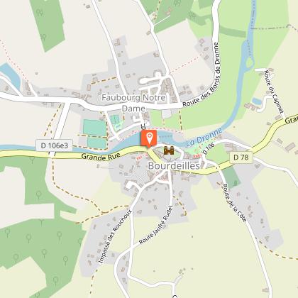
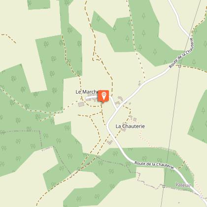
Chemin de Terre de Harrison Barker en Val de Dronne: De Bourdeilles à Brantome

cloitre-de-l-abbaye
Fontaine-Medicis

Description

The Dronne Valley is, according to Harrison Barker, "a tributary of the Isle, which no one who has not stifled the love of beauty in his soul can see without being overcome by the charm of its gentle influence. The Dronne valley is characterized by its low altitude. On the hills with softened lines framing the banks of the Dronne and its affluents,
the small lawns, dry moors and woodlands clinging to the slopes, bring a certain diversification and naturalness to the landscapes.
This fourth stage will take you from Bourdeilles to Brantome.

Technical Information

Walking
Difficulty
Medium
Dist.
14 km
Show more

Altimetric profile

Starting point

24310BOURDEILLES
Lat : 45.32429Lng : 0.58551

Steps

image du object
2

Du Hameau de Marcheix à l'arrivée

Traverser et profiter du point de vue du « Coteau des Chaufres ». Laisser le chemin à gauche, à l’intersection avec la route, prendre à gauche et suivre dir. « Brantôme ». Après le hameau de « La Chauterie », prendre le chemin à gauche, laisser un chemin à droite dans la descente et descendre jusqu’à la route. La traverser et aller en face dir « Valeuil ». Avant d’arriver au village, prendre un chemin à droite dont l’entrée est marqué d’une croix (jonction Valeuil tout droit (500m). Remonter jusqu’à une petite route, prendre à gauche. Traverser le Camping du Bas Meynaud, puis au carrefour, traverser pour prendre le chemin en face. Emprunter un chemin à gauche (balisage vert) dir. Brantôme. Au goudron, à « Labrousse », prendre la route à droite, traverser le hameau tout droit puis retrouver un chemin à gauche qui part dans les bois. 1 km plus loin, longer les maisons, traverser une petite route pour continuer sur le chemin, puis arriver sur une nouvelle route. Prendre brièvement à droite puis tourner à gauche direction « Vigonac ». Traverser le hameau, quitter la route pour un chemin à droite après le Moulin de Vigonac. Traverser une petite route, continuer sur le chemin en face. Se diriger vers les tunnels pour traverser sous la route. A la sortie des tunnels, longer la zone humide sur la droite puis continuer sur le chemin blanc à l’intersection devant la station d’épuration. Au bout du chemin blanc continuer sur la petite route tout droit jusqu’aux parkings. Juste derrière le parking du Vert Galant, se trouve le jardin des moines et le point coudé qui permet de rejoindre l’abbaye.

- Dordogne -
Consulter

Additional information

Contact

Fixed telephone : +33 5 53 05 80 63
Office Tourisme Périgord Dronne Belle

Balisage

Green
sur balise PDIPR

Typologie de l'itinéraire

Walking trail

Thèmes

Cultural
Historical
Natural
Religious

Data author

Image Dordogne
proposed by Dordogne
24000 France

Ratings and reviews

To see around
See more
Open
Close
Show
Show
Show
Show
Show
Show
Show
Show
Show
Show
Show
Caution!
We have no information on the difficulty of this circuit. You may encounter some surprises along the way. Before you go, please feel free to inquire more and take all necessary precautions. Have a good trip! 🌳🥾