Alert

Alerts

To see around
See more
Open
Close
Show
Show
Show
Show
Show
Show
Show
Show
Show
Show
Show

Oups... It would appear that Cirkwi does not have permission to use your location.

OSM Map
OSM Map
OpenStreetMap
Satellite images
Satellite images
Google
GoogleMap Map
GoogleMap Map
Google
Hybrid Map
Hybrid Map
Google
IGN - France
IGN - France
IGN
Cadastral Plan
Cadastral Plan
IGN
Presentation
Description
Map
Steps
Ratings and reviews
See around

The Auris loop

The Auris loop
The Auris loop
The Auris loop

IGN cards

3335ETR - LE BOURG-D'OISANS L'ALPE D'HUEZ RESISTANTE GRANDES ROUSSES SEPT LAUX
Editor : IGN
Collection : TOP 25 RÉSISTANTE
Scale : 1:25 000
17.20€
3336ETR - LES DEUX ALPES RESISTANTE OLAN MUZELLE PARC NATIONAL DES ÉCRINS
Editor : IGN
Collection : TOP 25 RÉSISTANTE
Scale : 1:25 000
17.20€
3335ET - LE BOURG-D'OISANS L'ALPE D'HUEZ GRANDES ROUSSES SEPT LAUX
Editor : IGN
Collection : TOP 25 ET SÉRIE BLEUE
Scale : 1:25 000
13.90€
3336ET - LES DEUX ALPES OLAN MUZELLE PARC NATIONAL DES ÉCRINS
Editor : IGN
Collection : TOP 25 ET SÉRIE BLEUE
Scale : 1:25 000
13.90€
TOP75006 - MASSIF DES ECRINS OISANS CHAMPSAUR
Editor : IGN
Collection : TOP 75
Scale : 1:75 000
9.80€
TOP100D38 - ISÈRE GRENOBLE VIENNE PARC NATIONAL DES ÉCRINS PARC NATUREL RÉGIONAL DU VERCORS
Editor : IGN
Collection : TOP 100
Scale : 1:100 000
8.40€
TOP100D73 - SAVOIE CHAMBÉRY ALBERTVILLE PARC NATIONAL DE LA VANOISE PNR DU MASSIF DES BAUGES
Editor : IGN
Collection : TOP 100
Scale : 1:100 000
8.40€
202 JURA ALPES DU NORD
Editor : IGN
Collection : TOP 200
Scale : 1:200 000
6.80€
D04-05 ALPES-DE-HAUTE-PROVENCE HAUTES-ALPES
Editor : IGN
Collection : CARTES DÉPARTEMENTALES IGN
Scale : 1:150 000
5.90€
D38 ISÈRE
Editor : IGN
Collection : CARTES DÉPARTEMENTALES IGN
Scale : 1:150 000
5.90€
NR14 AUVERGNE-RHÔNE-ALPES RECTO/VERSO MASSIF CENTRAL
Editor : IGN
Collection : CARTES RÉGIONALES IGN
Scale : 1:250 000
6.80€
NR16 PROVENCE-ALPES-CÔTE D'AZUR
Editor : IGN
Collection : CARTES RÉGIONALES IGN
Scale : 1:250 000
6.80€
NR15 AUVERGNE-RHÔNE-ALPES RECTO/VERSO MASSIF ALPIN
Editor : IGN
Collection : CARTES RÉGIONALES IGN
Scale : 1:250 000
6.80€
EUROPE
Editor : IGN
Collection : DÉCOUVERTE DES PAYS DU MONDE IGN
Scale : 1:2 500 000
7.00€

Description

This typical cross-country loop winds its way along the balcony paths of Auris. This is a pleasant, south-facing route, where you can explore some interesting single tracks, ride through unspoiled hamlets and enjoy amazing views over La Meije.

Itinerary from the "VTT en Oisans" guide (Oisans Tourisme)

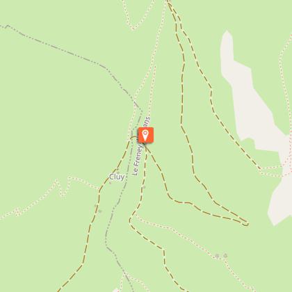
Start/finish (loop): Auris-en-Oisans (resort), 1,600 m
Duration: 3h30
Distance: 16 km
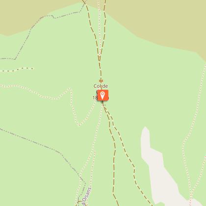
Highest point: 1,800 m
Lowest point: 1,298 m
Elevation gain: + 710 m
Negative altitude difference: - 710 m
Technical: 3/4
Endurance: 3/4

Map: Top 25 Bourg d'Oisans et l'Alpe d'Huez 3335 ET

ITINERARY
> From the Orgières parking lot in Auris, follow the signs for "Plancet" downhill to the right. The start of the trail is below the caravan park. Cross the beautiful spruce forest on a narrow path with a rather downhill profile for 2 km.
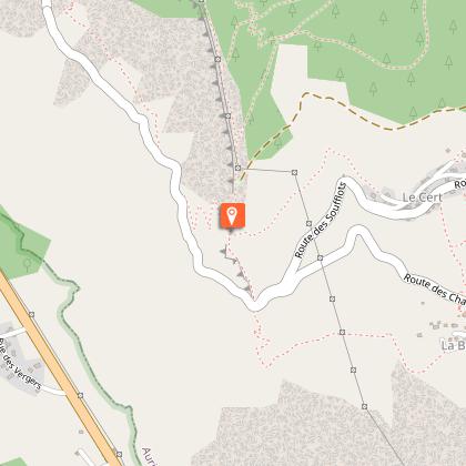
> When you reach the Piégut ridge, turn left down a straight, steep path to Plancet. You pass the small picnic area at Plancet and shortly afterwards, don't miss the intersection that takes you back to the hamlet of Certs. Cross the fence to the left and head across the fields to Les Certs.
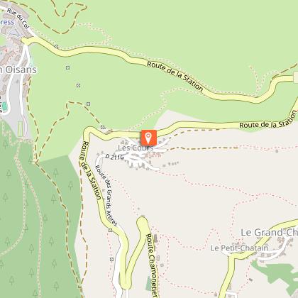
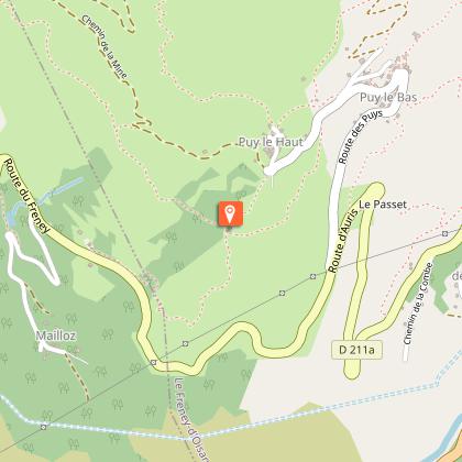
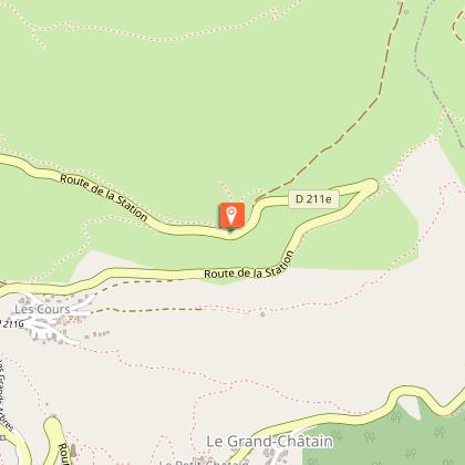
> At Les Certs, cross the hamlet upwards to join a beautiful path that leads up to Les Cours. Cross Les Cours and head up to the Chemin du facteur, which takes you to the Croix de Trévoux. From here, join the road and turn left to reach the hamlet of Puy-le-Haut.
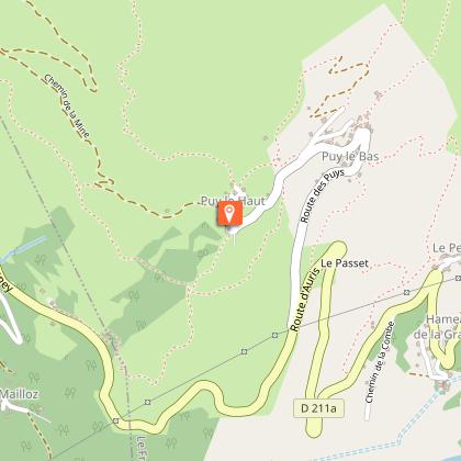
> From Le Puy, head for the Col de Cluy via the Chemin du Lauzat, then the 4x4 track that takes you past the Perchoux barn. The climb to the Col de Cluy (5 km, 500 m D+) is a fine one. Alternatively, you can shorten the climb by heading straight for the St-Giraud chapel on the 4x4 track.
> Just before reaching the Col de Cluy (1800 m), turn left onto a small grassy path that descends towards the Chapelle St-Giraud.
> Just before reaching the road, take the small path leading up to the chapelle St-Giraud. Pass behind the chapel and follow the path back to Auris, overhanging the road.

Technical Information

Mountainbiking
Difficulty
Medium
Duration
3h30mn
Dist.
16 km
Show more

Altimetric profile

Starting point

Les Orgières , 38142   Auris-en-Oisans
Lat : 45.055678Lng : 6.07839

Steps

Date and time

  • From 01/06/2025 to 31/10/2025
  • From 01/06/2026 to 31/10/2026

Additional information

Updated by

Oisans Tourisme - 09/10/2024
www.oisans.com
Report a problem

Environments

Mountain location

Open period

From 01/06 to 31/10.

Subject to favorable snow and weather conditions.

Contact

Phone : 04 76 80 13 52

Email : info@auris-en-oisans.fr

Website : www.bike-oisans.com/

Topo guides and map references

Topo guides references :
Route in the “MTB in Oisans” guide (Oisans Tourisme)

Map references :
Top 25 Bourg d'Oisans et l'Alpe d'Huez 3335 ET

Location complements

Leave your car in the Auris-en-Oisans car park.

Data author

Image Oisans Tourisme
proposed by Oisans Tourisme
1 bis rue Humbert 38520 Le Bourg d'Oisans France

Ratings and reviews

To see around
See more
Open
Close
Show
Show
Show
Show
Show
Show
Show
Show
Show
Show
Show
Caution!
We have no information on the difficulty of this circuit. You may encounter some surprises along the way. Before you go, please feel free to inquire more and take all necessary precautions. Have a good trip! 🌳🥾