Alert

Alerts

To see around
See more
Open
Close
Show
Show
Show
Show
Show
Show
Show
Show
Show
Show
Show

Oups... It would appear that Cirkwi does not have permission to use your location.

Presentation
Description
Map
Points of interest
Ratings and reviews
See around

Hicking trail From top of Jaillet to the village

Hicking trail From top of Jaillet to the village

IGN cards

3531OTR - MEGEVE RESISTANTE COL DES ARAVIS
Editor : IGN
Collection : TOP 25 RÉSISTANTE
Scale : 1:25 000
17.20€
3430ETR - LA CLUSAZ RESISTANTE LE GRAND-BORNAND
Editor : IGN
Collection : TOP 25 RÉSISTANTE
Scale : 1:25 000
17.20€
3531OT - MEGEVE COL DES ARAVIS
Editor : IGN
Collection : TOP 25 ET SÉRIE BLEUE
Scale : 1:25 000
13.90€
3430ET - LA CLUSAZ LE GRAND-BORNAND
Editor : IGN
Collection : TOP 25 ET SÉRIE BLEUE
Scale : 1:25 000
13.90€
TOP75004 - BEAUFORTAIN MASSIF DU MONT BLANC
Editor : IGN
Collection : TOP 75
Scale : 1:75 000
9.80€
TOP75032 - CHAINE DES ARAVIS - MASSIF DES BAUGES
Editor : IGN
Collection : TOP 75
Scale : 1:75 000
9.80€
TOP100D73 - SAVOIE CHAMBÉRY ALBERTVILLE PARC NATIONAL DE LA VANOISE PNR DU MASSIF DES BAUGES
Editor : IGN
Collection : TOP 100
Scale : 1:100 000
8.40€
TOP100D74 - HAUTE-SAVOIE ANNECY THONON-LES-BAINS MASSIF DU MONT BLANC CHAÎNE DES ARAVIS
Editor : IGN
Collection : TOP 100
Scale : 1:100 000
8.40€
202 JURA ALPES DU NORD
Editor : IGN
Collection : TOP 200
Scale : 1:200 000
6.80€
89025 - TOUR DU MONT-BLANC GR TMB®
Editor : IGN
Collection : DECOUVERTE DES CHEMINS
Scale : 1:50 000
9.10€
D38 ISÈRE
Editor : IGN
Collection : CARTES DÉPARTEMENTALES IGN
Scale : 1:150 000
5.90€
NR15 AUVERGNE-RHÔNE-ALPES RECTO/VERSO MASSIF ALPIN
Editor : IGN
Collection : CARTES RÉGIONALES IGN
Scale : 1:250 000
6.80€
NR14 AUVERGNE-RHÔNE-ALPES RECTO/VERSO MASSIF CENTRAL
Editor : IGN
Collection : CARTES RÉGIONALES IGN
Scale : 1:250 000
6.80€
SUISSE
Editor : IGN
Collection : DÉCOUVERTE DES PAYS DU MONDE IGN
Scale : 1:303 000
7.00€
EUROPE
Editor : IGN
Collection : DÉCOUVERTE DES PAYS DU MONDE IGN
Scale : 1:2 500 000
7.00€

Description

Easy walk offering fantastic views over the village, Mont Blanc and Chamonix aiguilles.

Take the Jaillet gondola. From the top, take the footpath on the left, following the slope "Les Prés".

It leads to a walk in the woods, and then goes along and crosses the slope Bel Ava. At the end, keep going down on the Jaillet road, with great views overlooking Megeve and Mont Blanc range.

Technical Information

Walking
Difficulty
Easy
Duration
2h30mn
Dist.
6 km
Show more

Altimetric profile

Starting point

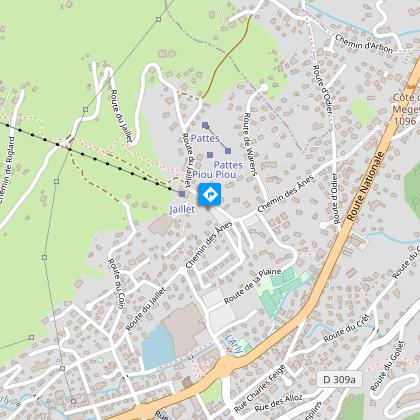
le Jaillet , 74120   Megève
Lat : 45.864668Lng : 6.61806

Additional information

Updated by

Mairie de Megève - 26/11/2024
mairie.megeve.fr
Report a problem

Tips

Free Meg-bus to go to the Jaillet gondola.

Environments

Near shuttle stop
Close to a public transportation

Open period

From 19/12 to 01/04

Contact

Phone : 04 50 21 27 28

Email : megeve@megeve.com

Type of land

Groomed trail
Ground
Not suitable for strollers

Location complements

Meg-bus stop "Télécabine du Jaillet", access to the trailhead via the télécabine du jaillet (in season) or via the sentier du jaillet (out of season due to lift closure).

Topo guides and map references

Map references :
Footpath number 3 on the "winter hikings and walkings in Megeve" map, available at Megeve Tourisme.

Guidebook with maps/step-by-step

0/ Take the Jaillet cable car. 1/ From the top station, a path follows the "Les Près" ski run down to the left, into a fir-tree forest. 2/ Join the forest track. 3/ The path follows and crosses the Bel Ava piste. 4/ At the end of the path, continue along the route du Jaillet, which gradually slopes down to the center of Megève.

Animals accepted

Dogs on leash only

Ratings and reviews

To see around
See more
Open
Close
Show
Show
Show
Show
Show
Show
Show
Show
Show
Show
Show
Caution!
We have no information on the difficulty of this circuit. You may encounter some surprises along the way. Before you go, please feel free to inquire more and take all necessary precautions. Have a good trip! 🌳🥾