Alert

Alerts

To see around
See more
Open
Close
Show
Show
Show
Show
Show
Show
Show
Show
Show
Show
Show

Oups... It would appear that Cirkwi does not have permission to use your location.

Presentation
Description
Map
Steps
Points of interest
Ratings and reviews
See around

Boucle de Bouch

Description

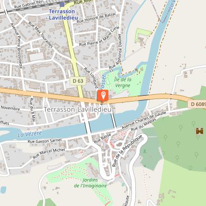
When you arrive in Terrasson-Lavilledieu, you will be at the entrance of the Vézère valley, the valley of Man... You will discover in the staircase lanes, old houses, an abbey church from the 15th century, two bridges, one of which is from the 12th century, a magnificent hillside which once sheltered Saint Sour, the founding father of Terrasson, as well as the Jardins de l'Imaginaire (Gardens of the Imagination) retracing the history of the gardens of mankind through the ages.
The Bouch loop passes on this hillside and allows you to walk away on the heights of the city and have a superb view on the valley before walking on the causse and going down on the Coly valley by the hamlet of Bouch
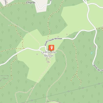
You will walk through the woods and arrive in the village of La Chapelle Mouret whose chapel dates back to the 12th century. The return journey is via the lime kilns and the other side of the hill.

Technical Information

Walking
Difficulty
Hard
Dist.
18 km
Show more

Altimetric profile

Starting point

24120   TERRASSON-LAVILLEDIEU
Lat : 45.12756Lng : 1.305566

Steps

image du object
1

Du départ à la Chapelle Mouret

1 Traverser le parking, prendre le pont vieux. Aller tout droit Rue Margontier puis à droite Rue Basse. Traverser, prendre Rue Marcel Michel jusqu’au bout. Prendre route à gauche, continuer sur le chemin en face 2.Prendre le chemin qui monte à gauche pour arriver sur un sentier bordé d’un muret de pierres sèches, aller jusqu’aux maisons. 3 Prendre la route à droite Boucle de Bouch à 600m. A la patte d’oie, prendre à droite, dir « La Talerie » et tout droit. A La Talerie, suivre Boucle de Bouch tout droit jusqu’au large chemin, l’emprunter. 4. Au carrefour, laisser Preyssac-Gaubert à droite, prendre à gauche Boucle de Bouch. Au carrefour des chemins, continuer tout droit Boucle de Bouch, passer entre les maisons. 5 Au goudron, prendre la route à gauche sur 30m. et le chemin à droite puis au croisement, prendre à gauche Boucle de Bouch. Au croisement des chemins, prendre le chemin à droite qui monte puis longe une combe.6 Au croisement des chemins, prendre à droite La Chapelle Mouret. En haut de la côte, prendre deux fois à gauche, suivre La Chapelle Mouret. A la patte d’oie, serrer à gauche, continuer jusqu’au goudron. Aller tout droit, continuer sur le chemin castiné en serrant à droite, passer le long des maisons.. Continuer tout droit et prendre à droite au croisement. Au croisement suivant, prendre le 1er chemin à gauche. Au croisement d’après, aller tout droit jusqu’au goudron.

- Dordogne -
Consulter

Additional information

Balisage

Yellow

Typologie de l'itinéraire

Loop

Thèmes

Historical
Natural

Data author

Image Dordogne
proposed by Dordogne
24000 France

Ratings and reviews

To see around
See more
Open
Close
Show
Show
Show
Show
Show
Show
Show
Show
Show
Show
Show
Caution!
We have no information on the difficulty of this circuit. You may encounter some surprises along the way. Before you go, please feel free to inquire more and take all necessary precautions. Have a good trip! 🌳🥾