Lourps hill

Description
Surrounded by the old cemetery, the modest church of Lourps stands alone on a hill, as described in the works of French writer Joris-Karl Huysmans. From there, the panorama stretches from the Provins region to the valleys of the Seine and the Voulzie.
Technical Information
Altimetric profile
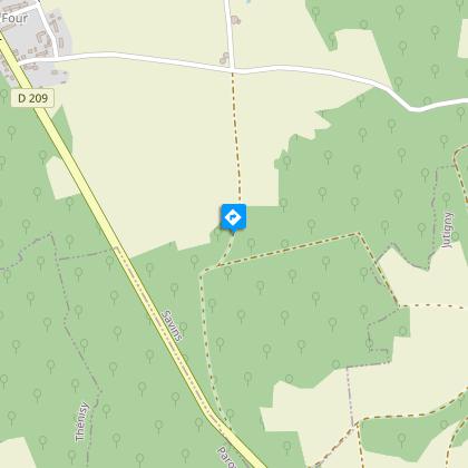
Starting point
Steps
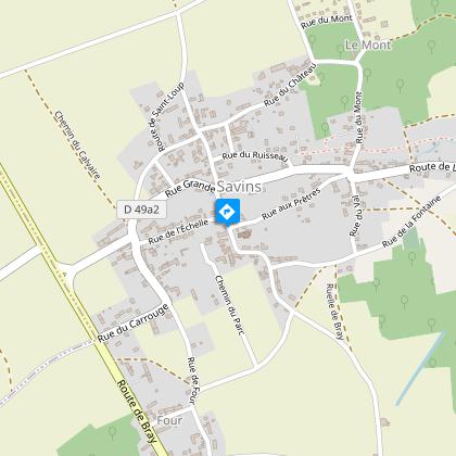
Departure- Point 1
Go down past the church and along Rue aux Prêtres, cross Rue Grande on your left and climb Rue du Mont. On the plateau, follow the road on your right. At the bend, continue straight ahead on the track. You come to a crossroads at the entrance to Pissottes wood.
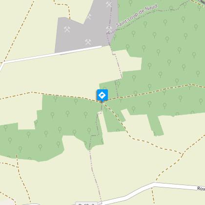
Point 2
Bear right, go down through the wood, then across the fields and down the track on your right. Cut across the D49a2 and go up opposite towards the Château de Lourps. At the top, the track bears left. Walk past the chapel, down the road, then follow the Voulzie aqueduct on your right for 1km. 3- In Jutigny, take the track crossing on your right and just before the road, go up on your right. At the top, turn left along the ridge path. Cut across the road and continue along the track opposite for 100m. Go down the track on your left and follow the road on your right for 250m.
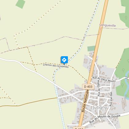
Point 3
In Jutigny, take the track crossing on your right and just before the road, go up on your right. At the top, turn left along the ridge path. Cut across the road and continue along the track opposite for 100m. Go down the track on your left and follow the road on your right for 250m.
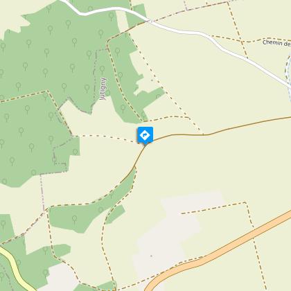
Point 4
Climb the track on your right. Just outside the wood, walk along the edge of the wood on your right, then go up through the wood to the T-junction.
Point 5
Take the track on your right. It brings you out of the wood. At the reservoir, continue along the road opposite and pass the calvary cross. Go right at the fork down the path, then follow Rue de la Fontaine on your left. Take Rue du Châteaud’Eau on your right, to get back to the village church.
Additional information
Tips
• Do not leave the marked paths.
• If there are any doubts regarding which path to take, markings take precedence over the description.
• Respect nature and private property.
• Don't litter.
• Avoid routes during hunting season (check with the town halls or the Seine-et-Marne hunting federation).
• Close gates and fences after you.
• Whenever possible, remove any obstacles from the path.
Guidebook with maps/step-by-step
1- Go down past the church and along Rue aux Prêtres, cross Rue Grande on your left and climb Rue du Mont. On the plateau, follow the road on your right. At the bend, continue straight ahead on the track. You come to a crossroads at the entrance to Pissottes wood.
2- Bear right, go down through the wood, then across the fields and down the track on your right. Cut across the D49a2 and go up opposite towards the Château de Lourps. At the top, the track bears left. Walk past the chapel, down the road, then follow the Voulzie aqueduct on your right for 1km.
3- In Jutigny, take the track crossing on your right and just before the road, go up on your right. At the top, turn left along the ridge path. Cut across the road and continue along the track opposite for 100m. Go down the track on your left and follow the road on your right for 250m.
4- Climb the track on your right. Just outside the wood, walk along the edge of the wood on your right, then go up through the wood to the T-junction.
5- Take the track on your right. It brings you out of the wood.
At the reservoir, continue along the road opposite and pass the calvary cross. Go right at the fork down the path, then follow Rue de la Fontaine on your left. Take Rue du Châteaud’Eau on your right, to get back to the village church.
Updated by
Provins Tourisme entre Bassée, Montois et Provinois - 24/06/2024
www.provins.net
Report a problem
Open period
All year round.
Contact
Phone : 01 64 60 26 26
Email : info@provins.net
Website : www.provins.net
