Alert
Alerts
Grand Goulet and Trois Commères

IGN cards


Description
Departing from Morbier - the village having given its name to the famous black-streaked cheese and to grandfather clocks - this diverse circuit will lead you to the foot of the Trois Commères, and, at its peak, to the "balcon des Crottes" with a plunging view over the Morez viaducts.
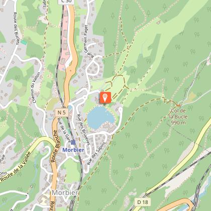
Starting at LA BUCLE CAMPSITE, the trail borders the campsite (yellow waymarking) before coming to "Rue des Pontets", at the roundabout, and heading right up "rue Germain Paget" for 300 m.
A good grassy path heads to the right and past the la Bucle farm, before turning left and up into the forest via a forest path that leads to Les Préhez.
The road to your right in the combe will lead you to the Goulet. Head behind the building and follow the leftmost path. A steep forest path will then lead you to the ridge at Sur les Côtes.
Opposite you, take the gravel road (yellow and red waymarking) that quickly branches off to the right and leads to the Trois Commères via a narrow trail. Continue on abother forest path to reach a road signposted LES TROIS COMMERES. To your left, the road descends to the La Bucle Pass.
At the pass, follow along the path (yellow waymarking), and then take the winding trail to your left towards the BALCON DES CROTTES. The steep trail overlooking and following alongside the railway will take you to Les Crottes.
The MORBIER church is accessible within 5 mins to your left via the Viaducts.
On returning to les Crottes, follow the trail along the mountain slope (yellow and red waymarking) and then take the stony path that heads up Sur la Gare.
Go down the road to your left (yellow waymarking). A trail bordering the Bruyères lake will take you to the Bucle campsite parking lot.
Technical Information
Altimetric profile
Starting point
Points of interest


Additional information
Public transport
To visit and get about in the High-Jura, visit www.reshaut-jura.fr, the eco-mobility portal listing all means of transport within the Park.
Advice
Be careful when approaching the Balcon des Crottes.
This trail uses forest paths. To respect the owners and farmers granting you passage, and for the security of livestock and wild fauna, we ask that you remain on the waymarked paths. Use the adapted passageways to get across fencing and be sure to close gateways behind you. Lastly, please keep your dog on a lead if you have one.Wild flowers are beautiful, they may be rare and protected and often wilt quickly. Do not pick them! They will delight the next hikers.In case of forest works (felling, skidding, etc.), for your safety, know when to stop and turn around.
Advised parking
in front of the swimming pool and campsite, at the top of the village
Access
3 km north of Morez via the N5. Head up the village of Morbier, head past the railway line and turn right onto rue Germain Paget.
Arrival
Morbier
Ambiance
This hike unveils a harmonious contrast between vast pastures scattered with a few isolated farms and remnants of an industrial nature, the mark of a successful union between the work of Man and that of nature. You will be seduced by the grandeur of the viaduct breaking away from the mountainside, proof of the obstinacy of human ingenuity and of Man's fierce determination to brave hostile environments for the purposes of communication.
Departure
Morbier
