To see around
See more
Open
Close
Show
Show
Show
Show
Show
Show
Show
Show
Show
Show
Show

Oups... It would appear that Cirkwi does not have permission to use your location.

Description
Map
Steps
Points of interest
Ratings and reviews
See around

De Bergerac à Rocamadour Etape 9

Description

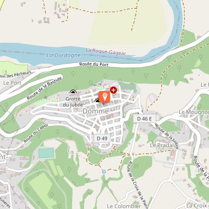
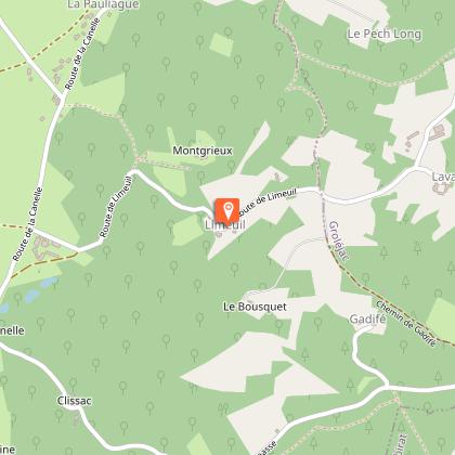
Former pilgrimage route of 180 kilometers allowing to join the Périgord to Rocamadour, this magnificent course is from now on marked out, and allows in full safety to cross the vineyards and hills bergeracoises, before skirting the green valley Dordogne and its cliffs, to arrive in the valley of Ouysse.For this 9th stage from Domme, you will visit this bastide also called the acropolis of the Périgord, and then head for Grolejac, not without having admired the view over the Dordogne valley from the panoramic terrace.

Technical Information

Walking
Difficulty
Medium
Dist.
12 km
Show more

Altimetric profile

Starting point

24250DOMME
Lat : 44.802675015Lng : 1.21456693

Steps

image du object
1

De Domme à Limeuil

De l’esplanade, passer devant l’église, place de halle et descendre la Grand rue. En bas de la rue aller à gauche pour rejoindre la porte des Deux Tours. En sortant de la bastide suivre la petite route en sens interdit, passer sous le pont, longer le parking. Au bout à gauche puis à droite route de l’aérodrome, après 300 mètre, filer à gauche vers le Péparai (GR). Continuer sur le chemin en montant puis sur le plateau pour rejoindre l’aérodrome par la petite route. Quitter la route en tournant à gauche sur le chemin face l’aérodrome. Faire 1,7 km sur ce plateu et au carrefour, abandonner le GR pour tourner à droite vers la Pauliague. Au bout à droite et tout de suite à gauche sur le chemin herbeux le long du bois en descendant vers Montgrieux. A la route, à gauche pour traverser le hameau de Limeuil.

- Dordogne -
Consulter
image du object
2

De Limeuil à Grolejac (la Mouline)

A la sortie du hameau de Limeuil, juste avant un carrefour, partir à gauche sur le chemin en sous-bois puis à droite en épingle à cheveux au carrefour avec le GR. Déboucher sur une route, aller à gauche et la suivre sur 400 mètres, tourner à droite sur un nouveau chemin en sous-bois, puis à gauche à travers prés (quitter Gr). Déboucher au hameau Redon, descendre et au stop aller à droite sur la D 50 à droite pour rejoindre La Mouline (GROLEJAC). Avant la fin de la route, aller à droite sur une placette et à gauche pour franchir une passerelle débouchant sur la D 704

- Dordogne -
Consulter

Additional information

Contact

Fixed telephone : +33 5 53 82 85 79
Philippe Debet
Cellular telephone : +33 6 33 93 36 71
Philippe Debet
e-mail : p.debet@dordogne.fr

Balisage

White and red (GR®)

Typologie de l'itinéraire

Walking trail

Thèmes

Compostela
Cultural
Historical
Religious

Data author

Image Dordogne
proposed by Dordogne
24000 France

Ratings and reviews

To see around
See more
Open
Close
Show
Show
Show
Show
Show
Show
Show
Show
Show
Show
Show
Caution!
We have no information on the difficulty of this circuit. You may encounter some surprises along the way. Before you go, please feel free to inquire more and take all necessary precautions. Have a good trip! 🌳🥾