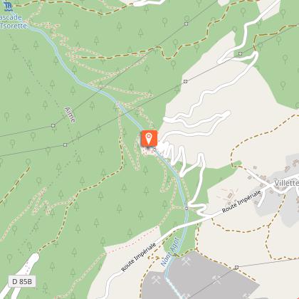
La Glière footpath

Description
A walking path along a stream that has been developed to combat the floods that used to regularly threaten the village of Villette
Nant Agot was often a threat for its frequent floods. The facilities built by man have made it possible to contain the whims of the stream.
Technical Information
Altimetric profile
Starting point
Additional information
Updated by
Office de Tourisme de la Grande Plagne - 27/06/2024
www.la-plagne.com
Report a problem
Guidebook with maps/step-by-step
0/ Start from La Glière car park
1/ At the bridge, cross Nant Agot and take the path on the right that climbs into the forest.
2/ Join the "balcony" path (signposted), then cross the stream on the right and follow the path down to a forest hut. Go past the oratory and join the road.
3/ Return to the starting point.
Open period
From 01/01 to 31/12.
According to snow cover.
Contact
Phone : 04 79 55 67 00
Email : info.vallee@la-plagne.com
Website : www.la-plagne.com/la-plagne-vallee
Data author
