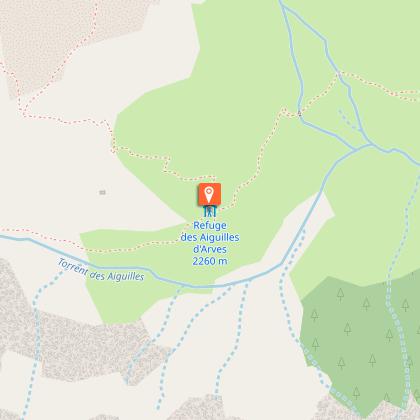
Vallon Chalets loop - Stage 1 - From Les Verneys to the Aiguilles d'Arves Refuge


Description
The Vallon loop offers a multi-day itinerary up to the Col de l'Épaisseur, via the Aiguilles d'Arves refuge.
To activate geolocation, click on the map icon.
Stage 1: Leaving Les Verneys, arriving at Refuge des Aiguilles d'Arves: Time: 3h40 / Distance: 7.6 Km / 747 m D+, 66 m D-. / Red/
Lodging at the Refuge des Aiguilles d'Arves.
Step by step:
From the Les Verneys parking lot, cross the departmental road 902 and head towards Les Choseaux - Verneys and continue towards Les Arolles. Follow the path to the Chalets du Vallon, then on to Commandraut.
From Commandraut, continue uphill to the Aiguilles d'Arves refuge.
Technical Information
Altimetric profile
Starting point
Date and time
- From 01/06/2024 to 15/09/2024
- From 01/06/2025 to 15/09/2025
Additional information
Reception conditions for animals
Due to the presence of guard dogs, we strongly advise you not to bring your dog.
Updated by
Office de Tourisme de Valloire - 24/06/2024
www.valloire.net/
Report a problem
Tips
Precautions: - Find out about weather conditions before you leave. - Inform someone of your itinerary, as communication may be limited. - Choose a morning departure to avoid being surprised by nightfall - The routes you take are your own responsibility. - Choose an itinerary suited to your physical and technical ability. If in doubt, contact mountain professionals. - Make sure you're properly equipped to hike safely and cope with the vagaries of the weather. - This hike is best done in summer when there's no more snow. - Passage through scree just before arriving at the refuge. There are a few things you can do to make your hiking experience safer and more enjoyable. Walking poles improve balance, and regular hydration is essential. Carry a water bottle and snacks to keep your energy up. Protect yourself from the sun with sunscreen and sunglasses. Don't forget binoculars to add a touch of observation to your adventure. These small adjustments will help you get the most out of your getaway.
Guidebook with maps/step-by-step
Departure from Place du Four in the hamlet of Les Verneys.
1/ Take the Pré Malin road towards the Les Arolles residence.
2/ Head for Commandraut via the hiking trail. This starts to the left of the residence's swimming pool.
3/ At the goose-paste intersection, continue up to the Aiguilles d'Arves refuge (altitude 2260m). Vertiginous passage at the "Mauvais pas", just before arriving at the refuge.
Open period
From 01/06 to 15/09.
Subject to favorable weather.
Contact
Phone : 04 79 59 03 96
Email : info@valloire.net
Website : www.valloire.net/
Data author

