Alert
Alerts
Tulle Auzelou

IGN cards


Description
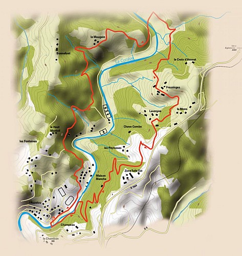
Starting from the bathing area, you'll make your way along the flora discovery trail. On one side, you'll find a number of playful structures that allow you to discover the biodiversity of the forest and, on the other, that of the river. One reaches the heights of Tulle through the woods on single-track paths, and then follows the Roman road, which in Gallo-Roman times linked Clermont-Ferrand to Bordeaux. At Fressinges, you have a magnificent view of the Monédières and the viaduct, one of the largest in Europe. Around the 6th km mark, you'll embark on a long descent. At the bottom, at a place called Les Angles, you come to the hamlet of Maugein. You then pass through a magnificent pine forest, then winding paths through the woods to reach Haut Bourbacoup. You then pass through the Forêt du Souvenir. This small forest of
Technical Information
Altimetric profile
Starting point
Additional information
Contact
Fixed telephone : +33 5 55 26 59 61
e-mail : tourisme@tulle-en-correze.com
Web site (URL) : www.tulle-en-correze.com/
Balisage
Yellow
Typologie de l'itinéraire
Loop
Durée moyenne de l'expérience
2 to 3 hours
Thèmes
Natural
Data author
