To see around
See more
Open
Close
Show
Show
Show
Show
Show
Show
Show
Show
Show
Show
Show

Oups... It would appear that Cirkwi does not have permission to use your location.

Description
Map
Steps
Points of interest
Ratings and reviews
See around

Dans la roue de Lawrence d'Arabie Etape 1 Castillon la Bataille-Mussidan

Description

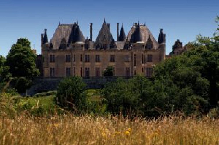
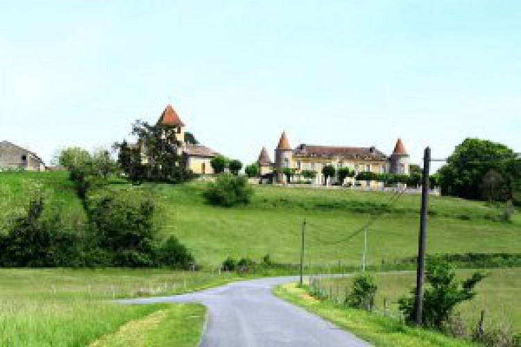
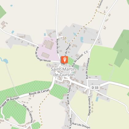
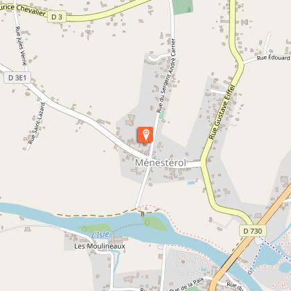
In 1908, a young English student, T E Lawrence, became fascinated with the medieval period. He decided to cycle around France on the trail of Richard the Lionheart. After Castillon, he heads for St Michel de Montaigne where he will discover with emotion the tower of the Great Man. Then he heads for the Isle valley. He crosses Montpeyroux, which keeps the traces of a rich history. Past the ruined dungeon of the castle of Gurson, he crosses Carsac and Saint Martin and admires their Romanesque churches. Arriving at Ménestérol behind the church, the river bears witness to the developments made in the 19th century for river transport. The traditional cob and wood architecture of some of the houses is a reminder of the proximity of the Double forest, and as you go up the valley, the bridges over the river alternate with the tunnels under the railway until you reach the station at Mussidan.

Technical Information

Racing biking
Difficulty
Easy
Dist.
55 km
Show more

Altimetric profile

Starting point

, 24230LAMOTHE-MONTRAVEL
Lat : 44.85225Lng : -0.04365

Steps

image du object
1

Castillon la Bataille-Montpeyroux

0m Porte de fer Castillon la Bataille :. 200mSerrer à droite et longer la rivière 1k800A gauche, « monument Talbot ».Plan de la bataille 4k400Entrée dans Lamothe-Montravel 4k900Traversée RD936 PRUDENCE! Prendre à droite, puis à gauche dir St Michel de Montaigne 6k300Prendre à gauche dir « Le Mathelin » 6k800 Prendre à gauche dir « Le Mathelin » 7k00 Prendre à droite dir « Les Illarets » 7k900Face à la croix en pierre, serrer à droite 8k500 Saint Michel de Montaigne. Traverser le bourg tout droit puis prendre à gauche dir Montcaret (C307) 9k200 Prendre route qui descend à gauche 12k300 A gauche dir Montpeyroux 15k400 Montpeyroux

- Dordogne -
Consulter
image du object
2

Montpeyroux-St Martin de Gurson

15k500 Sur la place du village prendre la route à droite devant la mairie 16k000 Prendre à gauche dir « Lac de Gurson » 16k100 Prendre à gauche 16k700 Hameau de « Bernix » 17k100 Prendre à droite dir « Lac de Gurson » puis continuer tout droit vers les ruines du château 18k600 Prendre la deuxième route vers le « lac de Gurson » 18k900 Tourner à droite au pied du château 19k700 Tourner à gauche 19k800 Passage sur la ligne de démarcation 19k900 Traversée de la D32 dir Carsac de Gurson 20k200 Carsac de Gurson : tout droit dir Saint Martin de Gurson 21k500 Saint Martin de Gurson

- Dordogne -
Consulter
image du object
3

Saint Martin de Gurson-Ménestérol

22k000 Prendre la route du lac à gauche, dir La Cristalline 25k300 A droite dir « les Coulauds » 25k900 Traversée D9 dir Ménesplet (C203) 29k700 Ménesplet: Traversée D6089 Tout droit dir Ménesplet: PRUDENCE 30k100 Au cédez le passage à droite puis tout droit 30k400 Au stop, (D3e2) dir Ménesterol / Le Pizou - Passer la rivière 31k500 A droite dir « Baillargeaux » 32k600 Arrivée « Marcillac ». Tout droit sur D3 33k400 Prendre à droite dir Ménesterol D3E1 34k500 Ménestérol

- Dordogne -
Consulter
image du object
4

Ménestérol-Mussidan

34k900 Prendre route à gauche dans le centre « Rue Sergent Carrier » 35 700 Après le cimetière, à droite, D3 36k000 Au cédez-le-passage, tout droit D3 36k800 Au cédez-le-passage, D708, dir Ribérac 37k000 A droite, dir Saint Laurent des Hommes D3 39k700 Après la peupleraie, tourner à droite 39k900 Hameau de « Bouffetias » 40k000 Prendre à gauche 40k300 Serrer à droite, puis tout droit 42k400 Au carrefour, tout droit 43k400 Tourner à droite sur D3 43k900 Saint Laurent des Hommes 44k400 Au stop, dir Saint Astier D3 45k700 Quitter D3 et tourner à droite 46k700 Prendre route à droite au stop 47k400 Traverser l’Isle 48k200 Prendre petite route à gauche vers RD6089, dir « Fournils » 49k700 Prendre route à droite après virage 50k100 Passer sous le pont à droite et au stop, à gauche 50k300 Route à droite, dir « Ribes » 51k000 Après la voie ferrée, prendre à gauche et longer la voie jusqu’à Mussidan 53k600 Suivre Mussidan, à gauche 54k500 Au cédez le passage, à gauche, puis tout droit jusqu’à la gare 55k100 Arrivée Gare de Mussidan

- Dordogne -
Consulter

Additional information

Contact

Fixed telephone : +33 5 53 82 85 79
Philippe Debet , Service du Tourisme
Web site (URL) : rando.cg24.fr
e-mail : p.debet@dordogne.fr

Balisage

Orange
panneaux

Typologie de l'itinéraire

Walking trail

Thèmes

Cultural
Historical

Data author

Image Dordogne
proposed by Dordogne
24000 France

Ratings and reviews

To see around
See more
Open
Close
Show
Show
Show
Show
Show
Show
Show
Show
Show
Show
Show
Caution!
We have no information on the difficulty of this circuit. You may encounter some surprises along the way. Before you go, please feel free to inquire more and take all necessary precautions. Have a good trip! 🌳🥾