Alert
Alerts
Type of practice
Walking
Very easy
3h30mn


Presentation
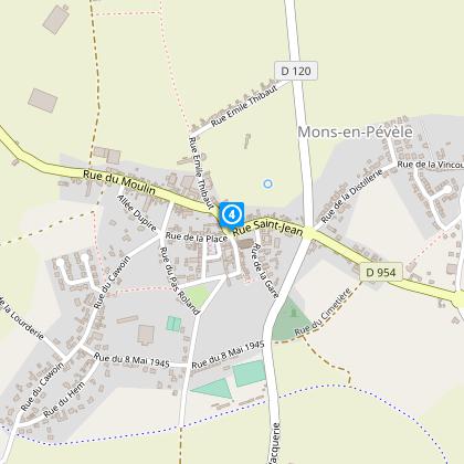
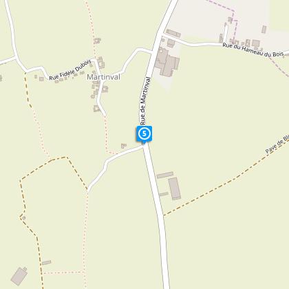
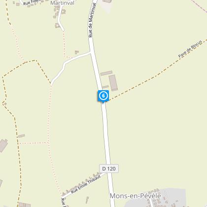
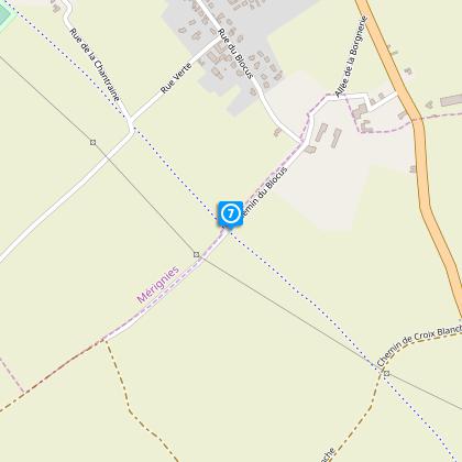
Map
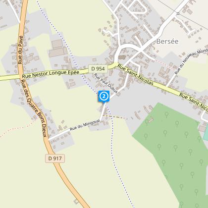
Steps
Points of interest
Cirkwi brief's
Ratings and reviews
See around
From the lowlands to the heights of Pévèle

Credit : Nord Tourisme
The Cirkwi brief
Discover Scenic Pévèle: A Path Through Time and Nature
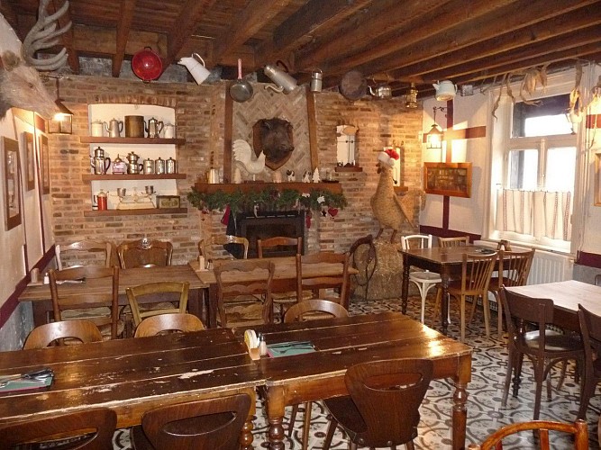
Immersing in the rustic charm of Pévèle, this route offers an unconventional journey marinated with history and natural beauty. Crafted by Nord Tourisme, the itinerary transcends a mere walk, inviting travelers to explore an old railway turned into a scenic path. The trek is adorned with the rugged allure of the Paris-Roubaix cobbles, unfolds the verdant Pévèle countryside, and introduces the region's common tree species. Amid this natural tapestry, the local culture vibrates warmly, especially at Chez Flavien where stories and traditional delights fuse, creating an unforgettable experience.
Brief Technical Insight for Hikers
This meticulously designed 12-km path starts at an elevation of 30 meters, climbs up to 93 meters, and involves a gentle positive elevation change, making it suitable for most fitness levels. The yellow trail marks guide through varying terrains, intertwining historical pavés and lush landscape. This route, with its minor elevation gains of 92 to 91 meters, offers a relatively easy hike, allowing participants to focus more on the surrounding beauty and less on challenging ascents.
Seasonal Tips for Trail Enthusiasts
Before embarking on this picturesque journey, consider the seasonal changes in Pévèle. Spring and autumn, with their mild temperatures and nature's vibrant hues, are ideal for this trek. Prepare for occasional showers by packing light waterproof gear. During summer, light clothing, sun protection, and ample water are essential to combat the warmth. Winters are chilly; warm layers and proper footwear are necessary for snow or icy paths. Always check the weather beforehand, and remember, safety comes first.
Pévèle: A Glimpse into History and Culture
Positioned within the Nord Department of France, Pévèle's rich narrative weaves through centuries. The area's geographical layout, marked by its transformation from a railway to a trekking path, highlights a shift from industrial utility to natural and historical preservation. The cobblestones of Paris-Roubaix whisper tales of bygone struggles and triumphs, embedding a deep sense of history into the landscape. This circuit is not just a route; it's a journey through the heartbeat of a region celebrated for its cultural resilience and communal spirit.
Understanding Pévèle's Climate for Travelers
Pévèle enjoys a temperate maritime climate, characterized by moderate temperatures and variability in weather conditions. Winters are cool, often accompanied by frost, while summers are pleasantly warm, rarely reaching extremes. The region receives consistent rainfall throughout the year, making the landscape perpetually lush and green. For the most enjoyable hiking experience, aim for late spring or early autumn when conditions are mild, and the changing seasons paint the countryside in spectacular colors. These periods also offer the best light for capturing the scenic beauty through photography.
Automatically generated.
IGN cards
2505SB - HÉNIN-BEAUMONT CARVON LEFOREST
Editor : IGN
Collection : TOP 25 ET SÉRIE BLEUE
Scale : 1:25 000
13.90€

102 LILLE MAUBEUGE PNR SCARPE ESCAUT PNR DE L'AVESNOIS
Editor : IGN
Collection : TOP 100
Scale : 1:100 000
8.40€

101 LILLE CALAIS LE TOUQUET-PARIS-PLAGE PNR DES CAPS ET MARAIS D'OPALE
Editor : IGN
Collection : TOP 100
Scale : 1:100 000
8.40€

D59-62 NORD PAS-DE-CALAIS
Editor : IGN
Collection : CARTES DÉPARTEMENTALES IGN
Scale : 1:150 000
5.90€

NR01 HAUTS-DE-FRANCE
Editor : IGN
Collection : CARTES RÉGIONALES IGN
Scale : 1:250 000
6.80€

NR05 GRAND EST RECTO/VERSO MASSIF DES VOSGES ALSACE LORRAINE
Editor : IGN
Collection : CARTES RÉGIONALES IGN
Scale : 1:250 000
6.80€

NR04 - GRAND EST RECTO/VERSO ARDENNE CHAMPAGNE
Editor : IGN
Collection : CARTES RÉGIONALES IGN
Scale : 1:250 000
6.80€

EUROPE
Editor : IGN
Collection : DÉCOUVERTE DES PAYS DU MONDE IGN
Scale : 1:2 500 000
7.00€

PAYS-BAS BELGIQUE LUXEMBOURG
Editor : IGN
Collection : DÉCOUVERTE DES PAYS DU MONDE IGN
Scale : 1:300 000
7.00€
Technical Information
Walking
Difficulty
Very easy
Duration
3h30mn
Dist.
12 km
Type of practice
Walking
Very easy
3h30mn
Show more
Altimetric profile
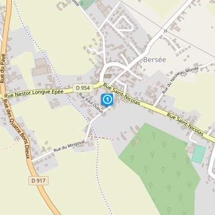
Starting point
22
Place du Maréchal Alexandre
,
59235
BERSEE
Lat : 50.4797163181Lng : 3.14330609764
Steps
Points of interest
Data author

Ratings and reviews
To see around