To see around
See more
Open
Close
Show
Show
Show
Show
Show
Show
Show
Show
Show
Show
Show

Oups... It would appear that Cirkwi does not have permission to use your location.

Description
Map
Steps
Cirkwi brief's
Ratings and reviews
See around

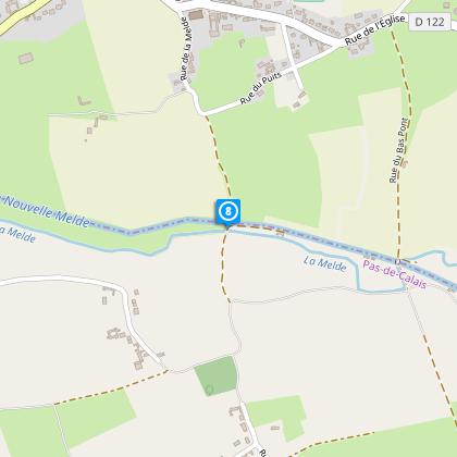
Tour of the Head of Flanders

Boeseghem tourisme fluvial
Credit : Nord Tourisme

The Cirkwi brief

Explore the Enchanting Circuit de la Tête de Flandre

Imagine strolling through the serene Flemish countryside, where every step takes you through a tapestry of preserved hedgerows, babbling becques, and gentle hills. This idyllic journey, curated by Nord Tourisme, is not just a walk, but an immersion into the heart of nature's unspoiled beauty. With a backdrop of rich heritage buildings dotting the landscape, this route promises an unforgettable escape into tranquility. Remember, though, the adventure does demand durable footwear, especially after rains that leave the paths challengingly muddy. Let yourself be drawn into an exploration where the yellow markers guide you through a realm of pastoral bliss.


Core Traits of the Journey

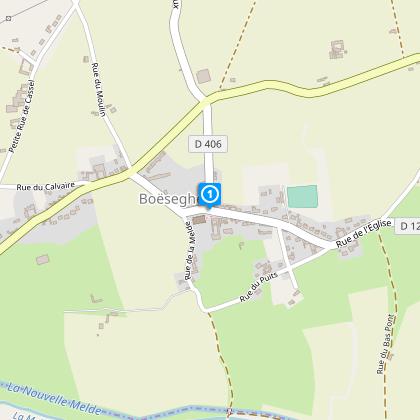
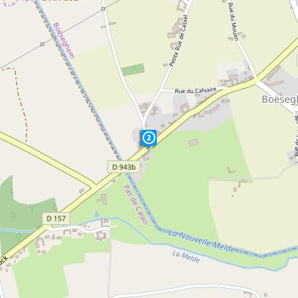
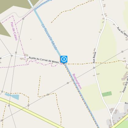
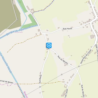
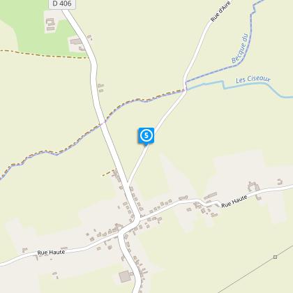
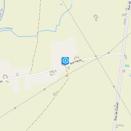
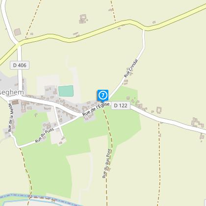
Spanning approximately 11.6 kilometers, the Circuit de la Tête de Flandre offers a modest elevation gain, fluctuating between 18 to 40 meters above sea level. The route is marked by a 63-meter ascent and 62-meter descent, presenting a relatively gentle topographic challenge ideal for walkers of intermediate fitness. This trail's technicalities lie in its terrain, particularly vulnerable to muddiness during wet weather, necessitating appropriate footwear. The carefully curated route assures a meaningful engagement with the Flemish countryside, guided succinctly by distinct yellow markers.


Seasonal Guide and Tips

For an optimal experience, equip yourself with waterproof shoes, especially in spring or after rainfall, as paths can become rather muddy. During the summer months, the verdant landscape is at its most vibrant, though it's wise to carry sunscreen and plenty of water. Autumn brings a mosaic of colors, yet paths may be slippery with fallen leaves. In winter, the crisp air offers clear views, but daylight is shorter – plan accordingly. Regardless of the season, remain cautious while traversing near the RD 943b - safety first!


A Glimpse into History and Culture

Boeseghem, nestled within the heart of Flanders, harbors a deep-seated cultural and historical essence that spans centuries. This region, integral to both French and Flemish heritage, has been a cradle of agricultural and architectural development. Through the Circuit de la Tête de Flandre, visitors can experience a tangible connection to the past, wandering paths that have been tread upon for generations. The presence of meticulously preserved buildings along the route serves as a testament to the area's resilience and enduring charm.


Weather Insights and Best Visits

The Flemish region, characterized by a temperate maritime climate, offers mild winters and cool summers, making it a year-round destination. However, for those seeking to fully embrace the lush pastoral scenes, late spring to early autumn presents the most favorable weather conditions. During these months, the countryside blooms into life, with drier paths and longer daylight hours enhancing your journey. Yet, always prepare for the occasional shower – after all, the area's verdancy owes much to its well-distributed rainfall.

Automatically generated.

Technical Information

Walking
Difficulty
Very easy
Duration
3h
Dist.
12 km
Show more

Altimetric profile

Starting point

Parking église , 59189BOESEGHEM
Lat : 50.6616697897Lng : 2.43839246272

Steps

image du object
1

Point 1

Quittez le parking de l’église, contournez l’édifice en prenant la rue à gauche et passez à l’arrière. Descendez la petite route ; à l’intersection suivante, prenez à droite la rue du Puits (en impasse) – vue sur le beffroi et la Collégiale d’Aire sur la Lys que l’on aura en point de mire tout au long du parcours. Le sentier enherbé serpente entre les pâtures et franchit deux chicanes.

- Département du Nord -
Consulter
image du object
2

Point 2

A la sortie du chemin, face à la rue Basse, empruntez le trottoir à gauche et traversez, – avec prudence au passage protégé. Après le passage sur le pont de la Melde, longez la Melde rectiligne jusqu’à une passerelle.

- Département du Nord -
Consulter
image du object
3

Point 3

Franchissez la Melde sur la passerelle. Suivez l’étroit sentier (ruelle du Cornet de Wittes) qui traverse un rideau arbustif et vire à gauche en longeant les champs. Traversez la petite route (rue Basse) et montez le long du chemin herbeux en face. A l’intersection, prenez deux fois à gauche et descendez la rue du Moulin.

- Département du Nord -
Consulter
image du object
4

Point 4

Suivez à droite la rue Basse. Laissez sur la droite la rue Haute et continuez sur la route principale (virage à droite). Après 100 m, engagez vous à droite sur le chemin de terre. Le vallon de la becque du Dah ouvre un large horizon sur un paysage ondulant et verdoyant. A l’arrivée sur la route (RD 406), montez à droite puis quittez la route aussitôt vers la gauche.

- Département du Nord -
Consulter
image du object
5

Point 5

Après la pâture, empruntez à droite l’étroit sentier entre les haies. Au bout, empruntez la rue (Haute) à gauche sur 1 km. Cette rue offre à nouveau un panorama sur le vallon de la becque du Dah.

- Département du Nord -
Consulter
image du object
6

Étape 6

Suivez à droite la rue de la Chapelle qui effectue un coude à droite et se dirige tout droit vers le clocher de Boëseghem, visible à l’horizon. Au croisement des chemins agricoles, rejoignez à gauche la RD 943b. Longez-la à gauche avec prudence sur 100 m puis, avant le virage quittez la et suivez à droite la rue  Crindal.

- Département du Nord -
Consulter
image du object
7

Point 7

Au carrefour, en entrée d’agglomération, continuez tout droit sur la rue du Bas Pont, empruntez le pont sur la Melde et rejoignez la Vieille Lys canalisée. Prenez à droite et longez le chemin du halage sur 500 m puis quittez-le à droite. Poursuivez tout droit. Au bout, suivez à droite la rue de la Basse Boulogne et dans le virage, allez tout droit sur la petite route en direction de Bonneghem.

- Département du Nord -
Consulter
image du object
8

Point 8

Franchissez à nouveau la Melde, et montez en face le chemin. A la route, partez à droite, laissez à gauche la rue du Puits et rejoignez l’église de Boëseghem.

- Département du Nord -
Consulter

Ratings and reviews

To see around
See more
Open
Close
Show
Show
Show
Show
Show
Show
Show
Show
Show
Show
Show
Caution!
We have no information on the difficulty of this circuit. You may encounter some surprises along the way. Before you go, please feel free to inquire more and take all necessary precautions. Have a good trip! 🌳🥾