Alert
Alerts
Type of practice
Walking
Medium
3h30mn
Presentation
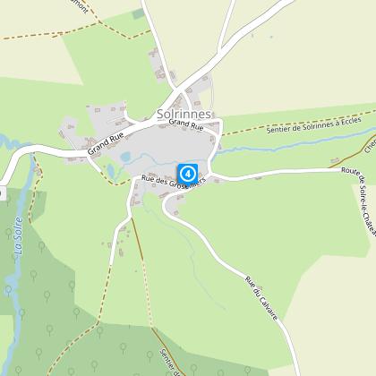
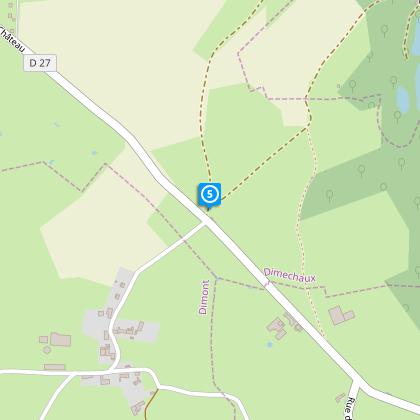
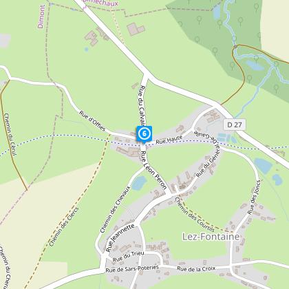
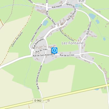
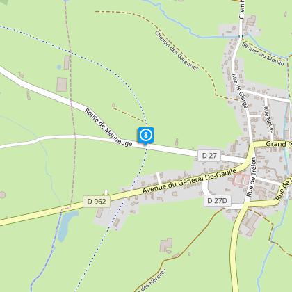
Map
Steps
Cirkwi brief's
Ratings and reviews
See around
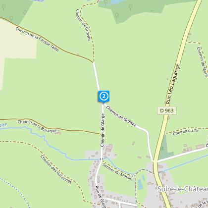
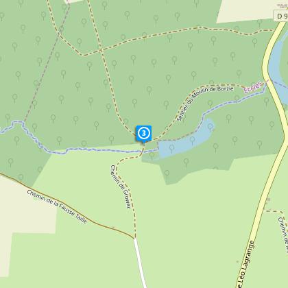
Woodland circuit of groez_hunting season

Credit : Nord Tourisme
The Cirkwi brief
Explore Solre-le-Château: A Scenic Avesnois Journey
Immerse yourself in the picturesque Avesnois region with a journey that promises both beauty and adventure. This trail, thoughtfully crafted by Nord Tourisme, takes you through the enchanting woods and pastoral landscapes, showcasing the area's characteristic blue stone and brick houses, charming kiosks, and quaint chapels. Perfect for families, the path is a gateway to experiencing the serene, rolling countryside, demanding nothing but a pair of good walking shoes. As you meander, let the narrative of the region’s natural and architectural splendor unfold, inviting a sense of discovery and connection with every step.
Technical Route Insight
Spanning 12.43 kilometers, this route navigates through a mix of terrain with an altitude variation from 155 to 216 meters, demanding moderate physical effort. The total positive elevation change is approximately 196 meters, making the walk pleasantly challenging. Critical points include cautious crossings at RD 27 and 962. For those visiting during hunting season, an alternative path is available, ensuring safety without compromising the experience. This walk is ideally suited for those seeking an engaging outdoor activity with mild physical demands.
Seasonal Guide and Safety Tips
To enjoy this captivating trail year-round, dressing appropriately for the season is key. In warmer months, lightweight, breathable clothing and sun protection are essential. Winter visitors should layer up to combat the chilly Avesnois air. Always wear sturdy footwear to navigate the varied terrain easily. During hunting season, ensure to follow the signposted alternative route to stay safe. The crossing points RD 27 and 962 demand extra caution; look out for oncoming traffic. Regardless of the season, bring water and a snack to maintain energy levels throughout this picturesque journey.
Cultural Tapestry of Avesnois
Solre-le-Château, nestled in the heart of the Avesnois, stands as a testament to the rich cultural and historical fabric of Northern France. This region, known for its unique blue stone and brick architecture, offers a glimpse into the past with its well-preserved kiosks and chapels dotting the landscape. Historically, Avesnois has been a crossroads of cultures and influences, contributing to the diverse heritage evident in its villages and countryside. Embarking on this trail offers more than just a walk; it's a journey through time, exploring the stories and lives that have shaped this enchanting territory.
Regional Climate Insights
The Avesnois region experiences a temperate climate, marked by mild summers and cool, sometimes brisk, winters. This balanced climate makes the area suitable for hiking year-round, with each season offering its unique charm. Spring and early fall are particularly ideal for exploring, as the weather is generally pleasant and the natural scenery is at its most vibrant. Summer provides longer days, although it can be slightly warmer. Winters, while cooler, offer a serene, frosty landscape, perfect for those who enjoy a crisp, refreshing walk amidst quiet, snow-dusted paths.
Automatically generated.
IGN cards

2806SB - MAUBEUGE JEUMONT
Editor : IGN
Collection : TOP 25 ET SÉRIE BLEUE
Scale : 1:25 000
13.90€
102 LILLE MAUBEUGE PNR SCARPE ESCAUT PNR DE L'AVESNOIS
Editor : IGN
Collection : TOP 100
Scale : 1:100 000
8.40€

D02-08 AISNE ARDENNES
Editor : IGN
Collection : CARTES DÉPARTEMENTALES IGN
Scale : 1:150 000
5.90€

D59-62 NORD PAS-DE-CALAIS
Editor : IGN
Collection : CARTES DÉPARTEMENTALES IGN
Scale : 1:150 000
5.90€

NR05 GRAND EST RECTO/VERSO MASSIF DES VOSGES ALSACE LORRAINE
Editor : IGN
Collection : CARTES RÉGIONALES IGN
Scale : 1:250 000
6.80€

NR04 - GRAND EST RECTO/VERSO ARDENNE CHAMPAGNE
Editor : IGN
Collection : CARTES RÉGIONALES IGN
Scale : 1:250 000
6.80€

NR01 HAUTS-DE-FRANCE
Editor : IGN
Collection : CARTES RÉGIONALES IGN
Scale : 1:250 000
6.80€

EUROPE
Editor : IGN
Collection : DÉCOUVERTE DES PAYS DU MONDE IGN
Scale : 1:2 500 000
7.00€

PAYS-BAS BELGIQUE LUXEMBOURG
Editor : IGN
Collection : DÉCOUVERTE DES PAYS DU MONDE IGN
Scale : 1:300 000
7.00€
Technical Information
Walking
Difficulty
Medium
Duration
3h30mn
(1d)
Dist.
12 km
Type of practice
Walking
Medium
3h30mn
Show more
Altimetric profile
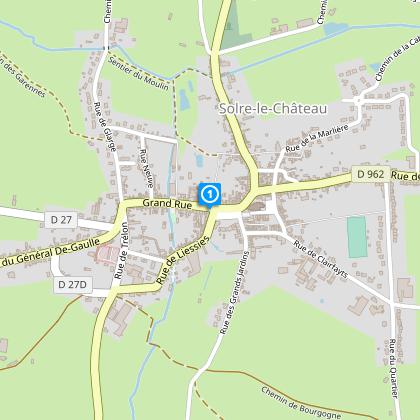
Starting point
Office de Tourisme / Hotel de Ville
,
59740
SOLRE-LE-CHATEAU
Lat : 50.1744182597Lng : 4.09063603395
Steps
Data author

Ratings and reviews
To see around