Alert
Alerts
Type of practice
Walking
Easy
2h20mn
Presentation
Description
Map
Steps
Cirkwi brief's
Ratings and reviews
See around
From Bonsberg to Becquerelle_variant

Credit : Nord Tourisme
The Cirkwi brief
Explore the Heart of French Flanders: A Picturesque Journey
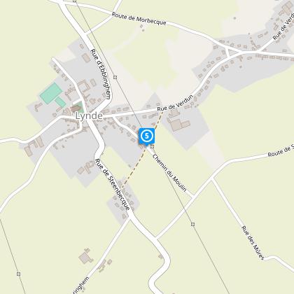
Embark on a delightful adventure with the "Du Bonsberg à la Becquerelle_variante" route, meticulously curated by Nord Tourisme. This trail unfurls the natural elegance between the Flanders and Artois hills, showcasing the quaint village of Lynde. Whether you're an experienced hiker or just seeking a leisurely stroll, the two versions of this trail, spanning 12.5 and 7 km, offer something for everyone. The journey through undulating landscapes and agricultural paths, especially charming after rain, promises an immersion into the serene beauty of Northern France that beckons outdoor enthusiasts and nature lovers alike.
Key Technical Details Unveiled
This itinerary spans approximately 6.9 km, reaching a maximum altitude of 66 meters with a minimum at 39 meters. The total positive elevation change is around 44 meters, a testament to its mild yet engaging topography. The route is well-marked with yellow signage, ensuring a user-friendly experience for walkers. These technical specifications highlight the accessible nature of the trail, making it suitable for both seasoned hikers and casual walkers looking for a scenic ramble.
Seasonal Tips and Safety Advice
When planning your walk along this picturesque route, consider the seasonal variances. Spring and autumn offer cooler temperatures and vibrant natural palettes, ideal for comfortable hiking. Summer brings lush landscapes but also requires sun protection and hydration. During rainy periods, the agricultural paths can become muddy; thus, waterproof footwear is highly recommended. Always adhere to the yellow trail markers to navigate the route safely and enjoy the stunning scenery that unfolds with each season.
Lynde: A Cultural and Historic Gem
Lynde, nestled within the unique landscape between the Flanders and Artois hills, carries a rich tapestry of history and culture. The area, part of the Nord department in the Hauts-de-France region, stands as a testament to the enduring charm of rural French Flanders. The village and its surroundings, characterized by their rolling hills and vibrant greenery, invite visitors to explore not just the natural beauty but also the historical depth of this region. From its medieval roots to its present-day tranquility, Lynde represents a significant chapter in the story of Northern France.
Understanding the Local Climate
The region experiences a temperate maritime climate, with mild winters and cool summers. Rainfall is fairly distributed throughout the year, yet the best times to visit would likely be from late spring to early autumn, to fully enjoy the outdoor activities this area offers. During these months, the weather is generally more stable and pleasant, with lower likelihood of the heavy rains that could affect the trail conditions. Be sure to check the local forecast before planning your journey to make the most of your visit to this captivating part of Northern France.
Automatically generated.
IGN cards
2304SB - SAINT-OMER AIRE-SUR-LA-LYS
Editor : IGN
Collection : TOP 25 ET SÉRIE BLEUE
Scale : 1:25 000
13.90€

101 LILLE CALAIS LE TOUQUET-PARIS-PLAGE PNR DES CAPS ET MARAIS D'OPALE
Editor : IGN
Collection : TOP 100
Scale : 1:100 000
8.40€

D59-62 NORD PAS-DE-CALAIS
Editor : IGN
Collection : CARTES DÉPARTEMENTALES IGN
Scale : 1:150 000
5.90€

NR01 HAUTS-DE-FRANCE
Editor : IGN
Collection : CARTES RÉGIONALES IGN
Scale : 1:250 000
6.80€

EUROPE
Editor : IGN
Collection : DÉCOUVERTE DES PAYS DU MONDE IGN
Scale : 1:2 500 000
7.00€

PAYS-BAS BELGIQUE LUXEMBOURG
Editor : IGN
Collection : DÉCOUVERTE DES PAYS DU MONDE IGN
Scale : 1:300 000
7.00€
Technical Information
Walking
Difficulty
Easy
Duration
2h20mn
Dist.
6.9 km
Type of practice
Walking
Easy
2h20mn
Show more
Altimetric profile
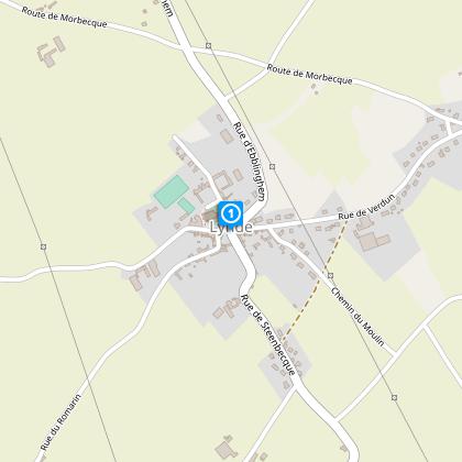
Starting point
35
Eglise Saint Vaast
,
59173
LYNDE
Lat : 50.7114976931Lng : 2.42312156611
Steps
Data author
Ratings and reviews
To see around
