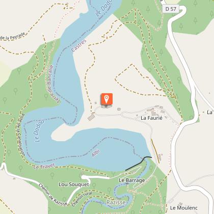
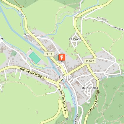
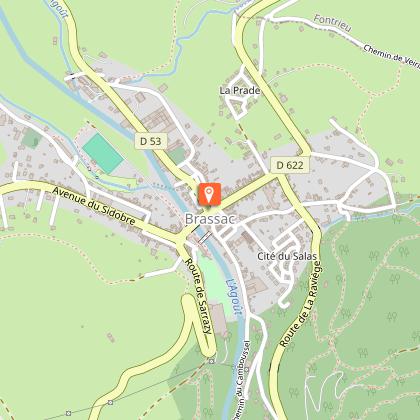
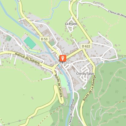
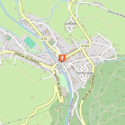
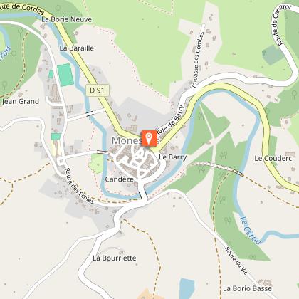
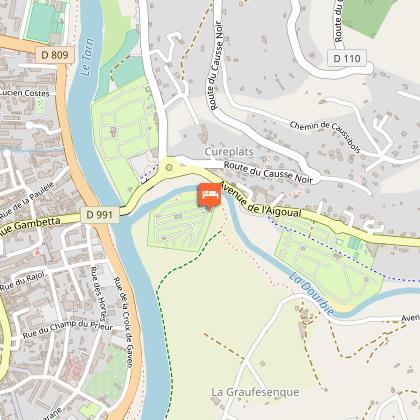
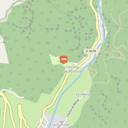
OSM Map
OSM Map
OpenStreetMap
Satellite images
Satellite images
Google
GoogleMap Map
GoogleMap Map
Google
Hybrid Map
Hybrid Map
Google
IGN - France
IGN - France
IGN
Cadastral Plan
Cadastral Plan
IGN
Tours
Activities
Places of interest
Where to eat
Where to sleep

Discover Ayssenes, Aveyron, Midi-Pyrénées Gems

Are you in charge of the destination?
Located in the beautiful Aveyron department, Ayssenes in Midi-Pyrénées is a gateway to discovery. This picturesque destination will captivate nature lovers and history enthusiasts alike with its rolling landscapes and abundant wildlife. Start your visit with the breathtaking Pont Sublime, offering stunning views over the Tarn Valley, a sight to behold in every season. Hiking enthusiasts will love ...See more

Walking around Ayssenes

See more suggestions
Family walks around Ayssenes.
See more suggestions
St-Izaire - Bois Noir
11 km

St-Izaire - Bois Noir

You will best enjoy the numerous scenic views by a bright and sunny day From the car park, walk up towards the bridge to cross the Dourdou river and turn left. Follow the D 25 for 875 m, then take a right turn and follow a small road towards Donacoste, and straight after take right a grassy path which runs alongside the road. Pass under a bridge, then cross a footbridge over a stream and further on you will find the entrance to a 500 m long unlit tunnel (old railway tunnel).Enter this tunnel, it is easier if you keep to the left hand side on the passageway. At the end of the tunnel you re-join the grassy path first running the D25, then deviating towards the hamlet les Roques. At the intersection between the D25 and the path, carry on straight leaving the hamlet to your left. Walk alongside the pond, leave on your right the entrance of another tunnel, walk over this tunnel to reach the hamlet of les Canacs.Enter the hamlet and just before you leave, walk to your left in a wide curve and follow a path rising progressively up, leaving 3 trails to the right one after the other. Walk into the woodland, and at the next fork, close by a barn, take the left most path and keep ascending towards NE.  As you get near the crest, pay attention to the trail signs and leave the numerous trails going left and right to carry straight on. At the top, enjoy the beautiful views of the surrounding landscape. Walk down the slope and cross over to the other side of the hill.When you reach a fork on the path, take the left track and start walking down through the woodland. You are now walking on the “bishop’s trail”, which makes a wide curve north. After approximately 20mn, follow the path around two hair pin bends and join a little tarmacked road.Stop and take time to look at the carved standing stone beside the road. Follow that road to the left walking downhill until you reach a fork. At the fork, turn right the road which leads to Riols (equestrian farm) for approximately 150 m, then take almost opposite, a path that rises to the left. Follow a ridge line between the fields and enjoy the beautiful landscape which stretches on either side. The path runs down towards Belle-vue from where the entire village of Saint-Izaire can be seen.6- Follow the small road which leads to Notre-Dame de Grâce chapel. Close to the chapel, you will see a wide path to the right side which runs down towards Saint-Izaire. Walk around the chapel and follow the path which joins the D 25. Turn left, then right to pass under the bridge and get back to the car park.     

3 h
10 km
Medium
Show
N°9 The castle trail
11 km

N°9 The castle trail

Three valleys are the guideline of this biking tourwhich starts from a castle and enables you to combine physical activity with heritage sight-seeing.This circuit which has easy gradients can be combined with circuit n° 10 “Le Bois Noir”. The two circuits share the same starting point.Follow the road towards Faveyrolles for about 1 km.Take the path to your right and enjoy the beautiful view overlooking the village. Pass alongside the deserted farm of Graudenc, then carry on along a path that picks its way through the undergrowth. Pass under the high voltage line and then cycle down towards the valley de Gos. Take your time to enjoy the nice views over the Dourdou valley on the eastern side. The Tarn valley is to the North and the Gos valley to the SW.Cycle up to a cross by the side of the trail, leave the trail here taking the path to the left that runs across a field up to some woodland.After a hairpin bend, cycle towards the sandpit and the banks of theTarn river. Carry on alongside the shady bank on the left side of the river, pass along the hamlet of les Alvernhes, and then follow the road for 300 m.Cycle down under the stone bridge of the former railway line. Then take the trail alongside the railway line that enables you to bypass the old tunnel by way of a 16th century house called Janolles. Follow the river and cycle under the bridge to reach the farm Mas de Gascuel from the left hand side. You will eventually end the circuit by cycling along a path which slopes gently down to Saint-Izaire.Saint-Izaire: Former residence of the Vabres l’Abbaye bishops, the castle and the village are built in red sandstone. The castle dates from the 9th century, and was remodeled during the 14th century by the bishop who was to become Pope John XXII. The Bishops’ bedroom with its magnificent wooden floor and fine frescoes is the gem of the castle. The lovely houses and dovecotes that you will see in the village are built in the style of the Albigeois period.

2 h
17 km
Easy
Show
The three Valleys
11 km

The three Valleys

Starting from the village of Saint-Izaire which holds a medieval red sandstone jewel, explore this route along the Dourdou, Tarn and Gos valleys and enjoy many spectacular views and a tremendous historic heritage.Take the road towards Faveyrolles up to the first intersection, then fork to the right on a dirt road for 800 m (scenic view over the village). Reach the disused "Le Graudenc" farm building, carry on towards the culminating point at the foot of a high-voltage tower, then walk down the Gos creek valley and enjoy an extensive scenic view over the distant horizon.After a steep slope between two fields, fork to the left at the intersection right by the small stone cross. Walk past dilapidated buildings and follow the track down to the valley. On the valley bottom, right at the intersection, take a hairpin bend to the right above the sandpit which can be seen 50 m further.Walk along the shady bank of the Tarn river and through the hamlet of Les Alverhnes. After a 300 m section of tarmac road, go down to the left and pass under the stone bridge of the former railway.Go to the left of the tunnel along the Dourdou river and carry straight on, leaving to the left a nice private bridge over the Dourdou river next to the hamlet of Janolles. Follow the river and pass under another bridge of the former railway, then get back to the tarmac road.Take to the left towards the Mas de Gascuel. Walk along the farm and take the gently sloping dirt road that leads you back to the village of Saint-Izaire.

4 h
17 km
Medium
Show
Notre Dame de Grace
12 km

Notre Dame de Grace

Treat yourself with an hour and a half getaway on the right bank of the Dourdou river, opposite the village of Saint-Izaire. This circuit is like going on an original pilgrimage to the 14th century chapel which is perched on top of a hill.The starting point is the Place de la Bascule (carpark under the bridge), cross the bridge.At the roundabout take to the left towards Broquiès. After approximately 50 m, head directly to the almost only tricky part of this walking route: a 100 m long steep path that leads to the foot of ND de Grâces Chapel. At the rear of the chapel, you will find a small enclosed area to relax and enjoy a scenic view over the village and the plain. A pilgrimage, well known in the region, takes place every year (nowadays, on August 15th) with an open air mass which is celebrated in the enclosed area.Carry on to the left towards the former hôtel Bellevue, leave the tarred road to ascend straight on the path called « chemin du château d’eau ».Keep walking until you reach a carved standing stone to the right, a notice board displays the history of the statue. Then, carefully follow the marking signs, for here several tracks head in all directions. The one which is to be followed is the most to the right, it is narrow, uneven, runs downhill and goes back to the Dourdou plain.Next, follow to the right the ancient railway until you reach a junction again on the right that rises to the chapel. Enjoy once more the view over the plain.Then retrace your way back to the starting point.

1 h
4.8 km
Easy
Show
The wine presses and the rock tombs in Savignac
14 km

The wine presses and the rock tombs in Savignac

A large half-day hiking loop that leads you around one of the seven hills surrounding Saint-Affrique and gives you the opportunity to explore, through the undergrowth and clearings, the ancient remains of an early human settlement.From the Pastoralia car park, walk back to the road and cross it, then take the small lane opposite that runs along the left side of the equestrian centre.At the intersection, take a path that runs alongside a small house. You leave this path very quickly to take a narrow track to the right which runs between two trees. Walk alongside the brook for approximately 350 m, then take a hairpin bend to the left and walk uphill through the oak grove.Climb over the fence by the cattle grid. Keep walking up the slope through the undergrowth, follow the markings. When you reach the second trail, go to the right for a few metres and climb a small bank. Follow the markings up to a fence, climb over it next to the cattle grid.               Follow the trail to the right. At the water reservoir, follow the path to the left and ascend to the intersection.Take the path to the left that follows the contour line and leads to the Cazotte winepress. Enjoy the views over Saint-Affrique and Vabres l’Abbaye, the remains of the wine press which displays two carved faces on the southern façade (walk around the rock on the left). From the winepress, walk uphill, go across a clearing until you join a wide trail. Take that trail to the left for a few metres, then take the rising stony path to the right until you reach the edge of the woodland.Walk along the small field on the left-hand side, carry on for 200 m on a trail following the edge of the field, and then turn right onto a path running between two fields (follow the fence line). At the end of the field, take a left onto the trail that leads to the edge of the Puech-Capel wood where a signposted track gives access to a necropolis with six rock tombs (walk there and back).Walk back to the trail on the left up to an intersection with another trail, then go down to the left for about 50 m.Take the descending logging trail to the left along to a curve. From there, head onto the path opposite and follow the markings that pass the remains of old dwellings and leads to the beautiful wine press in Savignac. The path gently slopes down to the road.Take this road to the left for approximately 1 km. Before the hamlet of Savignac, follow a trail to the left that overlooks the village.After about 500 m, leave the trail and take a path that runs to the right and goes over a slab (be cautious!). Notice the few remains of an ancient watering system. Follow the markings on the path up to the agricultural college. Keep walking along the contour line until you reach the fence, climb over the fence by the cattle grid. Reconnect with the path you took when starting the hike and retrace your steps back to the car park.Source: The Cardabelles Association  

3 h
8.9 km
Medium
Show
On the trail of the women of the land
14 km

On the trail of the women of the land

Come and explore the village of the Viala du Dourdou nestled in a verdant setting, you’ll be amazed by the atmosphere of serenity and simplicity that radiates from the placeThese women of the land raised their families, often composed of many children, made bread in the ovens which are still visible today in the village, worked in the steep sloping fields, cared for poultry and took charge of the farms when their husbands were away at war. They handed down their ancestral skills and knowledge (preparing cold cuts, gardening and picking wild plants for their medicinal virtues), invigorated the life of the parish community and made sure that people lived together in harmony. Madame Carriere from the Mas Viala, Rosa from the Borie de Boyer, Marie from the Cagné, Denise, Marthe, La Vayssettoune and la Durante from the Viala, all of these women are well remembered and deserve this tribute.From the car park, walk up the D632 for about 100m and very next to the village hall, take a right turn up a road with hair pin bends. On reaching the reservoir, leave the road taking a right turn onto a grassy footpath. Cross a ravine and leave a path on your right. Walk up to join the road that leads to the Combe.At the intersection, take the path that goes towards the South and that leads to the Mas Viala. On reaching the Mas, carry straight on for about 100 m, then turn left and follow the trail that makes a wide curve to the right and climbs up towards the crest.At the junction of the trails, take right fork along the hill a shady path that meets another trail after 550 m and provides a very nice view over the Gos valley. Follow a hair pin bend to the left and walk down a gentle slope towards the D632.Cross the road and take the path on the opposite side that ascends southward up a slope. At the junction with a small road, take the left turn and follow this road for approximately 600m.Just before the Borie du Boyer, follow the left hand path that goes down towards the valley where you can enjoy the beautiful view. Walk close to the Cagné and after a hair pin curve, leave on your right a path that goes downhill towards the Maxillou stream, and keep going NW, first on the road and then on a trail through woodlands.Follow a wide curve which takes you back onto the road and after a hair pin bend keep straight on towards the village.

2 h
7.6 km
Easy
Show
The grave walking tour via Saint-Apolit
14 km

The grave walking tour via Saint-Apolit

A hike that runs on gentle slopes between the Sorgues and Dourdou valleys, throughout a landscape with stunning colours and where the past has left its mark: graves dating from the early Middle Ages and an old quarry.From the Camper van parking lot which is the starting point, take right the prohibited direction, walk behind the school and along the graveyard.In the Garelle district, turn to the left and follow the tarmac road up to the Balros intersection.At the Balros intersection, carry straight on towards Vanière, the Vieuzet, the Tombes, and the Joncas.At the edge of the Vieuzet, leave the tarmac road and take to the left a track that goes towards the Tombes and the Joncas.After walking 10 minutes on this path, you will find on the left side, a big marked rock on which are the Visigoth tombs. Carry on the path towards the Joncas.At the signpost ‘’Balros sud-est n°10 ‘’, turn to the left and walk for 30 m, then take to the right.At the signpost ‘’Balros sud-est n°12 “, carry straight on towards the panoramic viewpoint.After 600 m, take the path that ascends to the left.After 150 m of uphill walking, you can enjoy the beautiful panorama. Turn to the left when leaving the viewpoint.At 100 m from the viewpoint on the right of the path is a signpost indicating a cave, 120 m further. This cave is an old sand quarry. At 160 m from the viewpoint is a signpost of ‘’Puech de la Martelle n°11’’, turn to the right towards Vabres via Saint-Apolit.At the signpost ‘’Saint-Apolit n°14’’ take right towards Vabres.On the way, pay attention to the large cypress tree planted against the Saint-Apolit cross.At the entrance of Vabres is the signpost ‘’Balise n°15‘’, turn to the right and walk downhill by the schoolchildren's path.At the signpost ‘’le Pesquier n°7‘’ in the la Garelle street, return your way by the small bridge, take to the right the small cemented road and walk back to the cars.

2 h
7.3 km
Easy
Show

What to do in Ayssenes

See more suggestions
Plan your leisure time in Ayssenes by booking activities that suit your preferences.
See more suggestions
Grand' Hortensia
44 km

Grand' Hortensia

Fully renovated and furnished holiday home for 14 people, just outside the village, 1 minute from the leisure centre. Situated at an altitude of 620 metres, in the Hautes Terres d'Oc, your holiday at Saint-Pierre de Trivisy in the Haut-Languedoc Regional Nature Park. You'll love the friendly locals, the leisure centre ideal for children (and adults too!), the first-class rivers for fishing, forest walks, hiking trails... In the village, you'll find all the shops you need for your holidays, a wellness and spa centre open all year round, a leisure centre with a water park, water slides, Aventure Parc (tree climbing) and lots of entertainment in summer... Fully renovated and furnished holiday home sleeping 14. For families or groups of friends, it is located at the entrance to the village, on the road to Lacaune, just a minute's walk from the leisure complex. Enclosed garden, terrace Ground floor: - large living room opening onto a single-storey terrace at the rear, equipped with a wood-burning stove, - fully-equipped kitchen (traditional oven, microwave, combined fridge-freezer, extractor hood, dishwasher... ) with comfortable dining area, - laundry room opening onto outside terrace with washing machine, ironing board and iron - wc 1st floor: - 3 bedrooms, each with double bed (140x190), - large bathroom with bath and shower, hairdryer - wc 2nd floor: - 2 bedrooms, each with double bed, - bedroom with 2 single beds (90x190) and 2 bunk beds (90x190), - 2 toilet cubicles with shower, - wc A small games house with a multi-games table (table football, billiards, table tennis and table hockey), board games and toys for the children. External electric car charging point. Le Grand Hortensia can be rented in a smaller format (ground floor and 1st floor only), a gîte for 6 people, Le Petit Hortensia (reference G1746 on Gîtes de France).

37 avenue de Lacaune 81330 Saint-Pierre-de-Trivisy
Book from 0 €Book
Show

What to visit in Ayssenes

See more suggestions
Relax in the parks of Ayssenes.
See more suggestions

Where to eat in Ayssenes

See more suggestions
Establishments in Ayssenes offer dishes for all tastes.
See more suggestions

Where to sleep in Ayssenes

See more suggestions
Choose a comfortable accommodation in Ayssenes.
See more suggestions
Grand' Hortensia
44 km

Grand' Hortensia

Fully renovated and furnished holiday home for 14 people, just outside the village, 1 minute from the leisure centre. Situated at an altitude of 620 metres, in the Hautes Terres d'Oc, your holiday at Saint-Pierre de Trivisy in the Haut-Languedoc Regional Nature Park. You'll love the friendly locals, the leisure centre ideal for children (and adults too!), the first-class rivers for fishing, forest walks, hiking trails... In the village, you'll find all the shops you need for your holidays, a wellness and spa centre open all year round, a leisure centre with a water park, water slides, Aventure Parc (tree climbing) and lots of entertainment in summer... Fully renovated and furnished holiday home sleeping 14. For families or groups of friends, it is located at the entrance to the village, on the road to Lacaune, just a minute's walk from the leisure complex. Enclosed garden, terrace Ground floor: - large living room opening onto a single-storey terrace at the rear, equipped with a wood-burning stove, - fully-equipped kitchen (traditional oven, microwave, combined fridge-freezer, extractor hood, dishwasher... ) with comfortable dining area, - laundry room opening onto outside terrace with washing machine, ironing board and iron - wc 1st floor: - 3 bedrooms, each with double bed (140x190), - large bathroom with bath and shower, hairdryer - wc 2nd floor: - 2 bedrooms, each with double bed, - bedroom with 2 single beds (90x190) and 2 bunk beds (90x190), - 2 toilet cubicles with shower, - wc A small games house with a multi-games table (table football, billiards, table tennis and table hockey), board games and toys for the children. External electric car charging point. Le Grand Hortensia can be rented in a smaller format (ground floor and 1st floor only), a gîte for 6 people, Le Petit Hortensia (reference G1746 on Gîtes de France).
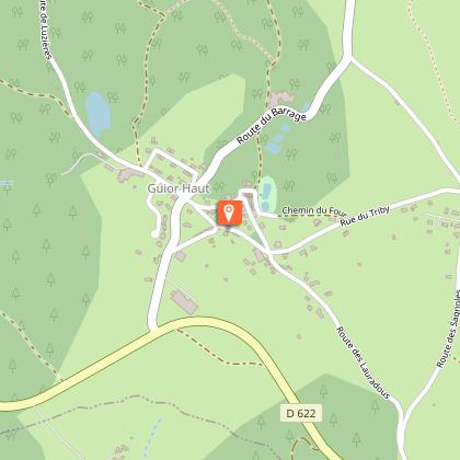
37 avenue de Lacaune 81330 Saint-Pierre-de-Trivisy
Book from 0 €Book
Show
Caution!
We have no information on the difficulty of this circuit. You may encounter some surprises along the way. Before you go, please feel free to inquire more and take all necessary precautions. Have a good trip! 🌳🥾