Tours
Activities
Places of interest
Where to eat
Where to sleep

Explore Veyre-monton, Puy-de-Dôme and its hidden gems

Are you in charge of the destination?
Tucked away in the heart of Auvergne, Veyre-monton in Puy-de-Dôme offers a variety of enchanting activities for visitors of all types. Start your adventure by hiking the scenic trails of the Auvergne Volcanoes Park, where breathtaking landscapes and preserved nature await you. History enthusiasts can wander through the town's streets, exploring its local heritage, including the Saint-Saturnin Chur...See more

Walking around Veyre-monton

See more suggestions
Hiking routes in Veyre-monton.
See more suggestions
On the way to the arkose
6.5 km

On the way to the arkose

Overlooking the Allier and the couze Chambon near Coudes, this hike on the plateau allows us to visit the very beautiful village of Montpeyroux and to cross landscapes of pailhats reminiscent of the old winegrowing economy. Starting point - From the starting panel, walk along the car park. At the educational farm, turn left and progress on the arkose outcrops (view of the Sancy massif and the Puys chain) until the beginning of the descent. Continue on this road until you reach an intersection at mid-slope. 1 - Turn right and go down immediately to the left until you reach a T-junction. Turn right and continue until you reach a wide flat path at the bottom of the descent. Take it to the left. At the next intersection go down to a road, cross it (access to Chadieu Castle, private site) and continue opposite until the first road on the right. 2 - Take it, barrier. Advance in the undergrowth along the banks of the Allier and leaving paths on either side. At the road, go down on the left and continue straight ahead until you reach the first houses of Coudes. Walk up to the level of a path going up to the right. 3 - Engage between hedges and fences, continue along gardens and then in the middle of houses until you reach the road. 4 - Go up to the right by the Chemin du Cuel. Further to the right, take the Pailhas path (terraces). On the plateau, continue to the left, until you reach the road. Turn left for 100 m, then go up on a road opposite. At the cross, go up the steps and turn right to the Place de l'Église. Go down through the streets of la Quye and des Granges (panorama on the Sancy massif) to reach the entrance of the village (former arkose quarry) and the starting car park.

3 h
8.5 km
Easy
Parkings à gauche à l’entrée du village 63114 Montpeyroux
Show
The Citadel of Buron
7.9 km

The Citadel of Buron

A tour in a beautiful area between the Allier and the " Nid d'aigle " of Buron through a path that is both village-like and country-like, leading to the summit of the puy Rousset, from where you can overlook the ruins of a 13th century feudal castle. Nice views. Starting point - From the starting sign, go up rue de Chabonat (fire brigade). At the last house, the street becomes a path (view on the Sancy and Montpeyroux massif). Continue on this path, ignoring the right and left paths, until you reach the entrance of the village of Buron (passage near an old washhouse). 1 - Go up the street to the left and ignore the path of the Buron fountain. Go up the main street for 30 m, turn right into rue de Fontbuisson and go up rue de la Forge to the main street. Take it on the right for 150 m, go through the car park and go up on the left towards the church. To the right, go down the path under the wall. Ignore the dead end on the left and turn left. At the Buron exit sign, at the fork, turn left onto the D 760. In Les Verdiers, go down the main street to the right. 30 m before the Calvary, turn right on Chemin de Largeleix. At the cemetery, continue to the left to enter Yronde. At the crossroads take the rue de l'Horloge on the left. Walk along the church and take the path of the Vias. Take the left track (other yellow PR on the right) to go up to the intersection (cross). 2 - Go straight ahead, ignoring the right and left paths, then continue straight ahead until you reach a crossing on the plateau. 3 - Turn left (radio relay / 180° panorama on the Cézallier, Sancy, Chaîne des Puys) and continue until the road. Follow it on the right for 50 m and then take the first road on the left. At the first intersection go down on the left. At the road, go opposite and follow the D 760 for 50 m. At the metal cross, take the right track. At the first intersection, turn left and continue straight ahead until you reach a crossroads of 5 paths. 4 - Go up in front then stay on the left on a grassy path. At a cross, go straight ahead (view of Montpeyroux). At the entrance to the village of Parent, at a fountain, go down to the left. At the next fountain, follow the direction of the VVF, on the left to return to the starting point.

3 h
11 km
Easy
Parking à droite au dessus du village-vacances 63270 Parent
Show
The Puy of Gourdon
8 km

The Puy of Gourdon

We are following the footsteps of the templars who took refuge at the Olloix commandery at the time when Auvergne was one of the main territories of the Order of Hospitallers of Saint John of Jerusalem. Superb views, crosses, bridges, megaliths.... Starting point - From the starting sign, go down towards the village of Chaynat. At the first fork, continue to the right. On the village square, turn right towards the rue du Four à pain until you reach the fountain. 1 - Turn left onto Chemin de Gourdon and continue up about 500 m to an intersection. 2 - Take the right track. At the T-junction, turn left. At a new T-junction on the flat, turn right and continue for 50 m (menhir des Deux territoires), until you reach a fork. 3 - Turn right. At the next road, turn left for 300 m, turn left again and continue until a crossing 300 m further on. 4 - Go up to the right on the wide grassy path for a round trip to the top of the Puy de Gourdon (from the top, distant circular view). Back to point 4, continue the path to the right. On the descent, the oblique path to the left before reaching a T-junction, near an agricultural building. Turn left and follow this main road back to point 3, continue to the right and keep east-west for 500 m. The path then turns largely to the left. Continue straight ahead, reach point 2 and continue until you reach the fountain in Chaynat. Follow the road on the right (D74, route de Ludesse) to pass below the church (church and commandery, 15th century). Stay on the road towards Saint-Saturnin. At the end of the village, turn left into rue des Avats, which runs alongside the castle park before going straight up to the starting point of the circuit.

3 h
10 km
Easy
Parking cimetière de Chaynat - Au bord de la départementale 500 m avant le village 63320 Ludesse
Show
The low crosses
10 km

The low crosses

This hike will introduce you to the former winegrowing villages of Chadeleuf and Neschers and will take you along an old roman road. Starting point - From the starting sign, located on Place de la Résistance, opposite the iron cross and between 2 conifers, go down through the passage of the Canche. Beautiful habitat heritage. Continue opposite by going up rue Borie. At the T-junction, turn right and continue along the grassy path. At the next crossing, turn right into a wide dirt road (viewpoint) to an electric pole facing a calvary. 1 - Go down to the right on the grassy path (old Roman road). View on Neschers. At the road, continue the descent to the right towards Neschers. Cross the road of Coudes and go down on the left the street Robert Oléon. Walk past the town hall. Ignore the Chemin des Vergers on the right and the rue des Licettes on the left. Continue until you reach the tower of the Chemin des Meuniers. 2 - Turn left on rue Pierre Fourvel, until you reach the lava fountain (1859). Turn left into rue des Vignerons. Go around the church. After the calvary, take to the right the rue des Murettes extended by the rue des Croix Basses. Facing the n°11, go down to the right to reach the banks of the Couze Chambon. Do not take the Pont des Croix Basses but follow the Couze to the right (picnic area). At the rue du Theil, turn left. Go under the bridge. Continue along the Couze Chambon by Chemin des Meuniers on the left, until you reach a dam on the watercourse. 3 - Take the 2nd narrow path on the right between high walls. 4 - At the first crossing of 4 lanes, turn right, then, 50 m further on, turn left. At the next T-junction, turn right to join an asphalt street. Turn left until you reach characteristic point 2. Turn left then, 50 m further on, turn left again into Chemin des Vergers, until you reach the cemetery. Turn right, cross the road of Coudes to go up by the track opposite. At the top of the hill (crossing), turn left (view of Chadeleuf) until you see a steep drainage channel in the coppices on the right. 5 - Go down to the right, in the drainage channel, by a path with laces. Walk past a dovecote. At the bottom of the slope, turn right. Walk past a washhouse, then turn right for 80 m. Then go up on the left by a path. In the village, take the Champ Serre trail. At the foot of the tower, turn left and then right. Reach the starting point after going around the church and passing under a fortified gate.

2 h
6 km
Very easy
Place de la Résistance 63320 Chadeleuf
Show
The Cellars of Saint-Julien
10 km

The Cellars of Saint-Julien

From Champeix, we then discover, in Saint-Julien, the old Saint-Nectaire maturing cellars dug into the rock. Back through the site of the Marchidial de Champeix, one can only succumb to the temptation to infiltrate its pretty alleys. Starting point - Starting sign on the square, rue des Halles, near the town hall. Go past the town hall, towards the bridge without crossing it, turn right and go up the Petite Rue Beauregard until you reach the road on the plateau. 1 - Turn left twice. Follow a wide path (view on the top of Champeix). We reach a sign (point of view on the Marchidial district). Continue, leaving two paths on the right (view of the castle of Montaigut-le-Blanc and the Sancy) and go down to a transverse path. Turn left and continue down to Saint-Julien by a hollow ochre path. Cross the stream and go up to the entrance of the village of Saint-Julien. 2 - In front of the municipal school turn left. Cross the Place de la Chapelle. Continue along rue des Granges and chemin des Caves (the entrances to the Saint-Julien cellars). Turn right on the road until the crossing with the D631. Turn left for 30 m and go down a small road towards the Montaigut-le-Blanc cemetery. Cross the bridge and go up rue de l'Église then turn left before the monumental gate (panoramic view from the church square) to go down to the D996. 3 - Cross the road and take the bridge over the Couze Chambon. Immediately turn left and walk along the right bank of the river for a long time. Then turn right until you reach the first houses. Turn left and go to the porch of the castle of Marchidial (gardens). 4 - Go down to the center of Champeix. Turn left to cross the metal bridge that leads back to the car park.

3 h
9.6 km
Easy
Champeix 63320 Montaigut-le-Blanc
Show
The Puy Neyrand
10 km

The Puy Neyrand

From Sauvagnat, a former Carolingian courtyard, we progress on the slopes of the Puy de Neyrand with long rows of lavender blending with orchards and beautiful vegetable gardens in front of wealthy houses dating back to before the phylloxera crisis. Starting point - At the top of the square, take the Trézins path. Go up to the first track on the left. 1 - Follow it towards the grove. At the top of the hill take the small path on the left, access to "Puy Neyrand": AR 20 minutes (view on Chaîne des Puys, Sancy and Cézallier). On the way back, continue the balcony trail (view of St Yvoine, Issoire, Le Livradois), and go down to a T-intersection. 2 - Go to the left. Before the power line, go down the path on the right. At the crow's feet, follow the grassy path down towards the valley until you reach the D 712. 3 - Go down this road for 100 m. Turn right before the bridge. Cross a garden area. When you arrive at rue J. Aujame, immediately turn left onto chemin de la Tarraie until you reach the first path on the left. 4 - Follow it to the top (Racoulat rock), turn off towards the two pylons and turn immediately to the left to go down towards Sauvagnat. Go up rue de la Dray then rue de la Conche. At the fountain, go down rue du Bac. Turn left into the main street. Place de la Fontaine, enter the Fort district. Turn left into a dead end and then turn right. Go up the stairs, take the rue de l'Eglise on the right and then on the left and then turn left again to return to the starting car park.

2 h
6.3 km
Very easy
2 Place du Creux-de-la-Grave 63500 Sauvagnat-Sainte-Marthe
Show

What to do in Veyre-monton

See more suggestions
Book your activities in Veyre-monton and experience memorable moments.
See more suggestions

What to visit in Veyre-monton

See more suggestions
Admire the unique architecture of Veyre-monton.
See more suggestions
Gondole Oppidum
4.9 km

Gondole Oppidum

Recent archaeological discoveries revealed the existence of a Gallic fortified town on the site of Gondole, in the shadows of the Plateau de Gergovie. There is evidence of its occupation as far back as the 1st century BCE. Set out on an overlook, the town was protected by a fortification made up of a bank and a trench. The fortification ran 700 metres long, 100 metres wide and 10 metres high. It is still visible today. Inside, vast residences installed on large basements were identified. They were organised around a structured road network, along a main road and on both sides of secondary roads. A huge artisanal district was also discovered. It extended over several hectares, in front of the oppidum. Business was very active: potters, bronze workers (copperware and foundry), blacksmiths (manufacture of small objects), tabletiers (bone rings), horn workers (horns and antlers) and furriers (skins and furs). The presence of many wine amphoras and other imports (ceramic tableware) from Spain or Italy is evidence of trade exchanges with the Romans. Close by, in the plain, a grave containing eight knights and eight horses, with a layout unique in Europe, was discovered in 2022. A short distance from this oppidum are two other sites: the sites of Corent and Gergovie. The oppidum at Gondole was inhabited until 30 BC. Photos : 1/ Gondole Oppidum, between the Allier and the Cournonnaise conurbation (photo by S. Foucras, Inrap/ARAFA) 2/ The men's and horses' tomb (photo by U. Cabezuelo, Inrap) 3/ Battery of four potter's kilns uncovered in the artisanal quarter in front of Gondole (photo by Y. Deberge, Inrap/ARAFA) 4/ Potter's kiln uncovered in the artisanal quarter in front of Gondole (photo by Y. Deberge, Inrap/ARAFA) 5/ Intaglio rings imported from Italy and Gallic ring ornaments (photo by Y. Deberge, Inrap/ARAFA) 6/ Gems (cornelian and glass paste) from rings imported from Italy depicting a canid (top) and a cornucopia (bottom) (photo by Y. Deberge, Inrap/ARAFA) 7/ Accumulation of empty wine amphorae at the bottom of a well (photo by Y. Deberge, Inrap/ARAFA)

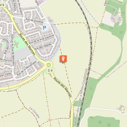
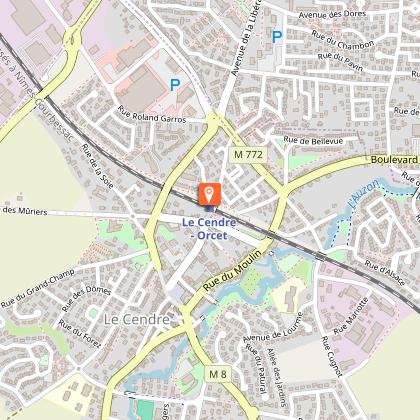
Chemin de Cournon aux Martres-de-Veyre 63670 Le Cendre
Show
Saint-Pierre Church
5.3 km

Saint-Pierre Church

Église Saint-Pierre is a 19th century church in neo-Gothic style, built to replace an older church. In the 19th century, when the Église Saint-Pierre was entirely rebuilt, excavations performed in 1851 revealed the presence of a former Roman church dating back to the 11th and 12th centuries, in place of the current building. The village fort, a highly individualised area, was then structured around this former church and occupied the peak of a hillock that was more pronounced at the time. Constructions built close to one another ensured collective safety inside the fort, which included 23 houses, the church and its cemetery, a common house (municipal services) and a fortified house that no longer exists. A Rue du Fort still exists. In 1849, Aymon Mallay (1805-1883), a departmental architect in Puy-de-Dôme and architect for the diocese, was commissioned for the reconstruction of the church. He had previously worked on several religious buildings in the Auvergne region, including église Saint-Léger de Royat. The present-day church is built from Volvic stone. It is in neo-Gothic style, inspired by medieval forms such as pointed arches, which can be seen above the openings, and rose windows, above the western gate. The church retains a number of statues which are on the additional inventory of historic monuments. As for the bell tower, it has two bells, one cast in 1822 (62 cm in diameter), the other in 1823 (72 cm diameter).

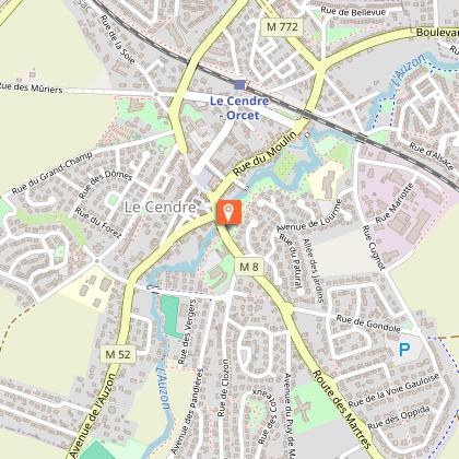
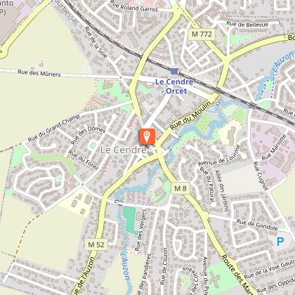
Place de l'église 63670 Le Cendre
Show

Where to eat in Veyre-monton

See more suggestions
The dining spots in Veyre-monton have surprises in store.
See more suggestions

Where to sleep in Veyre-monton

See more suggestions
Find an ideal lodging in Veyre-monton.
See more suggestions
Caution!
We have no information on the difficulty of this circuit. You may encounter some surprises along the way. Before you go, please feel free to inquire more and take all necessary precautions. Have a good trip! 🌳🥾