Description
Map
Ratings and reviews
See around
La lande de Montomblay
Credit
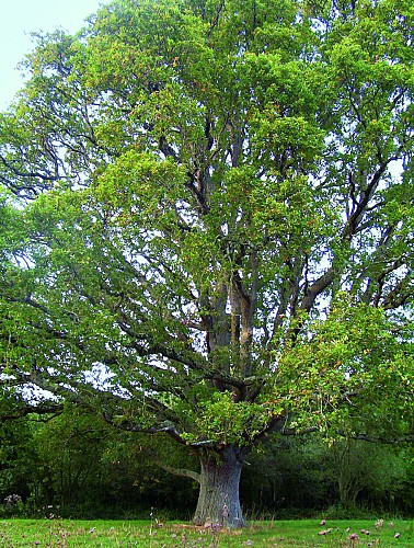
: ©OT SMBMSM Chêne de la Liberté
Description
Dans le centre bourg, prendre la route en face de l'église qui mène à la lande de Montomblay. Sur la lande se dresse un chêne, planté dit-on en 1792. Symbole de la liberté, cet arbre commémore la Révolution et la prise de la Bastille. Les terrains de la lande sont joliment entretenus par les habitants du hameau. Prendre ensuite le petit chemin qui s'avance vers la Baie : la vue panoramique donne une idée de l'immensité de la Baie du Mont-Saint-Michel. On comprend bien le paysage : la zone de polders, terres gagnées par l'homme sur la mer utilisée pour les cultures et plus au loin, les polders où paissent les moutons. Descendre tranquillement la route pour rejoindre Saint-Georges-de-Gréhaigne.
Technical Information
Lat, Lng
48.5629763-1.5739631
Coordinates copied
Altitude
0 m
Uncertain state
Point of Interest updated on 21/12/2021
This point of interest hasn't been updated recently, which could compromise the reliability of this information. We recommend that you inquire and take all necessary precautions. If you're the author, please verify your information.
Altimetric profile
Data author

proposed by
Destination Saint-Malo Baie du Mont-Saint-Michel
Esplanade Saint Vincent 35400 SAINT MALO France
Ratings and reviews
To see around