Alert
Alerts
Description
Map
Ratings and reviews
See around
Les Combettes

Credit
: © Olivier Prohin
Description
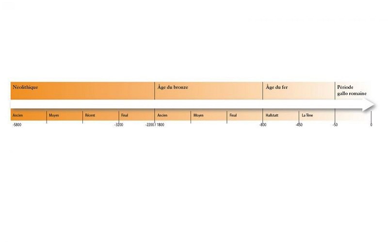
Marker 7The village of Les Combettes is built in a natural depression, as its name indicates (combette = little valley). The exhibition on display in the communal oven building emphasises how late Mont Lozère was first settled. By the Upper Neolithic (around 3500 BC), the region of the Grands Causses was widely settled, following a population increase. The first agro-pastoral communities formed, creating farms and villages and clearing land to grow cereals and breed livestock, whilst still hunting and gathering. These groups are behind local megalithism. The age of metals put an end to the practice of erecting menhirs, but dolmens were in use for a while longer.
Technical Information
Lat, Lng
44.40259953.5807072
Coordinates copied
Uncertain state
Point of Interest updated on 16/11/2022
This point of interest hasn't been updated recently, which could compromise the reliability of this information. We recommend that you inquire and take all necessary precautions. If you're the author, please verify your information.
Altimetric profile
IGN cards

2639SB - FLORAC SAINTE-ÉNIMIE GORGES DU TARN
Editor : IGN
Collection : TOP 25 ET SÉRIE BLEUE
Scale : 1:25 000
13.90€

2739OT - MONT LOZÈRE FLORAC PARC NATIONAL DES CÉVENNES
Editor : IGN
Collection : TOP 25 ET SÉRIE BLEUE
Scale : 1:25 000
13.90€

TOP75011 - CÉVENNES - GORGES DU TARN
Editor : IGN
Collection : TOP 75
Scale : 1:75 000
9.80€

162 RODEZ MILLAU PNR DES GRANDS CAUSSES
Editor : IGN
Collection : TOP 100
Scale : 1:100 000
8.40€

TOP100D48 - LOZÈRE MENDE FLORAC-TROIS-RIVIÈRES PARC NATIONAL DES CÉVENNES GORGES DU TARN ET DE LA JONTE
Editor : IGN
Collection : TOP 100
Scale : 1:100 000
8.40€

89023 - CHEMIN DE STEVENSON - GR70®
Editor : IGN
Collection : DECOUVERTE DES CHEMINS
Scale : 1:90 000
9.10€

D30-34 GARD HÉRAULT
Editor : IGN
Collection : CARTES DÉPARTEMENTALES IGN
Scale : 1:150 000
5.90€

D12-48 AVEYRON LOZÈRE
Editor : IGN
Collection : CARTES DÉPARTEMENTALES IGN
Scale : 1:150 000
5.90€

EUROPE
Editor : IGN
Collection : DÉCOUVERTE DES PAYS DU MONDE IGN
Scale : 1:2 500 000
7.00€
Data author

proposed by
Parc national des Cévennes
Ancienne gare 48400 Florac-trois-Rivières France
Ratings and reviews
To see around