Alert
Alerts
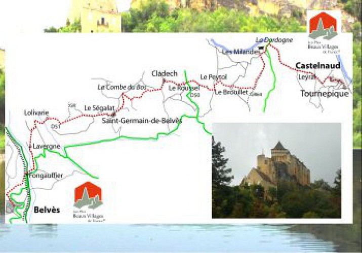
De Belves à St Germain de Belves
Description
BELVES – St GERMAIN DE BELVES : 7,1 km
De l’église, prendre rue de la providence puis avenue des cèdres, traverser le jardin public, descendre rue de la Tannerie et après 30 m, tourner à gauche sur le chemin herbeux descendant puis remontant à la gendarmerie. Aller à droite puis à gauche sur un joli chemin pour descendre au rond-point de Fongauffier. Traverser, en suivant le GR, passer derrière l’hôtel, à la sortie du village suivre la route à gauche. A Lavergne, bifurquer à droite pour retrouver un chemin qui monte raide dans le bois. A la route, à droite puis à gauche au carrefour dans un chemin qui mène à Lolivarie (golf). Traverser la D51 pour monter en face, au calvaire suivre le chemin légèrement à droite. Dans la montée, au carrefour, quitter le GR pour aller tout droit en montant dans les pins. A la route, tourner à droite, et aller tout droit pour rejoindre le village de St GERMAIN DE BELVES .
Technical Information
Altimetric profile
IGN cards


Data author
