Alert
Alerts


Description
Map
Ratings and reviews
See around
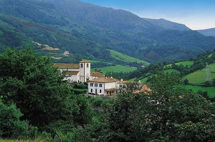
Biriatou
Credit
: ©
Description
Au col de Pitara, poursuivre l’ascension tout droit et à Osinka lepo obliquer légèrement à droite pour rejoindre le sommet du Xoldokogaina (486m). Basculer dans le versant qui regarde l’océan. La première partie de la descente est commune avec le GR10. Puis quand le sentier prend de la pente, partir à droite sur un sentier très rocailleux. Il est conseillé de mettre pied à terre. La pente s’adoucit et le chemin rejoint un parking et une antenne. Repérer à gauche en dessous de l’antenne, un chemin qui part à flanc de montagne jusqu’à rejoindre le GR10. Descendre à droite sur le GR10 pour rejoindre le village de Biriatou.
Technical Information
Lat, Lng
43.317247-1.716792
Coordinates copied
Uncertain state
Point of Interest updated on 01/01/1970
This point of interest hasn't been updated recently, which could compromise the reliability of this information. We recommend that you inquire and take all necessary precautions. If you're the author, please verify your information.
Altimetric profile
IGN cards

1245OT - HENDAYE SAINT-JEAN-DE-LUZ COTE D'ARGENT
Editor : IGN
Collection : TOP 25 ET SÉRIE BLEUE
Scale : 1:25 000
13.90€

M1244OT - BIARRITZ HENDAYE LA RHUNE
Editor : IGN
Collection : MINI TOP 25
Scale : 1:25 000
8.80€

TOP75023 - PAYS BASQUE
Editor : IGN
Collection : TOP 75
Scale : 1:75 000
9.80€

166 DAX BAYONNE PAYS BASQUE
Editor : IGN
Collection : TOP 100
Scale : 1:100 000
8.40€

89030 - TRAVERSEE DES PYRENEES GR10®
Editor : IGN
Collection : DECOUVERTE DES CHEMINS
Scale : 1:100 000
9.10€

D64 PYRÉNÉES-ATLANTIQUES
Editor : IGN
Collection : CARTES DÉPARTEMENTALES IGN
Scale : 1:150 000
5.90€

NR11 NOUVELLE-AQUITAINE RECTO/VERSO BASSIN AQUITAIN
Editor : IGN
Collection : CARTES RÉGIONALES IGN
Scale : 1:250 000
6.80€

NR10 NOUVELLE-AQUITAINE RECTO /VERSO LIMOUSIN POITOU
Editor : IGN
Collection : CARTES RÉGIONALES IGN
Scale : 1:250 000
6.80€

EUROPE
Editor : IGN
Collection : DÉCOUVERTE DES PAYS DU MONDE IGN
Scale : 1:2 500 000
7.00€
Data author

proposed by
Office de Tourisme Pays Basque
64502 France
Ratings and reviews
To see around