Alert
Alerts
Description
Map
Ratings and reviews
See around
L'Adour
Description
L'établissement de la ville sous le règne de l'empereur Auguste (27 av. J-C – 14 ap. J-C) répond à un choix géographique stratégique lié au franchissement de l'Adour. À cet endroit, le fleuve et ses plaines inondables (les barthes) se rétrécissent, facilitant le passage d'une rive à l'autre. L'Adour constitue aussi une voie commerciale essentielle : à Dax transitaient les marchandises redistribuées dans toute l'Europe via le port de Bayonne.
Technical Information
Lat, Lng
43.71174-1.05509
Coordinates copied
Uncertain state
Point of Interest updated on 01/01/1970
This point of interest hasn't been updated recently, which could compromise the reliability of this information. We recommend that you inquire and take all necessary precautions. If you're the author, please verify your information.
Altimetric profile
IGN cards

1342SB - DAX CASTETS
Editor : IGN
Collection : TOP 25 ET SÉRIE BLEUE
Scale : 1:25 000
13.90€
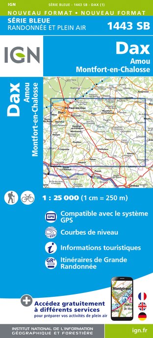
1443SB - DAX AMOU MONTFORT-EN-CHALOSSE
Editor : IGN
Collection : TOP 25 ET SÉRIE BLEUE
Scale : 1:25 000
13.90€

166 DAX BAYONNE PAYS BASQUE
Editor : IGN
Collection : TOP 100
Scale : 1:100 000
8.40€

D40 LANDES
Editor : IGN
Collection : CARTES DÉPARTEMENTALES IGN
Scale : 1:150 000
5.90€

D64 PYRÉNÉES-ATLANTIQUES
Editor : IGN
Collection : CARTES DÉPARTEMENTALES IGN
Scale : 1:150 000
5.90€

NR11 NOUVELLE-AQUITAINE RECTO/VERSO BASSIN AQUITAIN
Editor : IGN
Collection : CARTES RÉGIONALES IGN
Scale : 1:250 000
6.80€

NR10 NOUVELLE-AQUITAINE RECTO /VERSO LIMOUSIN POITOU
Editor : IGN
Collection : CARTES RÉGIONALES IGN
Scale : 1:250 000
6.80€

EUROPE
Editor : IGN
Collection : DÉCOUVERTE DES PAYS DU MONDE IGN
Scale : 1:2 500 000
7.00€
Data author

proposed by
OT Grand Dax
40104 France
Ratings and reviews
To see around