Alert
Alerts
Description
Map
Ratings and reviews
See around
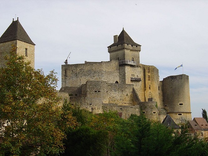
De Castelnaud la Chapelle à Cénac St Julien Etape 88
Credit
: cd24
Description
Etape 88: Depuis le parking de Tournepique à Castelnaud-la-Chapelle, suivre la D 57 direction « Saint-Cybranet ». Après 500 mètres tourner à gauche, passer le pont, continuer à droite et après 200 mètres quitter la route pour prendre le chemin à gauche (GR).
Quitter le GR avant le village de Saint-Julien pour aller à droite vers le Bastid. Suivre la petite route jusqu’à Font de Merle, à la sortie du hameau retrouver le GR. A droite puis tout de suite à gauche sur le chemin qui rejoint les bords de Dordogne. Longer la rivière, puis quitter le GR pour suivre à droite un chemin allant à l'église. Après le cimetière aller à gauche.
Technical Information
Lat, Lng
44.813851.15045
Coordinates copied
Uncertain state
Point of Interest updated on 01/01/1970
This point of interest hasn't been updated recently, which could compromise the reliability of this information. We recommend that you inquire and take all necessary precautions. If you're the author, please verify your information.
Altimetric profile
IGN cards

1936ET - LES EYZIES-DE-TAYAC-SIREUIL VALLÉES DE LA DORDOGNE ET DE LA VÉZÈRE
Editor : IGN
Collection : TOP 25 ET SÉRIE BLEUE
Scale : 1:25 000
13.90€

TOP75026 - PERIGORD NOIR HAUT QUERCY
Editor : IGN
Collection : TOP 75
Scale : 1:75 000
9.80€

154 BRIVE-LA-GAILLARDE TULLE FIGEAC PNR DES CAUSSES DU QUERCY (NORD)
Editor : IGN
Collection : TOP 100
Scale : 1:100 000
8.40€

D46-47 LOT LOT-ET-GARONNE
Editor : IGN
Collection : CARTES DÉPARTEMENTALES IGN
Scale : 1:150 000
5.90€

D24 DORDOGNE
Editor : IGN
Collection : CARTES DÉPARTEMENTALES IGN
Scale : 1:150 000
5.90€

NR11 NOUVELLE-AQUITAINE RECTO/VERSO BASSIN AQUITAIN
Editor : IGN
Collection : CARTES RÉGIONALES IGN
Scale : 1:250 000
6.80€

NR10 NOUVELLE-AQUITAINE RECTO /VERSO LIMOUSIN POITOU
Editor : IGN
Collection : CARTES RÉGIONALES IGN
Scale : 1:250 000
6.80€

EUROPE
Editor : IGN
Collection : DÉCOUVERTE DES PAYS DU MONDE IGN
Scale : 1:2 500 000
7.00€
Data author

proposed by
Dordogne
24000 France
Ratings and reviews
To see around