Alert
Alerts


Description
Map
Ratings and reviews
See around
Le port

Credit
: © D. Remazeilles (Gironde Tourisme)
Description
Au XVIIe siècle, la Garonne s’éloigne progressivement des remparts ; le port est déplacé en 1868. Aujourd’hui subsiste le quai de pierre, qui constitue de troisième port de Saint-Macaire, le port de Rendesse étant devenu obsolète.
Le cours de la Garonne est modifié pour garantir la bonne circulation des bateaux entre Bordeaux et le canal latéral à Castets-en-Dorthe. Son utilisation fut courte, le développement du chemin de fer le concurrençant inexorablement…
Technical Information
Lat, Lng
44.56288-0.22142
Coordinates copied
Point of Interest updated on 13/11/2024
Altimetric profile
IGN cards
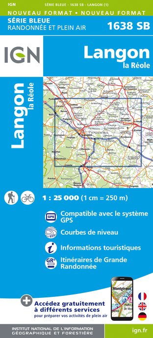
1638SB - LANGON LA RÉOLE
Editor : IGN
Collection : TOP 25 ET SÉRIE BLEUE
Scale : 1:25 000
13.90€

160 AGEN MARMANDE PAYS DE L'AGENAIS
Editor : IGN
Collection : TOP 100
Scale : 1:100 000
8.40€

153 PERIGUEUX BERGERAC PÉRIGORD
Editor : IGN
Collection : TOP 100
Scale : 1:100 000
8.40€

D40 LANDES
Editor : IGN
Collection : CARTES DÉPARTEMENTALES IGN
Scale : 1:150 000
5.90€

D33 GIRONDE
Editor : IGN
Collection : CARTES DÉPARTEMENTALES IGN
Scale : 1:150 000
5.90€

NR11 NOUVELLE-AQUITAINE RECTO/VERSO BASSIN AQUITAIN
Editor : IGN
Collection : CARTES RÉGIONALES IGN
Scale : 1:250 000
6.80€

NR10 NOUVELLE-AQUITAINE RECTO /VERSO LIMOUSIN POITOU
Editor : IGN
Collection : CARTES RÉGIONALES IGN
Scale : 1:250 000
6.80€

EUROPE
Editor : IGN
Collection : DÉCOUVERTE DES PAYS DU MONDE IGN
Scale : 1:2 500 000
7.00€
Data author

proposed by
OT Sauternes Graves Landes Girondines
33210 France
Ratings and reviews
To see around