Alert
Alerts
Description
Map
Ratings and reviews
See around
Chapelle Saint-Nicolas
Credit
: MAIRIE
Description
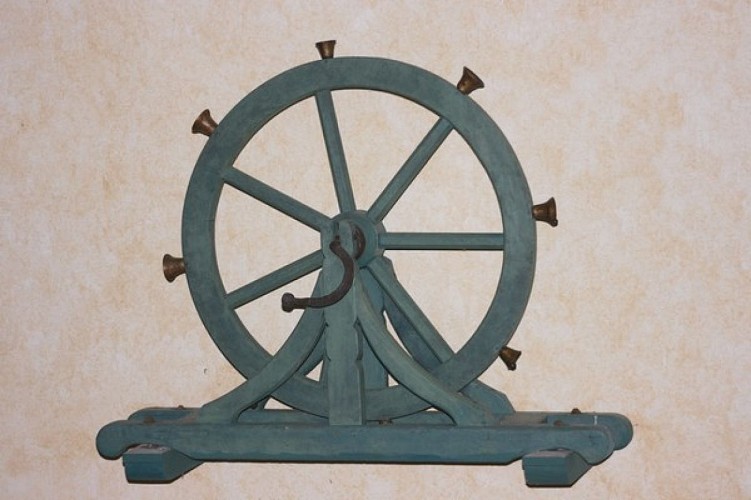
Édifice du XVIe : elle conserve un des treize jubés non transformés de Bretagne et recèle une autre particularité : une roue à carillons.
Continuer la route goudronnée sur 100 m. Bifurquer à droite pour retrouver un chemin d'exploitation qui part ensuite sur la gauche pour arriver au-dessus du village de Morgant. Emprunter la route pour monter vers la D132. Avant la départementale, prendre un sentier parallèle à celle-ci. La reprendre pour la couper au carrefour suivant. Se diriger vers Restelegan, mais après 350 m, prendre un chemin d'exploitation à droite sur 200 m. Bien tourner à droite le long d'un champ, puis descendre par un chemin d'exploitation.
Technical Information
Lat, Lng
48.0421685-3.4320742
Coordinates copied
Altitude
161 m
Uncertain state
Point of Interest updated on 08/01/2018
This point of interest hasn't been updated recently, which could compromise the reliability of this information. We recommend that you inquire and take all necessary precautions. If you're the author, please verify your information.
Altimetric profile
Data author

Ratings and reviews
To see around