Alert

Alerts

To see around
See more
Open
Close
Show
Show
Show
Show
Show
Show
Show
Show
Show
Show
Show

Oups... It would appear that Cirkwi does not have permission to use your location.

Description
Map
Ratings and reviews
See around

De Bonnefont à Saint-Gaudens

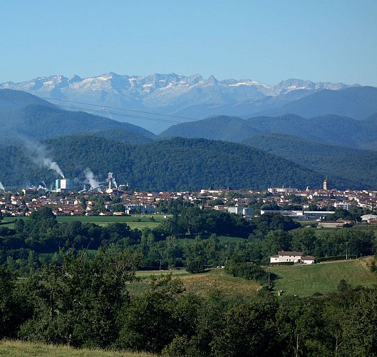
Saint-Gaudens et les Pyrénées vus depuis les Serres

Description

Quitter Bonnefont par le chemin de Nankin mais rester dans le vallon pour prendre rapidement à gauche un chemin agricole qui monte vers une crête.
La Via Garona est balisée par Castillon de Saint-Martory, Beauchalot et Labarthe-Inard. Pour un parcours plus direct (3 kilomètres de moins), rester sur la ligne de crête. Ce chemin qui se prolonge plus loin par la route des Serres offre des vues sur les Pyrénées parmi les plus belles de la chaîne (Luchonnais, Maladetta...). Le chemin passe par Borde de Lieux puis rejoint Saint-Roch. Avant l'entrée du hameau prendre la route à gauche pour traverser le vallon et rejoindre la route des Serres par Jouan de Goy. Descendre pour traverser l'autoroute et rejoindre Saint-Gaudens au niveau de la piscine.

Technical Information

Lat, Lng
43.14240.858479
Coordinates copied
Altitude
418 m
Uncertain state
Point of Interest updated on 24/05/2020
This point of interest hasn't been updated recently, which could compromise the reliability of this information. We recommend that you inquire and take all necessary precautions. If you're the author, please verify your information.

Altimetric profile

Data author

Image Via Garona
proposed by Via Garona

Ratings and reviews

To see around
See more
Open
Close
Show
Show
Show
Show
Show
Show
Show
Show
Show
Show
Show
Caution!
We have no information on the difficulty of this circuit. You may encounter some surprises along the way. Before you go, please feel free to inquire more and take all necessary precautions. Have a good trip! 🌳🥾