Alert
Alerts
Description
Map
Ratings and reviews
See around
Echelle de tracé des crues
Description
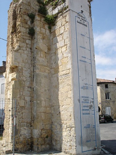
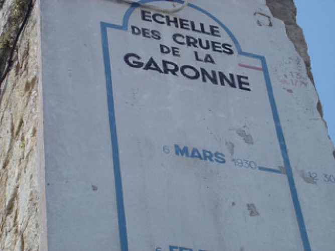
These ladders, located at the corner of rue de la Brèche and rue Laffargue, make it possible to observe the flooding of the Garonne over the years. The most important floods are those of 1770, the most catastrophic, which is erroneously indicated in 1774, and of 1930 and 1982.
Technical Information
Lat, Lng
44.556074-0.245368
Coordinates copied
Point of Interest updated on 18/06/2025
Altimetric profile
Date and time
- From 01/01/2025 to 31/12/2025
Additional information
Typologie de site
House and building
Ouverture
Date de début : 01/01/2025 00:00:00
Date de fin : 31/12/2025 00:00:00
IGN cards
1638SB - LANGON LA RÉOLE
Editor : IGN
Collection : TOP 25 ET SÉRIE BLEUE
Scale : 1:25 000
13.90€

160 AGEN MARMANDE PAYS DE L'AGENAIS
Editor : IGN
Collection : TOP 100
Scale : 1:100 000
8.40€

153 PERIGUEUX BERGERAC PÉRIGORD
Editor : IGN
Collection : TOP 100
Scale : 1:100 000
8.40€
D40 LANDES
Editor : IGN
Collection : CARTES DÉPARTEMENTALES IGN
Scale : 1:150 000
5.90€

D33 GIRONDE
Editor : IGN
Collection : CARTES DÉPARTEMENTALES IGN
Scale : 1:150 000
5.90€

NR11 NOUVELLE-AQUITAINE RECTO/VERSO BASSIN AQUITAIN
Editor : IGN
Collection : CARTES RÉGIONALES IGN
Scale : 1:250 000
6.80€

NR10 NOUVELLE-AQUITAINE RECTO /VERSO LIMOUSIN POITOU
Editor : IGN
Collection : CARTES RÉGIONALES IGN
Scale : 1:250 000
6.80€

EUROPE
Editor : IGN
Collection : DÉCOUVERTE DES PAYS DU MONDE IGN
Scale : 1:2 500 000
7.00€
Data author

proposed by
OT Sauternes Graves Landes Girondines
33210 France
Ratings and reviews
To see around