Alert
Alerts
Description
Map
Ratings and reviews
See around
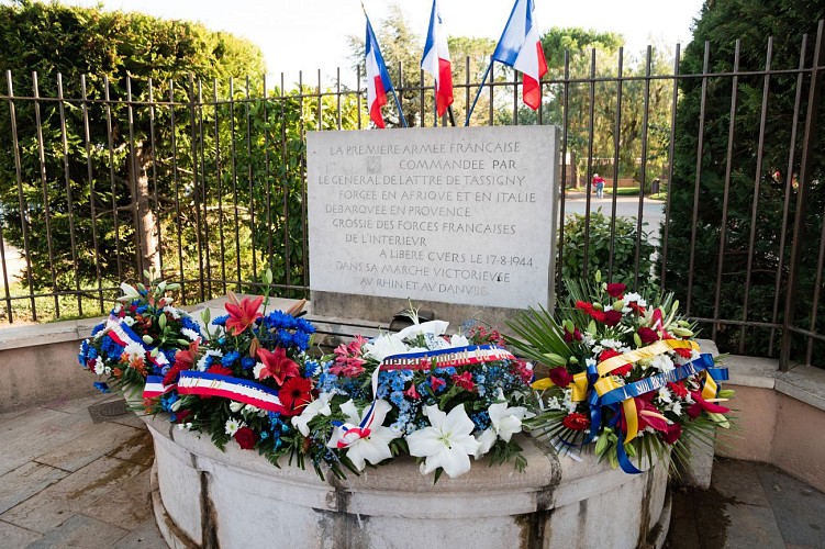
Commemorative plaque of the liberation

Credit
: Office de tourisme intercommunale La Londe les Maures
Description
In 1964, the association RHIN & DANUBE, at the national level and in agreement with the government, suggested to affix a marble plate in all the cities and cities crossed by the armies of the Liberation, which would thus remind the future generations, the date of the Liberation of each. The plate of Cuers inaugurated on August 17, 1964 carries the following engraving:
«THE FIRST FRENCH ARMY COMMANDED BY THE GENERAL OF LATTER OF TASSIGNY, FORGED IN AFRICA AND ITALY, DEBARQUEE IN PROVENCE, GROSSIE OF THE FRENCH FORCES OF THE INTERIOR, TO LEAVE CUERS, ON AUGUST 17, 1944, IN HIS VICTORIOUS MARKET IN RHINE AND DANUBE »
Technical Information
Lat, Lng
43.23677586.0728002
Coordinates copied
Altitude
140 m
Uncertain state
Point of Interest updated on 28/08/2019
This point of interest hasn't been updated recently, which could compromise the reliability of this information. We recommend that you inquire and take all necessary precautions. If you're the author, please verify your information.
Altimetric profile
IGN cards

3445OT - CUERS
Editor : IGN
Collection : TOP 25 ET SÉRIE BLEUE
Scale : 1:25 000
13.90€

TOP75035 - PROVENCE SAINTE VICTOIRE ST BAUME CALANQUES
Editor : IGN
Collection : TOP 75
Scale : 1:75 000
9.80€

VEL06 - LE VAR A VELO
Editor : IGN
Collection : DECOUVERTE A VELO
Scale : 1:110 000
9.10€

TOP100D83 - VAR TOULON FRÉJUS MASSIFS DES MAURES ET DE L'ESTEREL PARC NATUREL RÉGIONAL DU VERDON
Editor : IGN
Collection : TOP 100
Scale : 1:100 000
8.40€

D83 VAR
Editor : IGN
Collection : CARTES DÉPARTEMENTALES IGN
Scale : 1:150 000
5.90€

D06 ALPES-MARITIMES
Editor : IGN
Collection : CARTES DÉPARTEMENTALES IGN
Scale : 1:150 000
5.90€

NR16 PROVENCE-ALPES-CÔTE D'AZUR
Editor : IGN
Collection : CARTES RÉGIONALES IGN
Scale : 1:250 000
6.80€

EUROPE
Editor : IGN
Collection : DÉCOUVERTE DES PAYS DU MONDE IGN
Scale : 1:2 500 000
7.00€
Ratings and reviews
To see around
