Alert

Alerts

To see around
See more
Open
Close
Show
Show
Show
Show
Show
Show
Show
Show
Show
Show
Show

Oups... It would appear that Cirkwi does not have permission to use your location.

OSM Map
OSM Map
OpenStreetMap
Satellite images
Satellite images
Google
GoogleMap Map
GoogleMap Map
Google
Hybrid Map
Hybrid Map
Google
IGN - France
IGN - France
IGN
Cadastral Plan
Cadastral Plan
IGN
Description
Map
Ratings and reviews
See around

PONTE DE GOMAIL

PONTE DE GOMAIL

Description

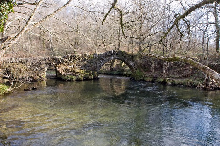
É un das pontes de arco máis antigas desta zona (século XV). Trátase dunha ponte construída en mampostería en forma de “chapacuña” de tres arcos, o máis grande lixeiramente apuntado. Este ten unha luz aproximada de oito metros, mentres que os dous restantes actúan como aliviadoiros. Ademais, veremos outro arco polo que discorre unha canle de auga que recolle as augas dunha presa situada uns metros máis arriba. Supomos que este foi construído posteriormente, quizais nalgunha pequena reforma da ponte no século XVIII ou XIX.

Por este trazado discorría o camiño dos “arrieiros”, os cales transportaban as súas prezadas mercadorías até Santiago de Compostela.

Este percorrido foi recuperado recentemente como vía de peregrinación a través do Camiño da Geira e dos Arrieiros, e como “Camiño Ribeiro-Miñoto”.

Technical Information

Lat, Lng
42.579776-8.3532446
Coordinates copied
Uncertain state
Point of Interest updated on 13/11/2020
This point of interest hasn't been updated recently, which could compromise the reliability of this information. We recommend that you inquire and take all necessary precautions. If you're the author, please verify your information.

Altimetric profile

Ratings and reviews

To see around
See more
Open
Close
Show
Show
Show
Show
Show
Show
Show
Show
Show
Show
Show
Caution!
We have no information on the difficulty of this circuit. You may encounter some surprises along the way. Before you go, please feel free to inquire more and take all necessary precautions. Have a good trip! 🌳🥾