Allarme
Allarmi
")


- Tour ›
- Camminata ›
- france ›
- rhône-alpes ›
- haute-savoie ›
- monnetier-mornex
Boucle pédestre : chemin du Funiculaire

Per visualizzare questo annuncio, accetta i cookie di marketing in: Gestione dei Cookie
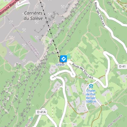
IGN Carte


Informazioni tecniche
Profilo altimetrico
Punto di partenza
Per visualizzare questo annuncio, accetta i cookie di marketing in: Gestione dei Cookie
Punti di interesse

Per visualizzare questo annuncio, accetta i cookie di marketing in: Gestione dei Cookie
Informazioni aggiuntive
Updated by
Office de Tourisme des Monts du Genevois - 24/06/2024
www.comlespros.com
Report a problem
Open period
Dal 01/12 al 31/12/10 : aperto tutti i giorni. Tutto l'anno : aperto tutti i giorni.
Contact
Phone : 04 50 95 07 10
Email : ot@montsdegeneve.com
Website : www.cirkwi.com/fr/circuit/54511-chemin-du-funiculaire
Animali accettati
Gli animali sono accettati.
Autore dei dati
