Om te zien rondom
Zie meer
Open
Sluiten
Toon
Toon
Toon
Toon
Toon
Toon
Toon
Toon
Toon
Toon
Toon

Oups... Het lijkt erop dat Cirkwi geen toestemming heeft om uw locatie te gebruiken.

Beschrijving
Kaart
Stappen
Punten van interesse
Beoordelingen en recensies
Zie rondom

Sentier des mulets / Mandobidexka

IMG_8128
IMG_8147
PLRV1076-T1-4384
PLRV1076-T3-4760

Beschrijving

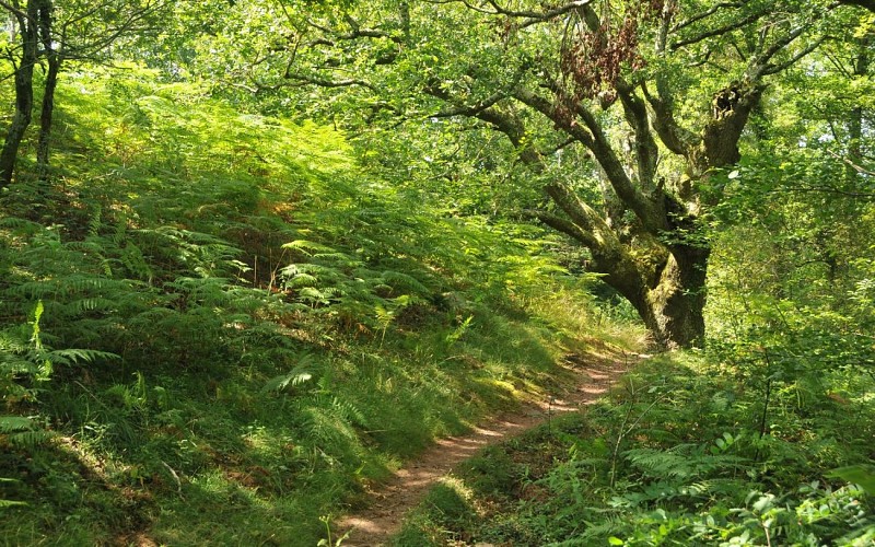
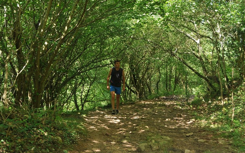
Als de oude eiken van het Muilezelpad konden praten, zouden ze de douanebeambten heel wat te vertellen hebben! Tussen Herboure en de pas van Ibardin hebben zij tientallen handelaren, smokkelaars en smokkelaars gezien die dit oude pad in het verleden dag en nacht hebben gebruikt. De muilezels droegen de zware lasten op hun rug.
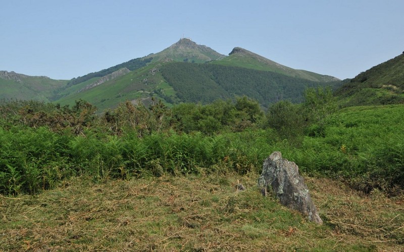
De route begint halverwege de Ibardin-pas en, na het genieten van het weidse uitzicht op de kustlijn vanaf het Aire Leku-plateau, slingert hij zich een weg door bosjes en open plekken om het begin van het Muilezelpad te vinden. Ga naar de Ibardinpas, langs een pad dat onder het gebladerte van de Andureta-vallei aan het zicht en de zomerhitte is onttrokken. Een originele manier om de Ibardin pas te voet te bereiken, en waarom niet winkelen.

Technische informatie

Wandel
Moeilijkheid
Eenvoudig
Afstand
9.8 km
Meer informatie tonen

Hoogteprofiel

Startpunt

64122URRUGNE
Lat : 43.332033Lng : -1.687312

Stappen

image du object
1

From Aire Leku wood to Herboure (D404 road)

At the intersection (215m) with a dirt track, follow it downhill to the right (ignore the side paths). The path curves to the left under a large oak tree (view of the Urrugne neighbourhood); just after a stream, at the Y-shaped intersection, take the path on the right, which descends steeply through the stones. At the entrance of a plateau ant its fern grove, fork left onto a new path (2 dead trees); it is extended by a small path. In the woods, just after the small bridge, take the path that goes up to the left. It then goes between clearings and copses and crosses three new streams. When you reach a fenced-in meadow, follow the path to the left, along the fence.

- Office de Tourisme Pays Basque -
Consulter
image du object
2

From the Ibardin pass to the Abeilles Pass

At the « Lapurdi » sign (315m), leave the tarmac road to climb the dirt track to the right, marked in red and white. When the path bumps against a gate, go up the very steep grassy path on the right along the fence, then in the ferns. Reach a grassy pass (385m), with a view of the Ibardin pass on the right and the Rhune on the left (the first path on the left allows a round trip to the Redoute des Emigrés). Continue 30m to an intersection of 5 paths: take the second path on the left, downhill (Biarritz in view). Go through an esplanade (quarrymen’s quay) and then, after the collapsed dolmen, continue downhill into the forest. At the bottom, after the barrier, take the left-hand path until you return to the starting point.

- Office de Tourisme Pays Basque -
Consulter
image du object
3

From the Mokoa pass to the Ibardin pass

Reach the bend in a wide track (325m), with a view of the Rhune, and follow It to the left. It runs almost horizontally, through the forests, with a few viewpoints and then later passes under the ventas of the Ibardin pass. At the end of the track, cross a parking lot on the left and go down the road to the Ibardin pass. At the pass’ small roundabout (benta Gorria), walk along the road to the left for 50m (towards Urrugne), until you see the small “Lapurdi” sign.

- Office de Tourisme Pays Basque -
Consulter
image du object
4

From the Ibardin pass to the Abeilles Pass

At the « Lapurdi » sign (315m), leave the tarmac road to climb the dirt track to the right, marked in red and white. When the path bumps against a gate, go up the very steep grassy path on the right along the fence, then in the ferns. Reach a grassy pass (385m), with a view of the Ibardin pass on the right and the Rhune on the left (the first path on the left allows a round trip to the Redoute des Emigrés). Continue 30m to an intersection of 5 paths: take the second path on the left, downhill (Biarritz in view). Go through an esplanade (quarrymen’s quay) and then, after the collapsed dolmen, continue downhill into the forest. At the bottom, after the barrier, take the left-hand path until you return to the starting point.

- Office de Tourisme Pays Basque -
Consulter

Punten van interesse

image du object

The hawthorn

In front of the door of the barn ruin is a shrub called hawthorn. Three-lobed leaves, red berries and strong thorns identify it. They bloom in May and produce edible fruits in September. Passerines (such as the wren) find the density of the branches to be ideal nesting sites

- Office de Tourisme Pays Basque -
Consulter
image du object

The old mule track

On the mule track, deep erosion marks in the rocky slabs leave no doubt that this path was once heavily used by travellers, traders and smugglers, so much so that the wheels of the carts are still carved in the stone. For the record, the novel Ramuntcho by Pierre Loti, written in Ascain, recounts these smugglers’ stories.

- Office de Tourisme Pays Basque -
Consulter
image du object

The witnesses of history

From this pass, you can walk along a path that highlights the heritage. You can reach the Redoute des Emigrés (remains of the Napoleonic wars), but also find protohistoric witnesses: a simple hole in a tumulus reveals itself to be a dolmenic chest (ancient dolmen), and further down, a stone lying on the ground is the remains of another dolmen, collapsed, dated –3000 years BC.

- Office de Tourisme Pays Basque -
Consulter
image du object

The Quai des Carriers

With an astonishing rectilinear low wall in the middle of a flat area, this site bears witness to the ancient exploitation of the mountain’s resources. This plateau is known as the “Quai des Carriers”, a former loading area for stones from extraction sites. There a many explanatory panels on the circuit.

- Office de Tourisme Pays Basque -
Consulter

Aanvullende informatie

Balisage

Geel
Balisage jaune pour lestronçons de 1 à 4 - Balisage rouge et blanc pour le tronçon 5

Typologie de l'itinéraire

Ronde

Thèmes

Natuur

Durée moyenne de l'expérience

3 tot 4 uur

Equipements

Eetplek (kruidenier, restaurant)

Gegevensauteur

64502 France

Beoordelingen en recensies

Om te zien rondom
Zie meer
Open
Sluiten
Toon
Toon
Toon
Toon
Toon
Toon
Toon
Toon
Toon
Toon
Toon
Voorzichtigheid!
We hebben geen informatie over de moeilijkheidsgraad van dit circuit. U kunt onderweg enkele verrassingen tegenkomen. Voordat u vertrekt, aarzel niet om meer informatie in te winnen en alle nodige voorzorgsmaatregelen te nemen. Goede reis! 🌳🥾