Traversée des Aravis


Technical Information
Altimetric profile
Starting point
Steps
Points of interest
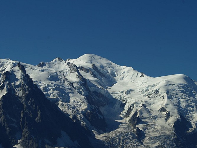
Mont Blanc
The roof of Europe, the third most visited natural site in the world, continues to attract millions of visitors and thousands of climbers every year.ALTITUDE Official altitude in 2021: 4807 meters GEOGRAPHY The Mont Blanc rises in the heart of the Mont Blanc massif and is the highest point of the Alps. It is also the highest peak in Western Europe, which gives it the nickname of the Roof of Europe. It is located between France and Italy, south of Chamonix and northwest of Courmayeur. HISTORY 1786, August 8th : FIRST ascent By Michel Gabriel Paccard and Jacques Balmat. Departure around 4 am from a bivouac at the top of the Côte mountain. At 6:23 pm, Paccard and Balmat are observed reaching the summit which he abandons at 7 pm. Return to the bivouac of the morning before Midnight. One agrees to admit that this ascent marks the birth of the mountaineering. THE ASCENT OF THE MONT BLANC To conquer the Mont Blanc remains a dream shared by many amateur or passionate climbers. This dream is accessible as long as you don't underestimate the apparently easy sides of this legendary mountain. It is necessary to give back to the ascent of this summit its true value as an act of mountaineering and to redefine its different aspects: high altitude, physical commitment, indispensable technical skills, preparation,... So that this ascent remains one of your most beautiful memories, call upon a high mountain guide.

Aravis Pass
Mountain pass (alt: 1498m) – means of passage between Savoie and Haute Savoie. Magnificent views over Mont-Blanc. Alpine meadows, hiking trails, restaurants…
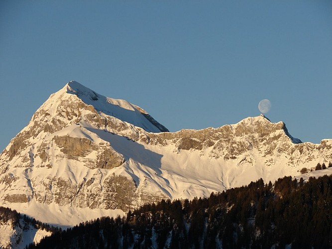
Le Mont-Charvin
Mont Charvin (2407 m) is one of the main peaks of the Aravis mountain range and is recognisable by its pyramid shape and steep rock face. This is maybe the reason for its name: Charvin means exposed summit (“charve” is patois for “chauve” meaning bald).In SUMMER : Two via ferratas have been fitted out on the faces of Charvin. ("Le Gollet de la Trouye" and "Le Pas de l'Ours"). Information at the tourist office of Ugine. Starting point of hikes in Marlens (Bouchet hamlet). On the Haute-Savoie side, you can reach the lake of Mont Charvin from the foot of Mont Charvin. On the left of Mont Charvin, according to the point of view, you can see three high peaks called Les Aiguilles du Mont (2133m) or, more poetically, "The three witches". According to an ancient legend, a treasure is hidden in one of them.
Date and time
- From 01/04/2024 to 31/10/2024
Additional information
Contact
Phone : 04 79 32 04 22
Email : tourisme@pays-albertville.com
Website : www.pays-albertville.com
Open period
С 01/04 до 31/10.
Updated by
Agence alpine des territoires - 14/12/2023
www.agate-territoires.fr
Report a problem
Data author
