警报
警报
The Giffre River
描述
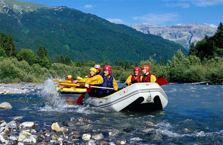
The Giffre is an outstanding mountain river. It crosses Samoëns and allows all water-related activities.
At the bottom of the valley, the Giffre river imperturbably unfolds its meanders of pebbles and gravel. A mountain torrent fed by the innumerable waterfalls of the Bout du Monde and Fer-à-Cheval, the Giffre becomes narrow and deep in the Tines gorges to let itself be won over by its desire for width further downstream in the Vallon plain. There, its banks and its pebble and sand beaches give free rein to water games, ephemeral dams and invigorating bathing. Lovers of rafting, kayaking and hydrospeed can enjoy themselves to the fullest. The Giffre does not stop at such a good bed and feeds both bodies of water at the leisure base. A vast and quiet area where you can fish for trout, try your hand at water golf or try your hand at the accro-branche course.
高程剖面
日期和时间
- 从 26/06/2024 到 31/12/2024
- 从 26/06/2025 到 31/12/2025
补充信息
Price(s)
Free access.
Updated by
Office de Tourisme de Samoëns - 26/04/2024
www.samoens.com
Report a problem
Open period
From 26/06 to 31/12.
Contact
Phone : 04 50 34 40 28
Email : infos@samoens.com
Tips
Practice white water sports in spring, the melting snow increases the flow!
IGN 地图





数据作者
