Alert

Alerts

To see around
See more
Open
Close
Show
Show
Show
Show
Show
Show
Show
Show
Show
Show
Show

Oups... It would appear that Cirkwi does not have permission to use your location.

OSM Map
OSM Map
OpenStreetMap
Satellite images
Satellite images
Google
GoogleMap Map
GoogleMap Map
Google
Hybrid Map
Hybrid Map
Google
IGN - France
IGN - France
IGN
Cadastral Plan
Cadastral Plan
IGN
Presentation
Description
Map
Steps
Ratings and reviews
See around

Combeynot Lake

Lac de Combeynot en hiver
Lac de Combeynot en été
Lac de Combeynot
Credit : Cyril Coursier - PNE

IGN cards

3435ETR - VALLOIRE RESISTANTE AIGUILLES D'ARVES COL DU GALIBIER
Editor : IGN
Collection : TOP 25 RÉSISTANTE
Scale : 1:25 000
17.20€
3535OTR - NÉVACHE MONT THABOR RESISTANTE COLS DU GALIBIER ET DU LAUTARET
Editor : IGN
Collection : TOP 25 RÉSISTANTE
Scale : 1:25 000
17.20€
3436ETR - MEIJE PELVOUX RESISTANTE PARC NATIONAL DES ÉCRINS
Editor : IGN
Collection : TOP 25 RÉSISTANTE
Scale : 1:25 000
17.20€
3435ET - VALLOIRE AIGUILLES D'ARVES COL DU GALIBIER
Editor : IGN
Collection : TOP 25 ET SÉRIE BLEUE
Scale : 1:25 000
13.90€
3436ET - MEIJE PELVOUX PARC NATIONAL DES ÉCRINS
Editor : IGN
Collection : TOP 25 ET SÉRIE BLEUE
Scale : 1:25 000
13.90€
3535OT - NÉVACHE MONT THABOR COLS DU GALIBIER ET DU LAUTARET
Editor : IGN
Collection : TOP 25 ET SÉRIE BLEUE
Scale : 1:25 000
13.90€
TOP75006 - MASSIF DES ECRINS OISANS CHAMPSAUR
Editor : IGN
Collection : TOP 75
Scale : 1:75 000
9.80€
TOP75005 - BRIANCONNAIS QUEYRAS
Editor : IGN
Collection : TOP 75
Scale : 1:75 000
9.80€
202 JURA ALPES DU NORD
Editor : IGN
Collection : TOP 200
Scale : 1:200 000
6.80€
D38 ISÈRE
Editor : IGN
Collection : CARTES DÉPARTEMENTALES IGN
Scale : 1:150 000
5.90€
D04-05 ALPES-DE-HAUTE-PROVENCE HAUTES-ALPES
Editor : IGN
Collection : CARTES DÉPARTEMENTALES IGN
Scale : 1:150 000
5.90€
NR16 PROVENCE-ALPES-CÔTE D'AZUR
Editor : IGN
Collection : CARTES RÉGIONALES IGN
Scale : 1:250 000
6.80€
NR15 AUVERGNE-RHÔNE-ALPES RECTO/VERSO MASSIF ALPIN
Editor : IGN
Collection : CARTES RÉGIONALES IGN
Scale : 1:250 000
6.80€
NR14 AUVERGNE-RHÔNE-ALPES RECTO/VERSO MASSIF CENTRAL
Editor : IGN
Collection : CARTES RÉGIONALES IGN
Scale : 1:250 000
6.80€
EUROPE
Editor : IGN
Collection : DÉCOUVERTE DES PAYS DU MONDE IGN
Scale : 1:2 500 000
7.00€

Description

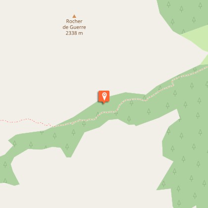
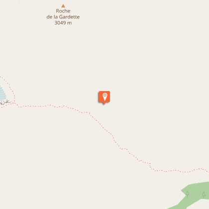
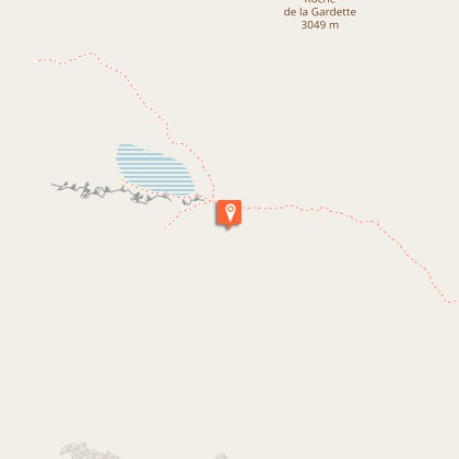
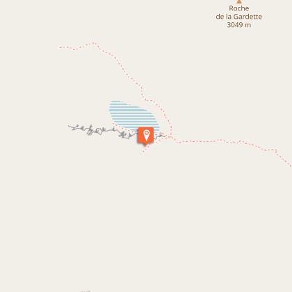
A blue veil has been lost in this mineral world.You will not find an  oasis in this desert of stones but a deep lake of freezing water. The unique marked trail starts from the carpark at the edge of  Guisane. It goes up on the right bank, with a regular ascent to Pré Chausson then through  Fontenil valley.  After a slightly more difficult section, the lake is hiding under an overhang in the bottom of the valley. Return using the same itinerary in the opposite direction. 

Technical Information

Walking
Difficulty
Medium
Duration
6h
Dist.
7.9 km
Show more

Altimetric profile

Starting point

Lat : 45.010702Lng : 6.466099

Steps

Additional information
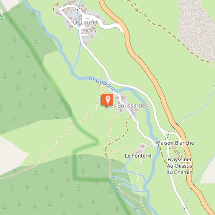
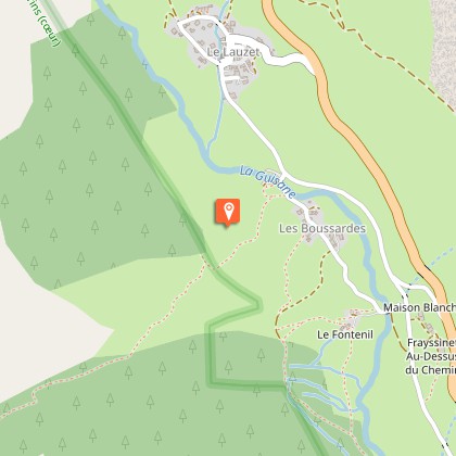
Departure

Les Boussardes

Arrival

Les Boussardes

Ambiance

"In the middle of the summer, the valley exposed to the North can be very hot. That’s why I like to go out at sunrise in order to make the most of the cool early morning. just like the chamois who make the most of this calm moment in order to graze.. At 10 o’clock, most of them are sleeping and immobile, dozing and ruminating,you could almost say they are invisible!” Cyril Coursier, heritage technician in Briançonnais 

Access

Leave the D1091 down from Lauzet hamlet, direction les Boussardes. 

Advised parking

Carpark beside the Guisane, Boussardes hamlet.

Public transport

Bus Grenoble - Briançon : stop at Lauzet (LER 35).

Advice

No water on this path, take 2 litres per person. The itinerary is indicated on the  signposts marked  « porte du Parc national » which can be found near the carpark. 

Herd protection dogs

In mountain pastures, protection dogs are there to protect the herds from predators (wolves, etc.).When I hike I adapt my behavior by going around the herd and pausing for the dog to identify me.Find out more about the actions to adopt with the article "Protection dogs: a context and actions to adopt".Tell us about your meeting by answering this survey.

Is in the midst of the park

The national park is an unrestricted natural area but subjected to regulations which must be known by all visitors.

Ratings and reviews

To see around
See more
Open
Close
Show
Show
Show
Show
Show
Show
Show
Show
Show
Show
Show
Caution!
We have no information on the difficulty of this circuit. You may encounter some surprises along the way. Before you go, please feel free to inquire more and take all necessary precautions. Have a good trip! 🌳🥾