Remembrance walking tour from Flaxlanden to Zillisheim


Description
Going from Palmenhart Hill to Geissberg Hill, one discovers part of the battlefield where French and German troops clashed on 19 August 1914, at the beginning of the First World War. Eight explanatory plaques detail the military events that took place at that time. You also pass through the village of Flaxlanden, which preserves an interesting historical heritage, including several stone houses dating from before 1630.
Technical Information
Altimetric profile
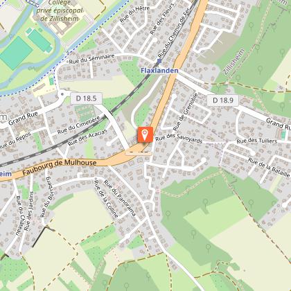
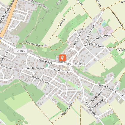
Starting point
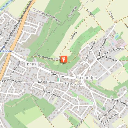
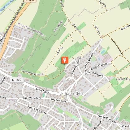
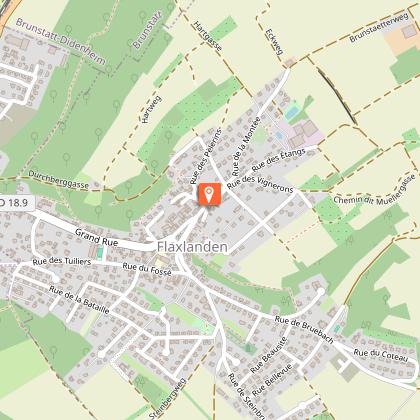
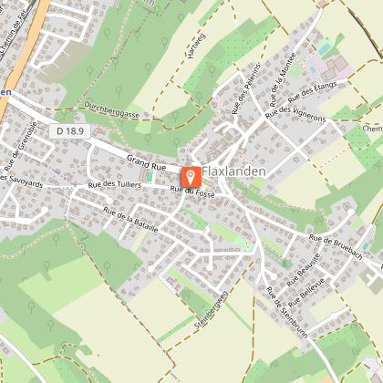
Points of interest
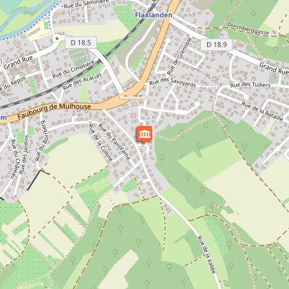
Remembrance monument
The monument was inaugurated in 1928 to commemorate this battle which cost the lives of more than 500 French soldiers and 100 Germans, during the second advance of French troops on Mulhouse, in an Alsace which had remained German since the 1871 Treaty of Frankfurt. In 1939, the medallion of General Plessier, the first French senior officer to be killed during the Great War, mortally wounded between Walheim and Wittersdorf on 19 August 1914, was affixed to the hill.
Palmenhart hill
The name refers to a dry, uncultivable soil (Hart) on which boxwood grows and is used on Palm Sunday (Palmen). On 19 August 1914, the Palmenhart was first occupied by French battalions of the 253rd Infantry Regiment and then taken by the 4th Battalion of the 119th Württemberg Landwehr Regiment. The latter dominated Flaxlanden on one side and the Ill valley on the other. It was driven out by French artillery fire from behind the Petit Séminaire in Zillisheim.
Lourdes grotto
It was built in 1958, on the initiative of the parish priest of Flaxlanden, Abbé Étienne Bilger, on the eve of his departure for Oltingue where he was to create the Musée Paysan. It was one hundred years after the apparitions of the Virgin Mary to Bernadette Soubirous in Lourdes. Since then, every 15th August, this anniversary is celebrated in Flaxlanden with a torchlight procession.
17th century winegrower's house
At the crossroads of Rue des Pèlerins and Rue du Rossignol, a typical old winegrower's house with a large arched doorway can be seen below. It is a reminder of the vineyards, which were still established in Flaxlanden on 21 hectares in 1760, 19 in 1822, 8 in 1900 and 4 in 1941. The stone floors date from 1629; the half-timbered floors date from after the Thirty Years' War.
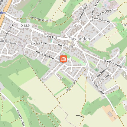
Church and presbytery
At the bottom of the slope, at the level of the church choir, on the left, a 16th century Renaissance house has imposing corner quoins and beautiful mullioned windows (divided by vertical posts). The bell tower of the Saint-Sébastien church, with its beautiful Gothic openings, dates in part from the 13th century. The nave and choir were rebuilt in 1787, according to the plans of Jean-Baptiste Kléber, Napoleon's future general. At the crossroads, before entering the Rue des Écoles, the presbytery (no. 27 Grand' Rue), with its double staircase and its vast hipped roof, and its vast pitched roof, built in 1765 by the abbey of Masevaux, are left on the left. The regular arrangement of arched windows is characteristic of 18th century buildings.
Fountain with coat of arms
It tells the story of the lords of Flaxlanden. In 1556, the Sundgau belonged to the House of Austria (coat of arms on the left with the horizontal bar called a fess in heraldry) which had given Flaxlanden in fief to the noble family of Masevaux as early as 1368 (in the centre, the two leoparded lions). Christophe, the last of the name, had married Madeleine de Sickingen (right, the five bezants). Both died before 1573 and Flaxlanden then passed to the Bollwillers, then to the Fuggers (1620), to the Rosens (1639) and finally to the Broglies (1779), all powerful and distant lords.
Rues de la Bataille et des Chasseurs Alpins
No less than fourteen streets in the two communes recall the day of 19 August 1914. Those of the Battle and the Alpine Chasseurs are located at the foot of the Geissberg, the hill where the French 97th RIA suffered its heaviest losses. It was in fact an Alpine infantry regiment, not an Alpine chasseur regiment. The thousand men of its 1st battalion did not wear kepi but berets (like the chasseurs), hence the confusion.
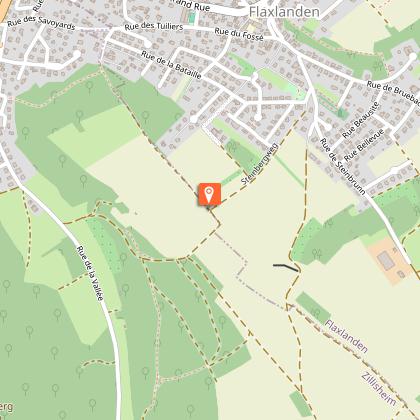
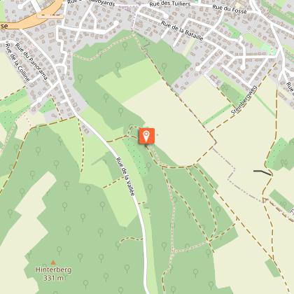
Geissberg and Steinberg hills
On the day of the battle, 3,000 men of the French 97th RIA concentrated in a rectangle 400 metres in front and 600 metres deep, on the Geissberg, extended by the Steinberg. From 1.45 p.m. German time onwards, three battalions rushed towards the village in succession. They came up against heavy German fire, retreated to the ridge, collided and fired at each other, causing several hundred casualties. The Geissberg, also known as hill 305 in reference to its altitude, was then occupied by German troops and retaken by the French of the 281st RI at around 8pm.
Nature discovery trail in Zillisheim
Start of a marked and explained trail of 1.5 km
Rue du Capitaine Pileux
Captain Louis René Pileux commanded a company of the 281st infantry regiment. He was killed on the evening of 19 August 1914, during the recapture of the Geissberg, and is buried in Zillisheim cemetery. Since 1991, neighbouring streets have been named after other protagonists of the battle: General Jacques Humbert (1893-1993), second lieutenant in 1914 and historian of the event, Canon Bernard Carte, former chaplain of the 97th, and Joseph Schwechler (1891-1992), witness and organiser of the commemorative ceremonies from 1922.
